Bisonó
| Bisonó | |
|---|---|
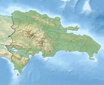 Bisonó Bisonó in the Dominican Republic | |
| Coordinates: 19°33′36″N 70°52′12″W / 19.56000°N 70.87000°WCoordinates: 19°33′36″N 70°52′12″W / 19.56000°N 70.87000°W | |
| Country |
|
| Province | Santiago |
| Area[1] | |
| • Total | 92.63 km2 (35.76 sq mi) |
| Population (2012)[2] | |
| • Total | 98,666 |
| • Density | 1,100/km2 (2,800/sq mi) |
| Municipal Districts |
0 |
Bisonó (Municipio de Bisonó) is a small municipality in northwestern Dominican Republic, created in 1962.[1][3] It lies approximately 25 kilometres (16 mi) from Santiago de los Caballeros, Dominican Republic's second largest city. The administrative centre is in the town of Villa Bisonó.
Geography
Bisonó is located in the Cibao Valley of the Yaque del Norte River. Before the clearance for agriculture and grazing, the area was forested, being in a subtropical dry forest ecosystem. The northern part of the municipality grades into the foothills of the Cordillera Septentrional.[3]
The southern boundary of Bisonó municipality is formed by the Yaque del Norte River. Across the river to the south is the municipal district of La Canela, to the southwest and west is the province of Valverde, to the north is the municipality of Altamira of Puerto Plata Province, to the southeast is the municipality of Villa Gonzalez and to the northeast is the municipal district of El Limon.[4]
Settlements
The major town is Villa Bisonó, often known as Navarrete. It was formally recognized in 1956 and named after a local land owner José Elías Bisonó. The town is at the junction of highways DR-1 and DR-5. The town has several neighborhoods (barrios), including Barrio 27 de Febrero, Barrio Los Candelones, Bario Duarte, Bario La Mella, Barrio Nuevo (Jeremias), Barrio Rotonda, Barrio San Miguel, Barrio Trinitaria, and Jalisco.[5][6]
Other settlements include Las Atravesadas, Cañada Bonita, Ponton, Pontoncito, El Estacion and Villanueva.[6]
History
In 1939 the area, known as Navarrete, was placed under the rural administration of the municipality of Santiago. In 1956 the settlement of Villa Bisonó, Navarrete, was recognized. In the late 1950s the area was upgraded to a municipal district under the name Navarrete, but still within the Santiago municipality. In 1962 the area was elevated to the category of municipality within the province of Santiago, with the name "Bisonó", although often referred to as "Villa Bisonó" or "Navarrete".[1][3]
Government
Outside Villa Bisonó the municipality is divided into seven rural sectors with forty-seven designated locations. The seven sectors are: Cañada Bonita, Mejía de Navarrete, Villa Heneken or Pontoncito, Villanueva, Estancia del Yaque, La Lomota, and Vuelta Larga.[3]
Since 2002, Amantina Gómez, of the Partido de la Liberación Dominicana (PLD), has been in charge of the municipal government.[3]
References
- 1 2 3 "Bisonó en cifras, Perfl Sociodemográfco Municipal" (PDF). Oficina Nacional de Estadistica. 2010.
- ↑ Censo 2012 de Población y Vivienda, Oficina Nacional de Estadistica
- 1 2 3 4 5 "Villa Bisonó". Gobernación Provincial de Santiago.
- ↑ "Santiago: División Territorial" (PDF). Proyecto de Actualización Y Digitalización Cartográfica Nacional, Departamento de Cartografía, Oficina Nacional de Estadística, Secretaría de Estado de Economía. 2009.
- ↑ "Villa Bisonó". Bing Maps.
- 1 2 "Poblacion de 3 años y más por alfabetismo, según region, provincia, municipio, distrito municipal, seccion, barrio o paraje (Population of 3 years and up for literacy by region, province, municipality, municipal district, sector, neighborhood and locale)". Oficina Nacional de Estadística (ONE), Secretaría de Estado de Economía. Archived from the original on 21 May 2011.
|chapter=ignored (help)
External links
- "Zona Urbano, Municipio Bisonó, Provincia Santiago (Map of the Urban Zone of Bisonó Municipality)" (PDF). Proyecto de Actualización Y Digitalización Cartográfica Nacional, Departamento de Cartografía, Oficina Nacional de Estadística, Secretaría de Estado de Economía.
| |||||||||||||||||||||||||||||||||||||||||||||||||||||||||||||||
(( Ademas Cuando Yosandy Yonathan A.M estava §←Situada A Estar Solo En El Mundo→° )))