Bishopville, South Carolina
| Bishopville, South Carolina | |
|---|---|
| City | |
|
The water tower in Bishopville | |
 Location in Lee County and the state of South Carolina. | |
| Coordinates: 34°13′8″N 80°14′56″W / 34.21889°N 80.24889°WCoordinates: 34°13′8″N 80°14′56″W / 34.21889°N 80.24889°W | |
| Country | United States |
| State | South Carolina |
| County | Lee |
| Area | |
| • Total | 2.4 sq mi (6.2 km2) |
| • Land | 2.4 sq mi (6.1 km2) |
| • Water | 0.0 sq mi (0.1 km2) |
| Elevation | 226 ft (69 m) |
| Population (2000) | |
| • Total | 3,670 |
| • Density | 1,554.8/sq mi (600.3/km2) |
| Time zone | Eastern (EST) (UTC-5) |
| • Summer (DST) | EDT (UTC-4) |
| ZIP code | 29010 |
| Area code(s) | 803 |
| FIPS code | 45-06310[1] |
| GNIS feature ID | 1220758[2] |
| Website | cityofbishopvillesc.com |

Bishopville is a city in Lee County, South Carolina, United States. The population was 3,471 at the 2010 census, a decline from 3,670 in 2000. It is the county seat of Lee County.[3]
Geography
Bishopville is located at 34°13′8″N 80°14′56″W / 34.21889°N 80.24889°W (34.219027, -80.248877).[4]
According to the United States Census Bureau, the city has a total area of 2.4 square miles (6.2 km2), of which 2.4 square miles (6.2 km2) is land and 0.04 square miles (0.10 km2) (1.26%) is water.
Demographics
| Historical population | |||
|---|---|---|---|
| Census | Pop. | %± | |
| 1880 | 144 | — | |
| 1890 | 422 | 193.1% | |
| 1900 | 715 | 69.4% | |
| 1910 | 1,659 | 132.0% | |
| 1920 | 2,090 | 26.0% | |
| 1930 | 2,249 | 7.6% | |
| 1940 | 2,995 | 33.2% | |
| 1950 | 3,076 | 2.7% | |
| 1960 | 3,586 | 16.6% | |
| 1970 | 3,404 | −5.1% | |
| 1980 | 3,429 | 0.7% | |
| 1990 | 3,560 | 3.8% | |
| 2000 | 3,670 | 3.1% | |
| 2010 | 3,471 | −5.4% | |
| Est. 2015 | 3,274 | [5] | −5.7% |
| U.S. Decennial Census | |||
As of the census[1] of 2000, there were 3,670 people, 1,438 households, and 907 families residing in the city. The population density was 1,554.8 people per square mile (600.4/km²). There were 1,616 housing units at an average density of 684.6 per square mile (264.4/km²). The racial makeup of the city was 65.83% African American, 32.83% White, 0.11% Native American, 0.44% Asian, 0.22% from other races, and 0.57% from two or more races. Hispanic or Latino of any race were 1.31% of the population.
There were 1,438 households out of which 31.6% had children under the age of 18 living with them, 29.8% were married couples living together, 29.6% had a female householder with no husband present, and 36.9% were non-families. 34.2% of all households were made up of individuals and 16.1% had someone living alone who was 65 years of age or older. The average household size was 2.43 and the average family size was 3.12.
In the city the population was spread out with 27.2% under the age of 18, 9.3% from 18 to 24, 24.1% from 25 to 44, 19.9% from 45 to 64, and 19.6% who were 65 years of age or older. The median age was 38 years. For every 100 females there were 78.3 males. For every 100 females age 18 and over, there were 69.0 males.
The median income for a household in the city was $24,400, and the median income for a family was $37,660. Males had a median income of $31,005 versus $18,635 for females. The per capita income for the city was $16,140. About 23.7% of families and 28.8% of the population were below the poverty line, including 42.7% of those under age 18 and 27.3% of those age 65 or over.
In 2010, Bishopville had the 25th-lowest median household income of all places in the United States with a population over 1,000.[6]
History
For more than a decade before Bishopville was named in honor of Jacques Bishop, it was known as Singleton’s Crossroads. The 465 acres (1.88 km2) of land was granted to Jacob Chamber by the state of South Carolina in 1786. Daniel Carter later purchased the property and it was once again sold to William Singleton in 1790. This was where the name Singleton’s Crossroads originated.
The tavern owned by Singleton and his wife sat at the intersection of what was once known as Mecklenburg Road, now named Church Street, and McCallum Ferry Road, now known as Main Street. During that time, the tavern was a stopping place for the stagecoach between Georgetown and Charlotte. (Now this intersection involves Highway 15, which at one point was the premier north-south route from New York to Miami.) In 1798, William Singleton died, leaving his wife owner of the tavern until her death in 1820. One year later the land was sold to Bishop. During this time period the area around present-day Bishopville was said to be composed of mostly wilderness, with only a few scattered, primitive houses.
Although voting for the creation of Lee County and for making Bishopville its county seat occurred in 1892, there was a delay in enacting these votes until February 1902, when it was ruled that Bishopville had met all requirements to be a county seat. This led to the marking of county boundaries, which were along Lynches River, Black River, Scape Ore Swamp, Sparrow Swamp, Long Branch, and Screeches Branch, as well as the development of a courthouse and jail. As surveyed in the parent counties, the main limits followed old roads and artificial limits.
It was not until December 15, 1902 that Bishopville received news of their success. To celebrate, the town hosted speeches and the shooting of the old cannon repeatedly. This cannon is located on the concrete base in front of Lee County’s Courthouse in Bishopville.
Lee County has historically been a leader in cotton production in the state and is the home of the South Carolina Cotton Museum.
In addition to the Lee County Courthouse, the Ashwood School Gymnasium and Auditorium, Bishopville Commercial Historic District, Bishopville High School, James Carnes House, Dennis High School, Thomas Fraser House, William Apollos James House, The Manor, Mt. Zion Presbyterian Church, William Rogers House, South Main Historic District, Spencer House, and Tall Oaks are listed on the National Register of Historic Places.[7][8]
Education
Students in Bishopville are served by Lee County Public Schools (Bishopville Primary School, Lee Central Middle School, Lee Central High School, and Lee County Career and Technology Center).[9] Alternative educational opportunities include Robert E. Lee Academy, a private school, and Pee Dee Math, Science and Technology Academy, a charter school.
Monster
This town is known for the alleged sightings of a reptile-like monster in and near a swamp called Scape Ore Swamp. It has supposedly frightened people and damaged some cars. At one point there was a one million dollar reward for anyone who could find and present "Lizard Man."
Tourism
Pearl Fryar's Topiary Garden is the home to one of the most breath-taking attractions in South Carolina. Located at 145 Broad Acres Road in Bishopville, South Carolina, this 3-acre (12,000 m2) garden is visited annually by many tourists. Fryar and his carefully sculptured topiary garden has been featured many times on television specials and in dozens of magazines. His garden offers 3 acres (12,000 m2) of trees and shrubs formed into fanciful spirals, 3-dimensional pieces, pom poms, and other extraordinary shapes that always seem to render visitors awestruck.
Fryar is known nationally for live topiary sculptures. He’s also won many awards as well as being named as South Carolina Ambassador for Economic Development by Mark Sanford in 2003. Fryar revealed that all he wanted was to have a nice yard and win yard of the month from his hometown of Bishopville, SC.
Lee State Park is one of the best known parks in Lee County. Located at 487 Loop Road in Bishopville, this park hosts just about everything from river fishing, boating, nature trails, show ring, and stables. The park also offers educational programs like pine needle basket weaving and owl prowls. Year-round, daylight hours, the Civilian Conservation Corps (CCC) workers built the Park during the Great Depression. This attractive park is approximately 2,839 acres (11.49 km2) of land . This park offers picnicking in shelters and camping. Picnic tables and serene environments are stationed around the 5.6 miles (9.0 km) of Lynches River that's owned by Lee State Park.
The South Carolina Cotton Museum and Lee County Veterans Museum are located next door to each other in Bishopville. The Cotton Museum preserves the history of cotton culture and the legacy of a way of life both long gone and very much a part of the present.[10] The museum has the world's largest boll weevil.[11] The Lee County Veterans Museum was designed, built and furnished by veterans of Lee County.[12] The museum preserves and tells the history of US wars and conflicts, as well as, the stories and lives of local veterans.
Notable people
- Heisman Trophy winner, "Mr. Inside" Felix "Doc" Blanchard, lived in Bishopville.
- Pearl Fryar, noted topiary artist.
- Tommy Gainey, professional golfer on the PGA Tour.
- Silas DeMary, a player for the Cleveland Gladiators, an Arena Football League team.
- Drink Small, the "Blues Doctor", an African American soul blues and electric blues guitarist, singer, and songwriter.
- The Button King, born Dalton Stevens, currently resides and showcases his button artwork in Bishopville.
References
- 1 2 "American FactFinder". United States Census Bureau. Archived from the original on 2013-09-11. Retrieved 2008-01-31.
- ↑ "US Board on Geographic Names". United States Geological Survey. 2007-10-25. Retrieved 2008-01-31.
- ↑ "Find a County". National Association of Counties. Archived from the original on 2011-05-31. Retrieved 2011-06-07.
- ↑ "US Gazetteer files: 2010, 2000, and 1990". United States Census Bureau. 2011-02-12. Retrieved 2011-04-23.
- ↑ "Annual Estimates of the Resident Population for Incorporated Places: April 1, 2010 to July 1, 2015". Retrieved July 2, 2016.
- ↑ "US Census". Factfinder2.census.gov. Retrieved 18 January 2014.
- ↑ National Park Service (2010-07-09). "National Register Information System". National Register of Historic Places. National Park Service.
- ↑ "National Register of Historic Places Listings". Weekly List of Actions Taken on Properties: 5/23/11 through 5/27/11. National Park Service. 2011-06-03.
- ↑ "Home - Lee County School District". Leeschoolsk12.org. Retrieved 2016-04-14.
- ↑ "Archived copy". Archived from the original on June 10, 2013. Retrieved August 27, 2013.
- ↑ "South Carolina Cotton Museum". Sccotton.org. Retrieved 2016-04-14.
- ↑ "South Carolina Cotton Museum". Sccotton.org. Retrieved 2016-04-14.
Further reading
- The Ten Creepiest Creatures In America, written by Allan Zullo, ISBN 0-8167-4288-X, Re.: "Lizard Man".
Municipalities and communities of Lee County, South Carolina, United States | ||
|---|---|---|
| City | 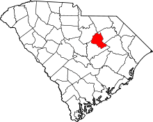 | |
| Town | ||
| Unincorporated communities | ||
| Footnotes | ‡This populated place also has portions in an adjacent county or counties | |