Biryulyovo Zapadnoye District
| Biryulyovo Zapadnoye District Район Бирюлёво Западное (Russian) | |
|---|---|
 Location of Biryulyovo Zapadnoye District on the map of Moscow (pre-2012 map) | |
| Coordinates: 55°35′N 37°38′E / 55.583°N 37.633°ECoordinates: 55°35′N 37°38′E / 55.583°N 37.633°E | |
.png) |
.png) |
|
| |
| Location | |
| Country | Russia |
| Federal subject | Federal city of Moscow[1] |
| Municipal structure (as of June 2013) | |
| Municipally incorporated as | Biryulyovo Zapadnoye Municipal Okrug[2] |
| Statistics | |
| Area (municipal okrug) (2013) | 8.5064 km2 (3.2843 sq mi)[3] |
| Population (2010 Census) | 85,726 inhabitants[4] |
| Population (January 2013 est.) | 87,764 inhabitants[3] |
| Density | 10,077.82/km2 (26,101.4/sq mi)[5] |
| Time zone | MSK (UTC+03:00)[6] |
| Official website | |
| Biryulyovo Zapadnoye District on WikiCommons | |
| 2010 Census | 85,726[4] |
|---|---|
| 2002 Census | 83,303[7] |
Biryulyovo Zapadnoye District (Russian: райо́н Бирюлёво За́падное) is a territorial division (a district, or raion) in Southern Administrative Okrug, one of the 125 in the federal city of Moscow, Russia.[1] It is located in the south of the federal city. The area of the district is 8.5064 square kilometers (3.2843 sq mi).[3] As of the 2010 Census, the total population of the district was 85,726.[4]
Municipal status
As a municipal division, the district is incorporated as Biryulyovo Zapadnoye Municipal Okrug.[2]
Economy
Transportation
The eastern border of the district is formed by the railway, and two railway stations, Biryulyovo-Tovarnaya and Biryulyovo-Passazhirskaya, are located in the district. They serve the Paveletsky suburban direction of Moscow Railway.
References
Notes
- 1 2 Law #13-47
- 1 2 Law #59
- 1 2 3 City of Moscow Territorial Branch of the Federal State Statistics Service Показатели, характеризующие состояние экономики и социальной сферы муниципального образования за 2013 год. Бирюлёво Западное. (Russian)
- 1 2 3 Russian Federal State Statistics Service (2011). "Всероссийская перепись населения 2010 года. Том 1" [2010 All-Russian Population Census, vol. 1]. Всероссийская перепись населения 2010 года (2010 All-Russia Population Census) (in Russian). Federal State Statistics Service. Retrieved June 29, 2012.
- ↑ The value of density was calculated automatically by dividing the 2010 Census population by the area specified in the infobox. Please note that this value is only approximate as the area specified in the infobox does not necessarily correspond to the area of the entity proper or is reported for the same year as the population.
- ↑ Правительство Российской Федерации. Федеральный закон №107-ФЗ от 3 июня 2011 г. «Об исчислении времени», в ред. Федерального закона №271-ФЗ от 03 июля 2016 г. «О внесении изменений в Федеральный закон "Об исчислении времени"». Вступил в силу по истечении шестидесяти дней после дня официального опубликования (6 августа 2011 г.). Опубликован: "Российская газета", №120, 6 июня 2011 г. (Government of the Russian Federation. Federal Law #107-FZ of June 31, 2011 On Calculating Time, as amended by the Federal Law #271-FZ of July 03, 2016 On Amending Federal Law "On Calculating Time". Effective as of after sixty days following the day of the official publication.).
- ↑ Russian Federal State Statistics Service (May 21, 2004). "Численность населения России, субъектов Российской Федерации в составе федеральных округов, районов, городских поселений, сельских населённых пунктов – районных центров и сельских населённых пунктов с населением 3 тысячи и более человек" [Population of Russia, Its Federal Districts, Federal Subjects, Districts, Urban Localities, Rural Localities—Administrative Centers, and Rural Localities with Population of Over 3,000] (XLS). Всероссийская перепись населения 2002 года [All-Russia Population Census of 2002] (in Russian). Retrieved August 9, 2014.
Sources
- Московская городская Дума. Закон №13-47 от 5 июля 1995 г. «О территориальном делении города Москвы», в ред. Закона №38 от 26 июня 2013 г. «О внесении изменений в статью 4 Закона города Москвы от 5 июля 1995 г. №13-47 "О территориальном делении города Москвы" и Закон города Москвы от 15 октября 2003 года №59 "О наименованиях и границах внутригородских муниципальных образований в городе Москве"». Вступил в силу с момента опубликования. Опубликован: "Вестник Мэрии Москвы", №14, июль 1995. (Moscow City Duma. Law #13-47 of July 5, 1995 On the Territorial Division of the City of Moscow, as amended by the Law #38 of June 26, 2013 On Amending Article 4 of the Law of the City of Moscow of July 5, 1995 #13-47 "On the Territorial Division of the City of Moscow" and the Law of the City of Moscow of October 15, 2003 #59 "On the Names and Borders of the Internal Municipal Formations in the City of Moscow". Effective as of the moment of publication.).
- Московская городская Дума. Закон №59 от 15 октября 2003 г. «О наименованиях и границах внутригородских муниципальных образований в городе Москве», в ред. Закона №38 от 26 июня 2013 г. «О внесении изменений в статью 4 Закона города Москвы от 5 июля 1995 г. №13-47 "О территориальном делении города Москвы" и Закон города Москвы от 15 октября 2003 года №59 "О наименованиях и границах внутригородских муниципальных образований в городе Москве"». Вступил в силу через 10 дней после официального опубликования (16 ноября 2003 г.). Опубликован: "Вестник Мэра и Правительства Москвы", №64, 5 ноября 2013 г. (Moscow City Duma. Law #59 of October 15, 2003 On the Names and Borders of the Internal Municipal Formations in the City of Moscow, as amended by the Law #38 of June 26, 2013 On Amending Article 4 of the Law of the City of Moscow of July 5, 1995 #13-47 "On the Territorial Division of the City of Moscow" and the Law of the City of Moscow of October 15, 2003 #59 "On the Names and Borders of the Internal Municipal Formations in the City of Moscow". Effective as of the day which is 10 days after the official publication (November 16, 2003).).
| Central Administrative Okrug | 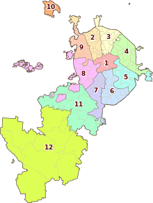 . . | |
|---|---|---|
| Northern Administrative Okrug | ||
| North-Eastern Administrative Okrug | ||
| Eastern Administrative Okrug | ||
| South-Eastern Administrative Okrug | ||
| Southern Administrative Okrug | ||
| South-Western Administrative Okrug | ||
| Western Administrative Okrug | ||
| North-Western Administrative Okrug | ||
| Zelenogradsky Administrative Okrug | ||
| Novomoskovsky Administrative Okrug |
| |
| Troitsky Administrative Okrug |
| |
This article is issued from Wikipedia - version of the 8/3/2015. The text is available under the Creative Commons Attribution/Share Alike but additional terms may apply for the media files.