Puerto Cabezas
| Puerto Cabezas | |||
|---|---|---|---|
| Municipality | |||
|
Pier in Bilwi, Puerto Cabezas | |||
| |||
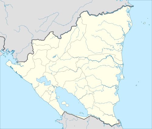 Puerto Cabezas Location in Nicaragua | |||
| Coordinates: 14°01′41″N 83°22′51″W / 14.02806°N 83.38083°W | |||
| Country |
| ||
| Department | North Caribbean Coast Autonomous Region | ||
| Area | |||
| • Municipality | 2,311 sq mi (5,985 km2) | ||
| Population (2005) | |||
| • Municipality | 66,169 | ||
| • Density | 29/sq mi (11/km2) | ||
| • Urban | 39,428 | ||
| Time zone | Central Time (UTC-6) | ||
| • Summer (DST) | No DST (UTC-6) | ||
| Climate | Am | ||
.jpg)

Puerto Cabezas (Spanish pronunciation: [ˈpweɾto kaˈβesas]; English: Bragman's Bluff; Miskito: Bilwi) is a municipality in Nicaragua. It is the capital of the North Caribbean Coast Autonomous Region (RACCN).
The municipality and the entire region are indigenous lands. The city of Bilwi is part of The Community of Karata, including land north of Bilwi, which borders The Community of Ten Communities. The owners are the various community groups who have demarcated their particular land areas under national law providing for recognition of aboriginal title to the land.
Hurricane Felix hit Puerto Cabezas on September 4, 2007, killing about 100 people.[1]
Education
The University of the Autonomous Regions of the Nicaraguan Caribbean Coast (URACCAN) has a campus in Puerto Cabezas, as well as in several other locations in the RACCN and the RACCS.
Transportation
The city is served by Puerto Cabezas Airport.
The culture, like the rest of Nicaragua's Caribbean coast, has a very prominent Caribbean influence.
Climate
Puerto Cabezas has tropical monsoon climate (Köppen climate classification Am) with significant precipitation year round, and a short dry season in March and April. Even so, these months see an average precipitation of 48 millimetres (2 in) and 54 millimetres (2 in).[2] The average temperature ranges from a low of 24.5 °C (76.1 °F) in February to 27.8 °C (82.0 °F) in May.[2] The average annual precipitation is 2,799 millimetres (110 in) with 198 days with measureable rainfall.[2]
| Climate data for Puerto Cabezas, Nicaragua | |||||||||||||
|---|---|---|---|---|---|---|---|---|---|---|---|---|---|
| Month | Jan | Feb | Mar | Apr | May | Jun | Jul | Aug | Sep | Oct | Nov | Dec | Year |
| Average high °C (°F) | 29.7 (85.5) |
29.7 (85.5) |
30.5 (86.9) |
31.3 (88.3) |
31.8 (89.2) |
31.4 (88.5) |
30.8 (87.4) |
31.2 (88.2) |
31.2 (88.2) |
31.6 (88.9) |
30.8 (87.4) |
29.7 (85.5) |
30.81 (87.46) |
| Daily mean °C (°F) | 25.0 (77) |
24.5 (76.1) |
26.5 (79.7) |
27.2 (81) |
27.8 (82) |
27.5 (81.5) |
27.1 (80.8) |
27.1 (80.8) |
27.0 (80.6) |
26.3 (79.3) |
25.8 (78.4) |
25.4 (77.7) |
26.43 (79.58) |
| Average low °C (°F) | 18.8 (65.8) |
18.6 (65.5) |
19.8 (67.6) |
20.9 (69.6) |
21.8 (71.2) |
22.0 (71.6) |
21.9 (71.4) |
22.0 (71.6) |
22.2 (72) |
21.6 (70.9) |
20.8 (69.4) |
19.3 (66.7) |
20.81 (69.44) |
| Average precipitation mm (inches) | 148 (5.83) |
83 (3.27) |
48 (1.89) |
54 (2.13) |
183 (7.2) |
378 (14.88) |
414 (16.3) |
370 (14.57) |
303 (11.93) |
338 (13.31) |
278 (10.94) |
202 (7.95) |
2,799 (110.2) |
| Average rainy days (≥ 1.0 mm) | 16 | 11 | 7 | 8 | 12 | 20 | 23 | 22 | 20 | 20 | 19 | 20 | 198 |
| Source: Hong Kong Observatory[2] | |||||||||||||
International relations
Twin towns – Sister cities
Puerto Cabezas is sister city to:
|
Bilwi has a "sistership" link with Manchester.[3]
See also
References
| Wikimedia Commons has media related to Puerto Cabezas. |
- ↑ AFP news
- 1 2 3 4 "Climatological Information for Puerto Cabezas, Nicaragua". Hong Kong Observatory. Retrieved December 6, 2012.
- ↑ "International networks and partnerships". Manchester City Council. Retrieved 17 June 2012.
Coordinates: 14°01′41″N 83°22′51″W / 14.02807°N 83.380791°W
Capital: Puerto Cabezas | ||
| Municipalities | 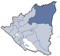 | |