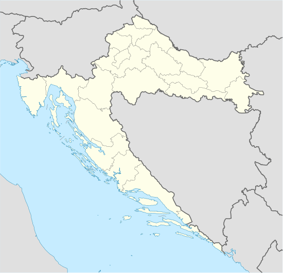
Biševo
 Biševo island seen from the airplane. | |
 Biševo | |
| Geography | |
|---|---|
| Location | Adriatic Sea |
| Coordinates | 42°58′N 16°0′E / 42.967°N 16.000°ECoordinates: 42°58′N 16°0′E / 42.967°N 16.000°E |
| Area | 5.8 km2 (2.2 sq mi) |
| Highest elevation | 239 m (784 ft) |
| Highest point | Straženica |
| Administration | |
|
Croatia | |
| County | Split-Dalmatia |
| Demographics | |
| Population | 15 (2011) |
Biševo (pronounced [bîʃɛv̞ɔ], Chakavian: Bisovo, Italian: Busi) is an island in the Adriatic Sea in Croatia. It is situated in the middle of the Dalmatian archipelago, five kilometers southwest of the Island of Vis. Its area is 5.8 km2[1][2] and it has a population of 15 (as of 2011).[3] It is composed of limestone;[4] the highest point is Straženica, 239 m high.[4] In the center of the island there is a fertile field, the northern part of the island is covered with pine forests and the rest of the island is covered with maquis shrubland or bare rocks. The coastal sea belt is a rich fishing area.[5] The main industries are viticulture and fishing.
A Benedictine monastery was founded on Biševo in 1050 by Ivan Grlić from Split, but it was deserted two centuries later because of the danger of pirates. The church of Saint Sylvester is preserved near the ruins of the monastery.[1][6]
Blue cave
On the steep shores there are many caves, the most famous being Blue Cave. It has been accessible since 1884, and the approach to the cave is only possible by boat.[5] It is 18 meters long, 6 meters deep, and 6 meters high.[4] The entrance to the cave is only 1.5 meters high and 2.5 meters wide.[7] Between 10 am and 1 pm sunbeams that penetrate through the submarine opening in Blue Cave are reflected from the white bottom floor, coloring the cave blue and objects in the water silver.[5]
Blue Cave on Bisevo is located on the eastern side of the island and is one of the most important attractions of the Adriatic. It was carved in limestone by the sea. It is entered on a boat. During the summer between 11 and 12 am sun’s rays penetrate and break up through an underwater opening making the whole interior shine with silvery blue light.
See also
References
- 1 2 (Croatian) First Croatian online peljar
- ↑ Duplančić Leder, Tea; Ujević, Tin; Čala, Mendi (June 2004). "Coastline lengths and areas of islands in the Croatian part of the Adriatic Sea determined from the topographic maps at the scale of 1 : 25 000" (PDF). Geoadria. Zadar. 9 (1): 5–32. Retrieved 2011-01-21.
- ↑ "Population by Age and Sex, by Settlements, 2011 Census: Biševo". Census of Population, Households and Dwellings 2011. Zagreb: Croatian Bureau of Statistics. December 2012.
- 1 2 3 "Biševo". General Encyclopedia of the Yugoslav Lexicographical Institute (in Croatian). 1. Zagreb: Yugoslav Lexicographical Institute. 1977.
- 1 2 3 Biševo at dalmacija.net
- ↑ Biševo on croatiatouristcenter.com
- ↑ (Croatian) Biševo on nautic-apartments.com Archived January 21, 2007, at the Wayback Machine.
External links
| Wikimedia Commons has media related to Biševo. |
- Biševo on croatia-beaches.com
- Biševo on croatiatouristcenter.com
- (Croatian) Biševo on nautic-apartments.com
- (Czech) Article about Biševo