Bhusawal
| Bhusawal भुसावळ Bhusaval | |
|---|---|
| Rail city | |
 Bhusawal Location in Maharashtra, India | |
| Coordinates: 21°03′N 75°46′E / 21.05°N 75.77°ECoordinates: 21°03′N 75°46′E / 21.05°N 75.77°E | |
| Country |
|
| State | Maharashtra |
| District | Jalgaon |
| Government | |
| • Type | Municipal Council |
| Elevation | 209 m (686 ft) |
| Population (2011) | |
| • Total | 204,016 |
| Demonym(s) | Bhusawalkar |
| Language | |
| • Official | Marathi |
| Time zone | IST (UTC+5:30) |
| PIN CODE | 425201 |
| Vehicle registration | MH-19 |
| Website | www.bhusawal.info |
Bhusawal also spelt as Bhusaval is a city and a municipal council (established in 1882) in Jalgaon district in the state of Maharashtra, India.
Geography
Bhusawal is located at 21°02′50.56″N 75°47′15.99″E / 21.0473778°N 75.7877750°E.[1] It has an average elevation of 209 metres (685 feet).
It is the biggest taluka of Jalgaon district, and situated on National Highway 6 (India)(old numbering). Bhusawal railway junction is one of the largest railway yards of the Indian subcontinent. Bhusawal is 181 km from historic city and tourism capital Aurangabad. World Heritage famous Ajanta is about 60 km (via Jamner) from Bhusawal.
Demographics
The total population of Bhusawal is 204,016. The male population of which is 105,164 while female population is 98,852. The literacy rate of Bhusawal is 90.53%. Literacy rate for male and female for Bhusawal stood at 94.94% and 85.89% respectively. Total literates in Bhusawal UA were 165,435 of which males were 88,928 and remaining 76,507 were females.
River
Bhusawal is located on the bank of Tapi river, The Tapti River (Hindi ताप्ती, Marathi तापी,Urdu تاپتی, Gujarati: તાપ્તી) ancient original name Tapi River (Sanskrit: तापी), is a river in central India. It is one of the major rivers (only the Tapi River along with the Narmada river, and the Mahi River run from east to west) of peninsular India with a length of around 724 kilometres (450 mi).
Transport
Railway
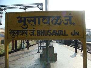
- Bhusawal railway station has very good railway connectivity, and is an important divisional headquarters of Central Railway of the Indian Railways. It is on both the Howrah-Allahabad-Mumbai line and the Howrah-Nagpur-Mumbai line.
- Bhusawal railway division is one of the five railway division under Central Railway Zone is headquartered at Bhusawal.
- The famous American 1956 movie, Bhowani Junction features a railway station that was modelled on the Bhusawal railway station.
- Bhusawal is a very big junction on Central Railway (The biggest railway station in Maharashtra).Mumbai – Delhi(North/West) & Mumbai-Kolkata (East/West) connections splits at this Junction.
- There is a Zonal Training Center for Railway Staff in Bhusawal. ZTC is the area known popularly.
- P.O.H. & M.O.H. are the two overhauling units work 24 hrs for maintenance of locomotive engines.
- When steam locomotives were used in India, this was a big Steam loco shed for the same and due to river Tapi, the train usually used to stop here to get water and stock for loco engines as well as passenger utility.
- A unique '#' crossing (known as diamond crossing) of railway line - which is in 90 degree to each other is seen here first.
- Bhusawal is the nearest such a railway junction to Ajanta (60 km away), where every train has a stop.
- Bhusawal railway yard is one of the biggest yard in Asia. It is second largest yard in Asia.
Air
Aurangabad is the ideal base since it has direct link to Delhi, Pune, Nagpur and Mumbai.
Jalgaon Airport is also nearer to Bhusawal, but still it's under development.
Excursions
- The world famous
- Thermal Power Station of Maharashtra State Electricity Board, Deepnagar (7 km)
- Ordinance Factory,BHUSAWAL AND Varangaon (15 km)
- Orient Cement Grinding Unit (12 km)
- Indian Oil Corporation Limited Depot (15 km)
- Railway's Zonal Training School
Education
Bhusawal has many educational schools in Marathi, English, Hindi and Urdu, Colleges, Technical Colleges, Computer Institutes and Management institutions within its city limits.Mr. Girish R. Parikh runs a computer institute which is considered to be the first computer institute of bhusawal and jamner provides second chance to students who fail or cannot continue their education.[2]
Schools
|
|
|
Colleges
|
|
Villages
- Achegaon
- Anjansonde
- Belkhede Digar
- Belvhal
- Bhankhede Pr. Edlabad
- Bhilmali
- Bhusawal (M Cl)
- Bhusawal (Rural)
- Bohardi Bk
- Bohardi Kh
- Chorwad
- Daryapur
- Deepnagar
- Fekari
- Fulgaon
- Gojore
- Gombhi
- Hatnur
- Jadgaon
- Jogalkhede
- Jogalkhori
- Kahurkhede
- Kandari (CT)
- Kanhale Bk.
- Kanhale Kh.
- Kathore Bk.
- Kathore Kh.
- Khadke
- Khandale
- Khedi Bk.
- Kinhi
- Kurhe Pr. Nashirabad
- Mandavedigar
- Manpur
- Manyarkhede
- Mirgavhan
- Mondhale
- Nimbhore Budruk (CT)
- Nimbhore Kh.
- Pimpalgaon Bk.
- Pimpalgaon Kh.
- Pimprisekam.
- Sakari
- Sakegaon
- Sangvi BK
- Savtar
- Shindi
- Sunasgaon
- Susari
- Tahakali
- Talwel
- Vanjole
- Varad Seem
- VARANGAON
- Vazarkhede
- Vilhale
Delicacies of Bhusawal
Bhusawal is also famous for its banana cultivation. Traders from various parts of the country come to Bhusawal to buy raw bananas. Bananas are exported to different countries across the world. Bhusawal is also known for its special white brinjals that are grown locally in the nearby areas. They often constitute the delicacies in local marriages, along with daal baati toop (a lentil dish served with ghee) served with peanut garlic chutney. "Banducha Vada-Pav" and "Ghasilal Vada-Pav" of Bhusawal are famous in whole Jalgaon District. People from nearby villages hardly miss to visit these places.
In fiction
The fictional Indian town of Bhowani, the setting of the historical novels Nightrunners of Bengal and Bhowani Junction by John Masters, is thought to be modeled on Bhusawal.
'27 Down', a 1974 Bollywood drama film directed by Awtar Krishna Kaul, features Bhusawal Railway Station, Railway Colony. Its storyline revolves around people working with Railways at Bhusawal and their families.
Director Vijaya Mehta's fil 'Pestonjee' (1988) also features Bhusawal.
Lt Col Sanjoy Banerji, the famous adventurer and photographer had published a photo feature on Bhusawal's Railways in National Geographic magazine.
See also
- Bhusawal Railway Station
- Bhusawal Railway Division
- Bhusawal Thermal Power Station
- Bhusawal (Vidhan Sabha constituency)
References
- ↑ "Maps, Weather, and Airports for Bhusawal, India". Fallingrain.com. Retrieved 2016-01-14.
- ↑ General Data Pvt. Ltd. "Educational institutions, Bhusaval, Management institutes". Bhusaval.com. Retrieved 2016-01-14.
- ↑ "TES's - Bhusawal Arts, Science & P. O. Nahata Commerce College". Basponccollege.org. Retrieved 2016-01-14.
- ↑ "Welcome To K.Narkhede College". Knarkhedecs.org. Retrieved 2016-01-14.
- ↑ "Smt.P.K.Kotecha Mahila Mahavidyalaya, Bhusawal". Pkkotecha.org. Retrieved 2016-01-14.
- ↑ "Hindi Seva Mandal's Shri Sant Gadge Baba College Of Engineering and Technology, Bhusawal.| Best Engineering College,Top Engineering College,Engineering College at Bhusawal,Engineering College in North Maharashtra University,Engineering Colleges affiliated". Ssgbcoet.com. Retrieved 2016-01-14.
- ↑ "Biyani Education Group Bhusawal". Biyanieducationgroup.com. Retrieved 2016-01-14.
- ↑ ":: Imcd ::". Imcdbsl.co.in. Retrieved 2016-01-14.
Jalgaon district topics | ||
|---|---|---|
| History | 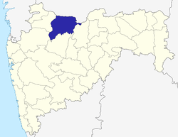 | |
| Tehsils | ||
| Education | ||
| Lok Sabha constituencies | ||
| Vidhan Sabha constituencies | ||
| Major towns and villages | ||