Bhujabalapatnam
| Bhujabalapatnam భుజబలపట్నం | |
|---|---|
| Village | |
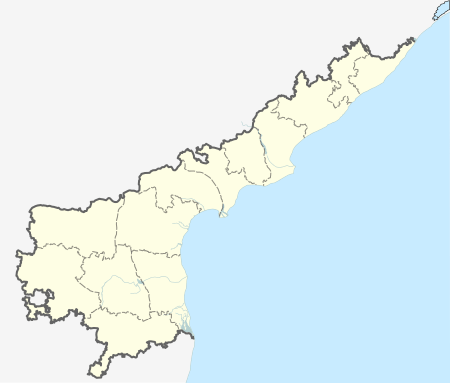
 Bhujabalapatnam  Bhujabalapatnam Location in Andhra Pradesh, India | |
| Coordinates: 16°35′N 81°16′E / 16.58°N 81.27°ECoordinates: 16°35′N 81°16′E / 16.58°N 81.27°E | |
| Country | India |
| State | Andhra Pradesh |
| Districts | Andhra Pradesh |
| Population (2011)[1] | |
| • Total | 6,046 |
| Languages | |
| • Official | Telugu |
| Time zone | IST (UTC+5:30) |
| PIN | 522403 |
| Telephone code | 91-8646 |
| Vehicle registration | AP |
Bhujabalapatnam is a village in Kaikaluru mandal, located in Krishna district of Indian state of Andhra Pradesh.[2]
Government and politics
Bhujabalapatnam gram panchayat is the local self-government of the village.[3] The elected members of the gram panchayat is headed by a sarpanch.[4]
References
- ↑ "Census 2011". The Registrar General & Census Commissioner, India. Retrieved 6 November 2014.
- ↑ "Mandal wise villages" (PDF). apland.ap.nic.in. Archived from the original (PDF) on 10 December 2014. Retrieved 4 November 2014.
- ↑ "Poll promise to downsize lake takes a heavy toll on Kolleru". The Hindu. 2014-12-09. ISSN 0971-751X. Retrieved 2016-04-10.
- ↑ Seetharam, Mukkavilli (1990-01-01). Citizen Participation in Rural Development. Mittal Publications. ISBN 9788170992271.
This article is issued from Wikipedia - version of the 11/1/2016. The text is available under the Creative Commons Attribution/Share Alike but additional terms may apply for the media files.