Bharuch district
| Bharuch district | |
|---|---|
| District | |
 Location of Bharuch district in Gujarat | |
| Country |
|
| State | Gujarat |
| Headquarters | Bharuch |
| Languages | |
| • Official | Gujarati, Hindi, English |
| Time zone | IST (UTC+5:30) |
| Vehicle registration | GJ |
| Website |
gujaratindia |
Bharuch (formerly commonly known as Broach) (Gujarati: ભરૂચ) in India, is a district in the southern part of the Gujarat peninsula on the west coast of state of Gujarat with a size and population comparable to that of Greater Boston. The Narmada River outlets into the Gulf of Khambat through its lands and that shipping artery gave inland access to the kingdoms and empires located in the central and northern parts of the sub-continent of India.
History

The city of Bharuch and its surrounds—today's district—has been settled far back into antiquity and was a major shipping building centre and sea port in the important pre-compass coastal trading routes to points West, perhaps as far back as the days of the Pharaohs, which utilised the regular and predictable Monsoon winds or galleys. Many goods from the Far East (the famed Spice and Silk trade) were trans-shipped there for the annual monsoon winds making it a terminus for several key land-sea trade routes and Bharuch was definitely known to the Greeks, the various Persian Empires and in the Roman Republic and Empire and other Western centres of civilisation right on through the end of the European Middle Ages.
With the advent of the Age of Discovery, the presence of deep draft sea going shipping it began a long slow decline in importance as it was a bit too far north to be convenient to shipping not confined to keeping within sight of shore.
Divisions
Administratively, it contains the talukas (administrative subdistricts) of Bharuch, Ankleshwar, Hansot, Jambusar, Jhagadia, Amod, Valia and Vagra. It also contains the city of Bharuch.
Demographics
According to the 2011 census Bharuch district has a population of 1,550,822,[1] roughly equal to the nation of Gabon[2] or the US state of Hawaii.[3] This gives it a ranking of 321st in India (out of a total of 640).[1] The district has a population density of 238 inhabitants per square kilometre (620/sq mi) .[1] Its population growth rate over the decade 2001-2011 was 13.14%.[1] Bharuch has a sex ratio of 924 females for every 1000 males,[1] and a literacy rate of 83.03%.[1] Muslims are a majority, comprising 57% of the district. hindu are significant minority This area is also home to the Muslim Vohra Patel community.
Culture
Notable personalities
- Abdulahad Malik Cricketer in IPL for Rajasthan Royals . Born in Hansot.
- Adam Patel, Baron Patel of Blackburn UK House of Lords.
- Ahmed Patel Indian Parliamentarian for the Indian National Congress .
- Professor Alimuddin Zumla Ennobled multi-award winning (Medicine) Medic at a prestigious London University. (University College London)
- Balwantray Thakore (1869–1952) Poet. Born in Bharuch.
- Farooq Shaikh Actor, TV presenter and philanthropist. Ancestral village Hansot.
- Kanaiyalal Maneklal Munshi (1887–1971) Indian independence movement activist, politician, writer and educationist. Born in the city of Bharuch.[4]
- Munaf Patel Cricketer formerly in the IPL for Rajasthan Royals.
- Rashid Patel
- Tribhuvandas Luhar (1908–1991) Poet. Born in Miyamatar.[5]
See also
References
- 1 2 3 4 5 6 "District Census 2011". Census2011.co.in. 2011. Retrieved 30 September 2011.
- ↑ US Directorate of Intelligence. "Country Comparison:Population". Retrieved 1 October 2011.
Gabon 1,576,665
- ↑ "2010 Resident Population Data". U. S. Census Bureau. Archived from the original on 19 October 2013. Retrieved 30 September 2011.
Hawaii 1,360,301
- ↑ "Bhavan's Faith". Bharatiya Vidya Bhavan. Retrieved 20 May 2011.
- ↑ "Tribhuvandas Luhar (Sundaram)". Thakkar Numismatic and Art Foundation. Retrieved 20 May 2011.
 |
Anand district | Vadodara district | | |
| Gulf of Khambhat | |
Narmada district | ||
| ||||
| | ||||
| Surat district | Surat district/Narmada district |
| Topics | 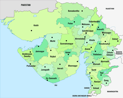 | |
|---|---|---|
| Regions of Gujarat |
| |
| Districts | ||
| Major cities | ||
| Ecoregions | ||
| Economy |
| |
| ||
Coordinates: 20°42′N 72°59′E / 20.700°N 72.983°E