Bethanien Airport
| Bethanien Airport | |||||||||||
|---|---|---|---|---|---|---|---|---|---|---|---|
| IATA: none – ICAO: FYBC | |||||||||||
| Summary | |||||||||||
| Airport type | Public | ||||||||||
| Serves | Bethanien | ||||||||||
| Elevation AMSL | 3,500 ft / 1,067 m | ||||||||||
| Coordinates | 26°32′45″S 17°10′55″E / 26.54583°S 17.18194°ECoordinates: 26°32′45″S 17°10′55″E / 26.54583°S 17.18194°E | ||||||||||
| Map | |||||||||||
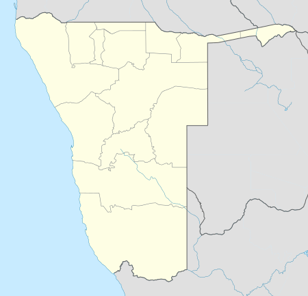 FYBC Location of the airport in Namibia | |||||||||||
| Runways | |||||||||||
| |||||||||||
Bethanien Airport (ICAO: FYBC) is an airport serving the town of Bethanien, Namibia. The runway is 5 kilometres (3.1 mi) southeast of the town, paralleling the C14 road.
See also
 Aviation portal
 Namibia portal
- List of airports in Namibia
- Transport in Namibia
References
- ↑ Google Maps - Bethanien
- ↑ Airport information for FYBC at Great Circle Mapper.
- Google Earth
External links
This article is issued from Wikipedia - version of the 11/8/2016. The text is available under the Creative Commons Attribution/Share Alike but additional terms may apply for the media files.