Berlin, Wisconsin
| Berlin, Wisconsin | |
|---|---|
| City | |
|
Downtown Berlin | |
| Nickname(s): fur and leather city | |
 Location of Berlin, Wisconsin | |
| Coordinates: 43°58′11″N 88°56′55″W / 43.96972°N 88.94861°WCoordinates: 43°58′11″N 88°56′55″W / 43.96972°N 88.94861°W | |
| Country | United States |
| State | Wisconsin |
| Counties | Green Lake, Waushara |
| Area[1] | |
| • Total | 6.36 sq mi (16.47 km2) |
| • Land | 5.78 sq mi (14.97 km2) |
| • Water | 0.58 sq mi (1.50 km2) |
| Elevation[2] | 807 ft (246 m) |
| Population (2010)[3] | |
| • Total | 5,524 |
| • Estimate (2012[4]) | 5,519 |
| • Density | 955.7/sq mi (369.0/km2) |
| Time zone | Central (CST) (UTC-6) |
| • Summer (DST) | CDT (UTC-5) |
| Area code(s) | 920 |
| FIPS code | 55-06925[5] |
| GNIS feature ID | 1561600[2] |
| Website |
cityofberlin |

Berlin is a city in Green Lake and Waushara counties in the U.S. state of Wisconsin. The population was 5,524 at the 2010 census. Of this, 5,435 were in Green Lake County, and only 89 were in Waushara County. The city is located mostly within the Town of Berlin in Green Lake County, with a small portion extending into the Town of Aurora in Waushara County.
History
In 1845, Nathan H. Strong (1813–1852) became the first resident of what is today Berlin.[6] He was joined by Hugh G. Martin, Hiram Barnes, and William Dickey. Their settlement was known as Strong's Landing.[6] In 1848 a post office was established. It was named Berlin after the capital of Prussia, now the capital of Germany.[7] The first school house was built in 1850 and the first church in 1851. Berlin was incorporated as a city in 1857.
Pronunciation
Area residents put the accent on the first syllable of Berlin /ˈbɜːrlɪn/ rather than on the second. It has been said that this was in reaction to the anti-German sentiment that swept across the United States during World War I, and that the accent was previously on the second syllable.[8][9]
Geography
Berlin is located at 43°58′11″N 88°56′55″W / 43.96972°N 88.94861°W (43.969732, −88.948717).[10] The Fox River runs north-south through the middle of the city splitting it.
According to the United States Census Bureau, the city has a total area of 6.36 square miles (16.47 km2), of which, 5.78 square miles (14.97 km2) is land and 0.58 square miles (1.50 km2) is water.[1]
Transportation
Berlin is served by Wisconsin Highway 49 and Wisconsin Highway 91.
Demographics
| Historical population | |||
|---|---|---|---|
| Census | Pop. | %± | |
| 1860 | 1,449 | — | |
| 1870 | 2,777 | 91.6% | |
| 1880 | 3,353 | 20.7% | |
| 1890 | 4,149 | 23.7% | |
| 1900 | 4,489 | 8.2% | |
| 1910 | 4,636 | 3.3% | |
| 1920 | 4,400 | −5.1% | |
| 1930 | 4,106 | −6.7% | |
| 1940 | 4,247 | 3.4% | |
| 1950 | 4,693 | 10.5% | |
| 1960 | 4,838 | 3.1% | |
| 1970 | 5,338 | 10.3% | |
| 1980 | 5,478 | 2.6% | |
| 1990 | 5,371 | −2.0% | |
| 2000 | 5,305 | −1.2% | |
| 2010 | 5,524 | 4.1% | |
| Est. 2015 | 5,420 | [11] | −1.9% |
2010 census
As of the census[3] of 2010, there were 5,524 people, 2,296 households, and 1,423 families residing in the city. The population density was 955.7 inhabitants per square mile (369.0/km2). There were 2,561 housing units at an average density of 443.1 per square mile (171.1/km2). The racial makeup of the city was 93.4% White, 0.5% African American, 0.6% Native American, 0.9% Asian, 3.6% from other races, and 1.0% from two or more races. Hispanic or Latino of any race were 8.0% of the population.
There were 2,296 households of which 31.3% had children under the age of 18 living with them, 44.4% were married couples living together, 11.8% had a female householder with no husband present, 5.7% had a male householder with no wife present, and 38.0% were non-families. 32.0% of all households were made up of individuals and 14.9% had someone living alone who was 65 years of age or older. The average household size was 2.38 and the average family size was 3.00.
The median age in the city was 39 years. 25.8% of residents were under the age of 18; 7.2% were between the ages of 18 and 24; 24.8% were from 25 to 44; 25.7% were from 45 to 64; and 16.4% were 65 years of age or older. The gender makeup of the city was 48.5% male and 51.5% female.
2000 census
As of the census[5] of 2000, there were 5,305 people, 2,170 households, and 1,425 families residing in the city. The population density was 887.4 people per square mile (342.5/km²). There were 2,391 housing units at an average density of 400.0 per square mile (154.4/km²). The racial makeup of the city was 95.70% White, 0.15% Black or African American, 0.28% Native American, 0.77% Asian, 0.02% Pacific Islander, 2.47% from other races, and 0.60% from two or more races. 4.56% of the population were Hispanic or Latino of any race.
There were 2,170 households out of which 31.5% had children under the age of 18 living with them, 51.8% were married couples living together, 9.4% had a female householder with no husband present, and 34.3% were non-families. 30.3% of all households were made up of individuals and 15.3% had someone living alone who was 65 years of age or older. The average household size was 2.39 and the average family size was 2.96.
In the city the population was spread out with 25.1% under the age of 18, 7.4% from 18 to 24, 28.1% from 25 to 44, 21.4% from 45 to 64, and 18.0% who were 65 years of age or older. The median age was 38 years. For every 100 females there were 92.2 males. For every 100 females age 18 and over, there were 88.4 males.
The median income for a household in the city was $36,896, and the median income for a family was $44,922. Males had a median income of $31,512 versus $21,658 for females. The per capita income for the city was $17,667. About 3.6% of families and 7.0% of the population were below the poverty line, including 5.3% of those under age 18 and 11.8% of those age 65 or over.
Religion
St. Paul's Evangelical Lutheran Church is a Christian church of the Wisconsin Evangelical Lutheran Synod in Berlin.[13]
Media
News media
- Berlin Journal is a weekly newspaper published in Berlin, Wisconsin.
Radio
- WISS (AM) is the area radio station in Berlin, Wisconsin.
Notable people
- Nelson F. Beckwith – Wisconsin State Assembly
- Fred Blair – candidate for Wisconsin Governor and U.S. Senate
- William A. Bugh - lawyer and Wisconsin State Assembly
- Valentine Detling - Wisconsin State Assembly
- George Fitch - Wisconsin State Senate
- Patricia A. Goodrich - Wisconsin State Assembly
- Chris Greisen – NFL player
- Timothy Huskey – Distinguished Flying Cross recipient and author of Blood and Iron
- Katherine Davies Jones - botantist
- Andy Jorgensen - Wisconsin State Assembly[14]
- William Nigh - actor and director
- Luther Olsen - Wisconsin State Senate
- Reuben W. Peterson - Wisconsin State Assembly
- Daniel E. Riordan - Wisconsin State Senate
- Hobart Sterling Sacket - Wisconsin State Assembly and Senate
- Fred W. Schlueter - Wisconsin State Assembly
- August E. Smith - Wisconsin State Assembly
- Newcomb Spoor - Wisconsin State Assembly
- George D. Waring - Wisconsin State Senate
- Christian C. Wellensgard - Wisconsin State Assembly
- Ferdinand T. Yahr - Wisconsin State Senate
Images


References
| Wikimedia Commons has media related to Berlin, Wisconsin. |
- 1 2 "US Gazetteer files 2010". United States Census Bureau. Archived from the original on 2012-07-14. Retrieved 2012-11-18.
- 1 2 "US Board on Geographic Names". United States Geological Survey. 2007-10-25. Retrieved 2008-01-31.
- 1 2 "American FactFinder". United States Census Bureau. Retrieved 2012-11-18.
- ↑ "Population Estimates". United States Census Bureau. Archived from the original on 2013-06-17. Retrieved 2013-06-24.
- 1 2 "American FactFinder". United States Census Bureau. Archived from the original on 2013-09-11. Retrieved 2008-01-31.
- 1 2 "Death [of Nathan H. Strong]". The Weekly Wisconsin. September 1, 1852. p. 1. Retrieved August 26, 2014 – via Newspapers.com.

- ↑ "Early History", Berlin (Wis.) Courant, January 26, 1905.
- ↑ Maxwell, Brandt. 2006. The Big Book of Geography: Mind-Boggling Facts from around the World. New York: Barnes and Noble.
- ↑ Mitchell, Myrtle Tews, Vaughn Allan Mitchell, Leonard L. Tews, & Adrienne L. Kaeppler. 1999. Every Day is Tewsday: A Memoir of the Martien and Julius Tews Family Histories, Genealogies, Remembrances. Author, p. 15.
- ↑ "US Gazetteer files: 2010, 2000, and 1990". United States Census Bureau. 2011-02-12. Retrieved 2011-04-23.
- ↑ "Annual Estimates of the Resident Population for Incorporated Places: April 1, 2010 to July 1, 2015". Retrieved July 2, 2016.
- ↑ "Census of Population and Housing". Census.gov. Archived from the original on April 22, 2013. Retrieved June 4, 2015.
- ↑ "St. Paul's Ev. Lutheran".
- ↑ "Andy Jorgenson", Wisconsin Blue Book 2007-2008, p. 45.
Further reading
- Newspaper articles describing Berlin's history
External links
- City of Berlin
- Sanborn fire insurance maps: 1884 1891 1895 1900 1911
- Nathan H. Strong (founder of Berlin) at Find a Grave
Municipalities and communities of Green Lake County, Wisconsin, United States | ||
|---|---|---|
| Cities | 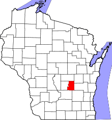 | |
| Villages | ||
| Towns | ||
| CDP | ||
| Unincorporated communities | ||
| Footnotes | ‡This populated place also has portions in an adjacent county or counties | |
Municipalities and communities of Waushara County, Wisconsin, United States | ||
|---|---|---|
| Cities |  | |
| Villages | ||
| Towns | ||
| CDPs | ||
| Unincorporated communities | ||
| Ghost town | ||
| Footnotes | ‡This populated place also has portions in an adjacent county or counties | |