Berlin, Massachusetts
| Berlin, Massachusetts | ||
|---|---|---|
| Town | ||
|
Rural scene, Berlin, Massachusetts | ||
| ||
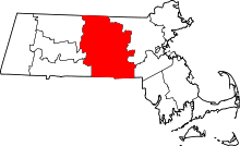
 Location in Worcester County and the state of Massachusetts. | ||
| Coordinates: 42°22′52″N 71°38′15″W / 42.38111°N 71.63750°WCoordinates: 42°22′52″N 71°38′15″W / 42.38111°N 71.63750°W | ||
| Country | United States | |
| State | Massachusetts | |
| County | Worcester | |
| Settled | 1665 | |
| Incorporated | 1812 | |
| Government | ||
| • Type | Open town meeting | |
| Area | ||
| • Total | 13.1 sq mi (33.9 km2) | |
| • Land | 12.9 sq mi (33.5 km2) | |
| • Water | 0.2 sq mi (0.4 km2) | |
| Elevation | 300 ft (91 m) | |
| Population (2010) | ||
| • Total | 2,866 | |
| • Density | 220/sq mi (85/km2) | |
| Time zone | Eastern (UTC-5) | |
| • Summer (DST) | Eastern (UTC-4) | |
| ZIP code | 01503 | |
| Area code(s) | 351 / 978 | |
| FIPS code | 25-05490 | |
| GNIS feature ID | 0619476 | |
| Website | www.townofberlin.com | |


Berlin /ˈbɜːrlᵻn/[1] is a town in Worcester County, Massachusetts, United States. The population was 2,866 at the 2010 census.
History
Berlin was first settled in 1665 and was officially incorporated in 1812.
Berlin lies in a low range of hills between the Nashua River and Assabet River valleys. Incorporated in 1812, the town was a residential and agricultural community, growing mixed hay grains and raising cattle. For a period after the Civil War, Berlin was home to a large shoe factory, and shoe manufacturing and lumbering provided non-agrarian jobs. The town soon moved into specialty market gardening, sending 41,000 bunches of asparagus to market in 1885, growing hops and raising chickens. By 1940, 83,600 dozen eggs were produced annually by the poultry farmers of Berlin.
Town hall
Berlin’s first town house was constructed in 1831 for town meetings and social activities. Community growth necessitated the construction of a new town hall, and construction of the new town hall was started in 1869 and completed in 1870. The lot, a small piece of land facing the Meeting House Common in the center of Berlin, was given to the town by Artemas Barnes.
The Memorial Hall, on the first floor, included photographs of nearly all the local soldiers lost in the Civil War. Later the photos of other Civil War veterans were added until likenesses of nearly 100 local men were collected there. In the 20th Century, war dead of World War I, World War II and Vietnam were added.
Barnes Hall, used for social gatherings, and the Selectmen’s Room were also on the first floor. In 1904-1905, an addition was built at the back of the building to provide space for a kitchen and the public library on the first floor, and the stage on the second floor. Toilets were added in the 1930s.
In 1998, however, the town hall was moved from the 1870 building to the former home of the elementary school (the school was moved into a new building).
The public library was located in the Town Hall from 1891 until 1928. Barnes Hall was used as a school room in the 1870s. As recently as 1999 the locally produced musical Swinging Into the Millennium was held in the upper hall. Two area contra dance groups have used the hall in recent years. Meetings of Boy and Girl Scouts and local youth baseball and soccer groups also are held in the building.
The project of refurbishing and renovations of the Town Hall, under the direction of the Friends of the Town Hall, is ongoing.[2]
Geography
According to the United States Census Bureau, the town has a total area of 16.1 square miles (42 km2), of which 12.9 square miles (33 km2) is land and 0.2 square miles (0.52 km2), or 1.22%, is water. Berlin is bordered by Hudson and Marlborough to the east, Bolton to the north, Clinton and Boylston to the west, and Northborough to the south. Berlin is the center of population for New England.[3]
Demographics
| Historical population | ||
|---|---|---|
| Year | Pop. | ±% |
| 1850 | 866 | — |
| 1860 | 1,106 | +27.7% |
| 1870 | 1,016 | −8.1% |
| 1880 | 977 | −3.8% |
| 1890 | 884 | −9.5% |
| 1900 | 1,003 | +13.5% |
| 1910 | 904 | −9.9% |
| 1920 | 868 | −4.0% |
| 1930 | 1,075 | +23.8% |
| 1940 | 1,057 | −1.7% |
| 1950 | 1,349 | +27.6% |
| 1960 | 1,742 | +29.1% |
| 1970 | 2,099 | +20.5% |
| 1980 | 2,215 | +5.5% |
| 1990 | 2,293 | +3.5% |
| 2000 | 2,380 | +3.8% |
| 2010 | 2,866 | +20.4% |
| * = population estimate. Source: United States Census records and Population Estimates Program data.[4][5][6][7][8][9][10][11][12][13] | ||
As of the census[14] of 2000, there were 2,380 people, 872 households, and 666 families residing in the town. The population density was 184.1 people per square mile (71.1/km²). There were 893 housing units at an average density of 69.1 per square mile (26.7/km²). The racial makeup of the town was 97.61% White, 0.17% African American, 0.08% Native American, 0.97% Asian, 0.38% from other races, and 0.80% from two or more races. Hispanic or Latino of any race were 0.50% of the population.
There were 872 households out of which 34.5% had children under the age of 18 living with them, 64.8% were married couples living together, 8.1% had a female householder with no husband present, and 23.6% were non-families. 18.7% of all households were made up of individuals and 8.1% had someone living alone who was 65 years of age or older. The average household size was 2.72 and the average family size was 3.13.
In the town the population was spread out with 25.0% under the age of 18, 5.3% from 18 to 24, 30.2% from 25 to 44, 27.1% from 45 to 64, and 12.4% who were 65 years of age or older. The median age was 40 years. For every 100 females there were 99.8 males. For every 100 females age 18 and over, there were 97.3 males.
The median income for a household in the town was $65,667, and the median income for a family was $76,419. Males had a median income of $50,711 versus $32,330 for females. The per capita income for the town was $28,915. About 2.1% of families and 3.9% of the population were below the poverty line, including 6.5% of those under age 18 and 2.7% of those age 65 or over.
Government
| County-level state agency heads | |
|---|---|
| Clerk of Courts: | Dennis P. McManus (D) |
| District Attorney: | Joseph D. Early, Jr. (D) |
| Register of Deeds: | Anthony J. Vigliotti (D) |
| Register of Probate: | Stephanie K. Fattman (R) |
| County Sheriff: | Lew Evangelidis (R) |
| State government | |
| State Representative(s): | Harold Naughton (D) |
| State Senator(s): | Jennifer Flanagan (D) |
| Governor's Councilor(s): | Jen Caissie (R) |
| Federal government | |
| U.S. Representative(s): | Niki Tsongas(D) (3rd District), |
| U.S. Senators: | Elizabeth Warren (D), Ed Markey (D) |
Notable people
- Walter Bickford, politician
- Donald Featherstone, artist.
References
- ↑ The town's name is pronounced with the stress on the first syllable.
- ↑ Berlin Art & Historical Society Home Page Archived July 17, 2011, at the Wayback Machine.
- ↑ Population and Population Centers by State: 2000 Archived 2013-06-22 at WebCite. United States Census Bureau, United States Department of Commerce. Retrieved January 14, 2007.
- ↑ "TOTAL POPULATION (P1), 2010 Census Summary File 1". American FactFinder, All County Subdivisions within Massachusetts. United States Census Bureau. 2010.
- ↑ "Massachusetts by Place and County Subdivision - GCT-T1. Population Estimates". United States Census Bureau. Retrieved July 12, 2011.
- ↑ "1990 Census of Population, General Population Characteristics: Massachusetts" (PDF). US Census Bureau. December 1990. Table 76: General Characteristics of Persons, Households, and Families: 1990. 1990 CP-1-23. Retrieved July 12, 2011.
- ↑ "1980 Census of the Population, Number of Inhabitants: Massachusetts" (PDF). US Census Bureau. December 1981. Table 4. Populations of County Subdivisions: 1960 to 1980. PC80-1-A23. Retrieved July 12, 2011.
- ↑ "1950 Census of Population" (PDF). Bureau of the Census. 1952. Section 6, Pages 21-10 and 21-11, Massachusetts Table 6. Population of Counties by Minor Civil Divisions: 1930 to 1950. Retrieved July 12, 2011.
- ↑ "1920 Census of Population" (PDF). Bureau of the Census. Number of Inhabitants, by Counties and Minor Civil Divisions. Pages 21-5 through 21-7. Massachusetts Table 2. Population of Counties by Minor Civil Divisions: 1920, 1910, and 1920. Retrieved July 12, 2011.
- ↑ "1890 Census of the Population" (PDF). Department of the Interior, Census Office. Pages 179 through 182. Massachusetts Table 5. Population of States and Territories by Minor Civil Divisions: 1880 and 1890. Retrieved July 12, 2011.
- ↑ "1870 Census of the Population" (PDF). Department of the Interior, Census Office. 1872. Pages 217 through 220. Table IX. Population of Minor Civil Divisions, &c. Massachusetts. Retrieved July 12, 2011.
- ↑ "1860 Census" (PDF). Department of the Interior, Census Office. 1864. Pages 220 through 226. State of Massachusetts Table No. 3. Populations of Cities, Towns, &c. Retrieved July 12, 2011.
- ↑ "1850 Census" (PDF). Department of the Interior, Census Office. 1854. Pages 338 through 393. Populations of Cities, Towns, &c. Retrieved July 12, 2011.
- ↑ "American FactFinder". United States Census Bureau. Archived from the original on 2013-09-11. Retrieved 2008-01-31.
External links
| Wikimedia Commons has media related to Berlin, Massachusetts. |