Berja
| Berja, Spain | |||
|---|---|---|---|
| |||
| Coordinates: 36°51′N 2°57′W / 36.850°N 2.950°WCoordinates: 36°51′N 2°57′W / 36.850°N 2.950°W | |||
| Country | Spain | ||
| Community | Andalusia | ||
| Municipality | Almería | ||
| Government | |||
| • Mayor | Antonio Torres López (PP) | ||
| Area | |||
| • Total | 218 km2 (84 sq mi) | ||
| Elevation | 335 m (1,099 ft) | ||
| Population (2005) | |||
| • Total | 14,249 | ||
| • Density | 65/km2 (170/sq mi) | ||
| Time zone | CET (UTC+1) | ||
| • Summer (DST) | CEST (UTC+2) | ||

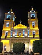
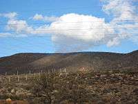
Berja (Spanish pronunciation: [ˈbeɾxa]) is a municipality of Almería province, in the autonomous community of Andalusia, Spain. It is located on the south-eastern slope of the Sierra de Gádor, 10 miles north-east of Adra by road.
History
| Historical population | ||
|---|---|---|
| Year | Pop. | ±% |
| 1999 | 13,317 | — |
| 2000 | 13,279 | −0.3% |
| 2001 | 13,331 | +0.4% |
| 2002 | 13,405 | +0.6% |
| 2003 | 13,670 | +2.0% |
| 2004 | 13,924 | +1.9% |
| 2005 | 14,249 | +2.3% |
| Source: INE (Spain) | ||
Berja may have Phoenician or Iberian origins; it was known to the Romans as Vergis or Vergium, and it was part of the province of Baetica. There are Roman remains in the Villa Vieja: an amphitheater and an aqueduct, and mosaics whose style and production are similar to those found in Pompeii and Herculaneum.
Saint Ctesiphon (San Tesifón), patron saint of the town, is said to have preached in the area in the first century, bringing Christianity to the town. From this era are conserved coins, crosses, and a sarcophagus found in the neighborhood of Alcaudique, which is now found in the National Archaeological Museum (Museo Arqueológico Nacional). A reproduction exists in the Museum of Almería.
The site suffered an earthquake in the fifth century, and the Roman town subsequently dissolved into various smaller communities, one of which –Berja- became the dominant one. After the Moorish invasion of Iberia in the eighth century, the town was known as Berja, and a fortress was built in the town. Remains of Moorish baths can still be seen in the neighborhood of Benejí.
It was occupied by Christian forces in 1489 during the Reconquista. The Morisco Revolt in 1568 led to many deaths in Berja, which was nearly depopulated after the end of the uprising. In autumn of 1588 two hermits arrived in Berja named Domingo de San Juan and Juan de Santa María, who founded in the depopulated area of Pixnela the sanctuary dedicated to a patroness of Berja: the Virgin of Gádor (Virgen de Gádor).
Berja would be administered from Ugíjar until October 29, 1753, when it was allowed to have its own mayor, forming part of the administrative area of Las Alpujarras, within the old kingdom of Granada. On August 25, 1804, another earthquake destroyed much of the town. Under the regency of Maria Christina, Javier de Burgos used his influence to turn Spain's antiquated administrative system into a provincial one, advocating the need for a centralized government. In 1833, Las Alpujarras was divided into two zones: one remained part of the province of Granada, the other was part of the province of Almería. Berja fell within the second province.
Exploitation of the lead mines in Berja began in the 19th century, and the city consequently flourished during this time.
Economy
The city was once known for its lead mines, but these are now closed. From the 16th century, the city began production of a wine whose cultivation was commercialized in the 19th century under the brand name “Salobra.” The city has a solar plant that was opened on December 12, 2007. It is found on the peak of the mountain Montivel.[1]
Climate
Berja has one of the sunniest, warmest and driest climates in Europe. It's located in a Semi-Arid climate zone.
References
| Wikimedia Commons has media related to Berja. |
- ↑ Planta de energía solar en Berja Archived July 13, 2011, at the Wayback Machine.
 Chisholm, Hugh, ed. (1911). "Berja". Encyclopædia Britannica. 3 (11th ed.). Cambridge University Press. p. 777.
External links
- (Spanish) Official website
- (Spanish)
- Berja - Sistema de Información Multiterritorial de Andalucía
- Patronato municipal de deportes de Berja