Berbérati Airport
| Berbérati Airport | |||||||||||
|---|---|---|---|---|---|---|---|---|---|---|---|
| IATA: BBT – ICAO: FEFT | |||||||||||
| Summary | |||||||||||
| Airport type | Public | ||||||||||
| Operator | Government | ||||||||||
| Location | Berbérati, CAR | ||||||||||
| Elevation AMSL | 1,929 ft / 588 m | ||||||||||
| Coordinates | 04°13′17″N 015°47′10″E / 4.22139°N 15.78611°ECoordinates: 04°13′17″N 015°47′10″E / 4.22139°N 15.78611°E | ||||||||||
| Map | |||||||||||
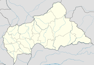 Berbérati Location of airport in Central African Republic | |||||||||||
| Runways | |||||||||||
| |||||||||||
Berbérati Airport (IATA: BBT, ICAO: FEFT) is an airport serving Berbérati,[1] the capital city of the Mambéré-Kadéï prefecture in the Central African Republic.
Facilities
The airport resides at an elevation of 1,929 feet (588 m) above mean sea level. It has one runway designated 17/35 with an asphalt surface measuring 1,660 by 30 metres (5,446 ft × 98 ft).[1]
References
- 1 2 3 Airport information for FEFT from DAFIF (effective October 2006)
- ↑ Airport information for BBT at Great Circle Mapper. Source: DAFIF (effective October 2006).
External links
- Current weather for Berberati, Central African Republic (FEFT) at NOAA/NWS
- Accident history for Berbérati Airport (BBT / FEFT) at Aviation Safety Network
This article is issued from Wikipedia - version of the 12/4/2016. The text is available under the Creative Commons Attribution/Share Alike but additional terms may apply for the media files.