Berango
| Berango | |||
|---|---|---|---|
| Municipality | |||
| |||
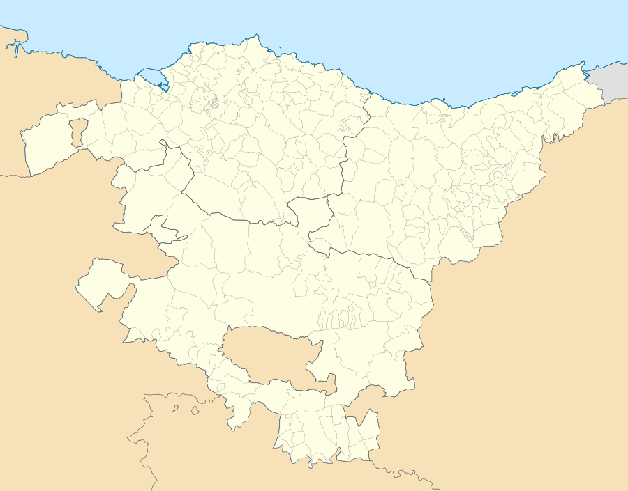 Berango Location of Berango within the Basque Country | |||
| Coordinates: 43°21′54″N 2°59′24″W / 43.36500°N 2.99000°WCoordinates: 43°21′54″N 2°59′24″W / 43.36500°N 2.99000°W | |||
| Country | Spain | ||
| Autonomous community | Basque Country | ||
| Province | Biscay | ||
| Comarca | Greater Bilbao | ||
| Government | |||
| • Mayor | María Isabel Landa Gaubeka (Basque Nationalist Party) | ||
| Area | |||
| • Total | 8.9 km2 (3.4 sq mi) | ||
| Elevation | 31 m (102 ft) | ||
| Population (2014) | |||
| • Total | 6,925 | ||
| • Density | 780/km2 (2,000/sq mi) | ||
| Demonym(s) | Basque: berangotarra | ||
| Time zone | CET (UTC+1) | ||
| • Summer (DST) | CEST (UTC+2) | ||
| Postal code | 48640 | ||
| Website | Official website | ||


Berango is a town and municipality located in the province of Biscay, in the region known as "Greater Bilbao" in the autonomous community of Basque Country, Spain with 8,9 km² of extension and a population of 6.748 inhabitants according to the census of the 2010. Its density reaches 174,81 inhabitants per square kilometre.
Geographical Location
Berango is confined by Sopelana in the north, with Urduliz in the northeast, with Erandio in southeast, and with Guecho to the western. In this region there are some cholines that stand out such as Munarrikolanda, Saiherri and Agirremendi mountains. The Gobela river passes through the municipality and disgorges in the Bahía de El Abra. Moreover, Berango receives Larrañazubi's streams and several natural fountains.
References
External links
- BERANGO in the Bernardo Estornés Lasa - Auñamendi Encyclopedia (Euskomedia Fundazioa) (Spanish)
- Berango's City Hall main page