Beni Suef
| Beni Suef | |
|---|---|
 | |
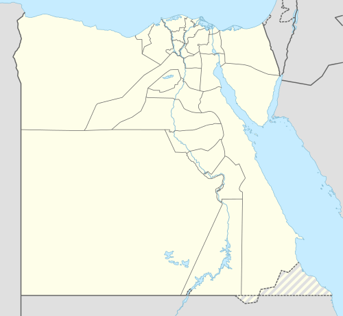 Beni Suef Location in Egypt | |
| Coordinates: 29°04′N 31°05′E / 29.067°N 31.083°E | |
| Country |
|
| Governorate | Beni Suef |
| Elevation | 16 m (52 ft) |
| Population (2012) | |
| • Total | 233,142 |
| Time zone | EET (UTC+2) |
| Area code(s) | (+20) 82 |
Beni Suef, (Egyptian Arabic: بنى سويف Baniswēf, IPA: [bænisˈweːf]; Coptic: Ⲡⲁⲛⲓⲥⲱϥ Panisōf) is the capital city of the Beni Suef Governorate in Egypt.
Overview
Beni Suef is an important agricultural center, which grew from a small village at the turn of the century and now hosts a population of over 200,000. It was famous for its linen manufacturing in the Middle Ages, and continues to be heavily involved in cotton-spinning and carpet-making. It is also known for its alabaster, quarried in the nearby hills. Beni Suef is located about 115 km (71 mi) south of Cairo. The Meidum Pyramid and Fayum Oasis are nearby. Beni Suef is known for its large mansions, including the Ismail Mansion, owned by General Ahmed Mamdouh Ismail. Beni Suef University and the private Al Nahda University are located in Beni Suef.
Climate
Beni Suef has a hot desert climate (BWh) in Köppen-Geiger classification, as does all of Egypt. It has very hot summers and warm winters with cool nights.
| Climate data for Beni Suef | |||||||||||||
|---|---|---|---|---|---|---|---|---|---|---|---|---|---|
| Month | Jan | Feb | Mar | Apr | May | Jun | Jul | Aug | Sep | Oct | Nov | Dec | Year |
| Record high °C (°F) | 30.4 (86.7) |
34.4 (93.9) |
39.0 (102.2) |
43.3 (109.9) |
47.7 (117.9) |
46.8 (116.2) |
44.9 (112.8) |
44.2 (111.6) |
43.4 (110.1) |
39.9 (103.8) |
36.2 (97.2) |
29.9 (85.8) |
47.7 (117.9) |
| Average high °C (°F) | 19.5 (67.1) |
21.5 (70.7) |
25.0 (77) |
30.3 (86.5) |
34.2 (93.6) |
36.9 (98.4) |
37.1 (98.8) |
36.6 (97.9) |
34.7 (94.5) |
31.0 (87.8) |
25.3 (77.5) |
20.9 (69.6) |
29.4 (84.9) |
| Daily mean °C (°F) | 12.3 (54.1) |
14.2 (57.6) |
17.2 (63) |
22.0 (71.6) |
26.0 (78.8) |
28.7 (83.7) |
29.3 (84.7) |
28.9 (84) |
27.1 (80.8) |
23.5 (74.3) |
18.2 (64.8) |
13.7 (56.7) |
21.8 (71.2) |
| Average low °C (°F) | 5.6 (42.1) |
6.9 (44.4) |
9.6 (49.3) |
13.8 (56.8) |
17.4 (63.3) |
20.2 (68.4) |
21.6 (70.9) |
21.4 (70.5) |
19.5 (67.1) |
16.7 (62.1) |
11.7 (53.1) |
7.4 (45.3) |
14.3 (57.7) |
| Record low °C (°F) | −0.2 (31.6) |
0.8 (33.4) |
2.5 (36.5) |
2.0 (35.6) |
9.5 (49.1) |
15.3 (59.5) |
18.0 (64.4) |
18.6 (65.5) |
9.0 (48.2) |
10.7 (51.3) |
1.8 (35.2) |
0.8 (33.4) |
−0.2 (31.6) |
| Average precipitation mm (inches) | 1 (0.04) |
1 (0.04) |
2 (0.08) |
0 (0) |
0 (0) |
0 (0) |
0 (0) |
0 (0) |
0 (0) |
0 (0) |
1 (0.04) |
0 (0) |
6 (0.24) |
| Average precipitation days (≥ 1.0 mm) | 0.3 | 0.1 | 0.2 | 0.0 | 0.1 | 0.0 | 0.0 | 0.0 | 0.1 | 0.0 | 0.0 | 0.2 | 0.9 |
| Average relative humidity (%) | 61 | 54 | 49 | 40 | 37 | 39 | 45 | 50 | 51 | 54 | 58 | 63 | 50.1 |
| Source #1: NOAA[1] | |||||||||||||
| Source #2: Climate Charts[2] | |||||||||||||
Accidents
- A train accident in 1995 near Beni Suef left 75 people dead.[3]
- The Beni Suef Cultural Palace Fire, on September 5, 2005, killed 46 people.[4][5]
Notable natives
- Berlenti Abdul Hamid, actress[6]
Sports
- Telephonat Bani Sweif football team has been promoted for the first time in the Egyptian Premier League for the 2011/2012 season.
Gallery
-

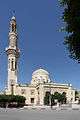
Beni Suef El Sayda Houria Mosque
-
Beni Suef Aziz Mosque
-

Beni Suef Archeological Museum
See also
- Sannur Cave national park
- Bishop Athanasius
- The Daughters of St. Mary
References
- ↑ "Beni Suef Climate Normals 1961–1990". National Oceanic and Atmospheric Administration. Retrieved October 25, 2015.
- ↑ "Beni Suef A., Egypt: Climate, Global Warming, and Daylight Charts and Data". Climate Charts. Retrieved 17 July 2013.
- ↑ "One Way Ticket, reported by Fatemah Farag in Al-Ahram". 2002-02-28. Archived from the original on 2012-10-13. Retrieved 2008-03-25.
- ↑ Hala Halim (2005-09-15). "In the aftermath of Beni Suef". Al-Ahram. Retrieved 2008-03-25.
- ↑ Ibn Ad Dunya (2006-05-22). "Eight convicted for negligence in Beni Suef Cultural Palace fire". Retrieved 2008-03-25.
- ↑ "Egyptian movie diva Berlenti Abdul Hamid dies at 75". Al-Masry Al-Youm. December 1, 2010.
External links
| Wikimedia Commons has media related to Beni Suef. |
| Wikivoyage has a travel guide for Beni Suef. |
- Falling Rain Genomics, Inc. - Beni Suef, Egypt
Coordinates: 29°04′N 31°05′E / 29.067°N 31.083°E