Benedict, Maryland
| Benedict, Maryland | |
|---|---|
| Census-designated place | |
|
Landscape in Benedict | |
 Benedict  Benedict Location within the state of Maryland | |
| Coordinates: 38°30′33″N 76°40′47″W / 38.50917°N 76.67972°WCoordinates: 38°30′33″N 76°40′47″W / 38.50917°N 76.67972°W | |
| Country | United States |
| State | Maryland |
| County | Charles |
| Area | |
| • Total | 0.2 sq mi (0.6 km2) |
| • Land | 0.2 sq mi (0.6 km2) |
| • Water | 0.0 sq mi (0.0 km2) |
| Time zone | Eastern (EST) (UTC-5) |
| • Summer (DST) | EDT (UTC-4) |
| ZIP codes | 20612 |
| GNIS feature ID | 583152 |
.jpg)
Benedict is a small unincorporated town and census-designated place in Charles County, Maryland, United States located on the Patuxent River in southern Maryland.[1] As of the 2010 census, it had a population of 261.[2]
History
Originally a fishing village along the Patuxent River in the southern Province of Maryland in the late 17th century, it was named Benedict-Leonardtown for Benedict Leonard Calvert, (1700-1732), 15th Proprietary Governor of Maryland, serving under his older brother, Charles Calvert, 5th Baron and Lord Baltimore, (1699-1751).[3]

War of 1812
In the War of 1812, Benedict was the location where the British Army led by General Robert Ross landed on August 18, 1814, after having fought fierce naval battles with American naval forces in the Patuxent. From Benedict, the British began their march to Washington, D.C., routing a larger American force at the Battle of Bladensburg before ultimately burning the capital. Following this, they failed to capture Baltimore in the Battle of Baltimore.[4][5]
Civil War
Benedict was the site of Camp Stanton, constructed in October 1863 for the Maryland 7th Regiment.[6] Camp Stanton was also the location where the Maryland 19th Regiment of the United States Colored Troops was formed on December 19, 1863, with freed slaves who were purchased for their freedom by the United States Government to serve as soldiers.[7] This unit distinguished itself at the Battle of the Wilderness.[8] Some of its members included the Rev. William Saunders Crowdy and his brother Daniel, of a plantation in St. Mary's County, Maryland.
A school was established on the site to educate the black soldiers, most of whom had received no education when they were slaves. The school was run by Samuel C. Armstrong.[9]
Benedict today
Adjacent to the town is the Benedict Bridge, a 0.5-mile-long (0.80 km) bridge where Maryland Route 231 crosses the Patuxent River from Charles County into Calvert County. The town also has one or two seafood restaurants, and the only church in southern Maryland to offer masses in Latin.
References
- ↑ U.S. Geological Survey Geographic Names Information System: Benedict, Maryland
- ↑ "Profile of General Population and Housing Characteristics: 2010 Demographic Profile Data (DP-1): Benedict CDP, Maryland". U.S. Census Bureau, American Factfinder. Archived from the original on September 11, 2013. Retrieved August 3, 2012.
- ↑ Zilliox, Jacqueline (2007). "Charles County". Arcadia Publishing: 17. ISBN 978-0-7385-4407-6. Retrieved 2008-04-05.
- ↑ Markham, Edwin (1912). The Real America in Romance Valor and Victory: The age of Vindication 1783 1824 Volume X. New York, Chicago: William H Wise & Company. pp. 370–382.
- ↑ "Fort Warburton". U. S. National Park Service. 2007-07-19. Retrieved 2007-12-15.
- ↑ "Seventh Regiment Infantry, U. S. Colored Troops. Maryland Volunteers.". 366. Archives of Maryland Online. 1861–1866: 155. Retrieved 2007-12-15.
- ↑ "Hidden Identities: Southern Maryland Slaves & the United States Colored Troops at Camp Stanton, Maryland". College of Southern Maryland. 2006. Retrieved 2007-12-15.
- ↑ "African-American Sites Along the Patuxent River: Camp Stanton". Maryland Department of Natural Resources. 2002-09-03. Retrieved 2007-12-15.
- ↑ Talbot, Edith Armstrong (1904). Samuel Chapman Armstrong: A Biographical Study. New York: Doubleday, Page & Company. p. 109. ISBN 0-8371-1512-4.
External links
- Camp Stanton historical marker
- Camp Stanton Training Post for USCT historical marker
- Benedict historical marker
- 19th Regiment U.S. Colored Troops
Municipalities and communities of Charles County, Maryland, United States | ||
|---|---|---|
| Towns | 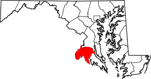 | |
| CDPs | ||
| Other communities | ||