Belonia, India
| Belonia | |
|---|---|
| City | |
 Belonia  Belonia | |
| Coordinates: 23°15′N 91°27′E / 23.25°N 91.45°ECoordinates: 23°15′N 91°27′E / 23.25°N 91.45°E | |
| Country | India |
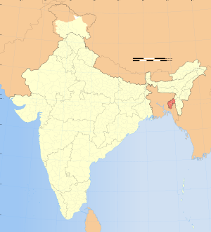
| State | Tripura |
| District | South Tripura |
| Area rank | 2 |
| Elevation | 23 m (75 ft) |
| Population (2015) | |
| • Total | 21,176 |
| Languages | |
| • Official | |
| Time zone | IST (UTC+5:30) |
| Telephone code | 03823 |
| Vehicle registration | TR |
| Website |
tripura |
Belonia is a town and Municipal Council in South Tripura district, Tripura, India. It is also the headquarters of South Tripura District. It is linked with Agartala (the state capital) by National Highway 44 via Udaipur and also via Rajnagar, Sonamura, Melaghar, and Bishramganj. Belonia lies on a border with Bangladesh.
Geography

Belonia is located at 23°15′N 91°27′E / 23.25°N 91.45°E.[1] It has an average elevation of 23 metres (75 feet).
Demographics
As of 2011 India census,[2] Belonia Municipal Council has a population of 19,996. Mrs. Subhra Mitra is the present Chairperson of Belonia Municipal Council. Males constitute 52% of the population and females 48%. Belonia has an average literacy rate of 95%, higher than the national average of 59.5%; with 54% of the males and 46% of females literate. 9% of the population is under 6 years of age.
Education
Schools:
- Belonia Vidyapith H/S School
- Brajendra Kishore Institution
- Aryya Colony H/S School
- S.B.C Nagar H/S School
- Barpathari H/S School
- Brindaban Royaja Para High School, Chittamara, Belonia
- Manurmukh High School
- Amjadnagar High School
- Belonia Govt. English Medium H.S. School
- Belonia Girls H.S. School
College:
- Ishwarchandra Vidyasagar College
- ITI College
Places of interest:
- Pilakpathar (the site is now preserved by ASI, about 12 kilometres (7.5 mi) away)
- Trishna Sanctuary
- Jogamaya Kalibari
- Famous Muhurichar
- Indo-Bangla Custom Checkpost
- Raj Rajeswari Temple, Muhuripur
- Muhuripur Fishery near Bamchara
Politics
Belonia assembly constituency is in the Tripura West Lok Sabha constituency.[3]
References
- ↑ Falling Rain Genomics, Inc - Belonia
- ↑ "Census of India 2001: Data from the 2001 Census, including cities, villages and towns (Provisional)". Census Commission of India. Archived from the original on 2004-06-16. Retrieved 2008-11-01.
- ↑ "Assembly Constituencies - Corresponding Districts and Parliamentary Constituencies" (PDF). Tripura. Election Commission of India. Archived from the original (PDF) on November 8, 2005. Retrieved 2008-10-08.