Belluton
| Belluton | |
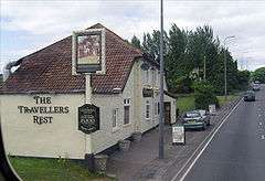 The Traveller's Rest, Belluton |
|
 Belluton |
|
| Population | approx. 100 |
|---|---|
| OS grid reference | ST615644 |
| Civil parish | Publow with Pensford |
| Unitary authority | Bath and North East Somerset |
| Ceremonial county | Somerset |
| Region | South West |
| Country | England |
| Sovereign state | United Kingdom |
| Post town | BRISTOL |
| Postcode district | BS39 |
| Dialling code | 01275 |
| Police | Avon and Somerset |
| Fire | Avon |
| Ambulance | South Western |
| EU Parliament | South West England |
| UK Parliament | North East Somerset |
Coordinates: 51°22′38″N 2°33′09″W / 51.3773°N 2.5525°W
Belluton is a village in Somerset, England. It is in the district of Bath and North East Somerset and is located due south of the city of Bristol and due west of the city of Bath. The eastern end of the village is defined by the A37 road.
In some documents it is alternatively called "Belton", which signifies, according to some antiquaries, "Baal town," or "the Town of the Sun".[1] According to Robinson it was called Belgetona in the 1086 Domesday Book, and the name comes from the Old English belgae and tun, the Belgae being a violent race who settled in what is now Wiltshire.[2]
It is close to the route of the ancient Wansdyke.
Government and politics
Belluton is part of the civil parish of Publow and Pensford, which has a parish council with some responsibility for local issues. Belluton is part of the Publow and Whitchurch Ward which is represented by one councillor on the Bath and North East Somerset Unitary Authority which has wider responsibilities for services such as education, refuse, tourism etc.
The village is a part of the North East Somerset constituency and part of the South West England constituency of the European Parliament.
Demographics
According to the 2001 Census, the Publow and Whitchurch Ward (which includes Pensford and Publow), had 1,087 residents, living in 429 households, with an average age of 40.8 years. Of these 73% of residents describing their health as 'good', 24% of 16- to 74-year-olds had no qualifications; and the area had an unemployment rate of 2.3% of all economically active people aged 16–74. In the Index of Multiple Deprivation 2004, it was ranked at 26,408 out of 32,482 wards in England, where 1 was the most deprived LSOA and 32,482 the least deprived.[3]
Buildings
John Locke's Cottage
John Locke lived in Belluton during his childhood. His father was a small landowner and attorney at the local village of Pensford. John Locke's Cottage is now a Grade II listed building.[4]
Other Grade II listed buildings
Other Grade II listed buildings include Belluton House, from the early 19th century,[5] and The Grange from the 18th century.[6]
References
- ↑ From The National Gazetteer of Great Britain and Ireland (1868) Transcribed by Colin Hinson © 2003
- ↑ Robinson, Stephen (1992). Somerset Place Names. Wimborne, Dorset: The Dovecote Press Ltd. ISBN 1-874336-03-2.
- ↑ "Neighbourhood Statistics LSOA Bath and North East Somerset 020D Publow and Whitchurch". Office for National Statistics 2001 Census. Retrieved 2006-04-25.
- ↑ "John Locke's Cottage". Images of England. Retrieved 2006-05-09.
- ↑ "Belluton House". Images of England. Retrieved 2006-05-09.
- ↑ "The Grange". Images of England. Retrieved 2006-05-09.
Bibliography
- Durham, I. & M. (1991). Chew Magna and the Chew Valley in old photographs. Redcliffe Press. ISBN 1-872971-61-X.
- Janes, Rowland (ed) (1987). The Natural History of the Chew Valley. ISBN 0-9545125-2-9.
External links
External links
![]() Media related to Belluton at Wikimedia Commons
Media related to Belluton at Wikimedia Commons