Belle Meade, Tennessee
| Belle Meade, Tennessee | |
|---|---|
| City | |
|
The Namesake of Belle Meade, Belle Meade Plantation | |
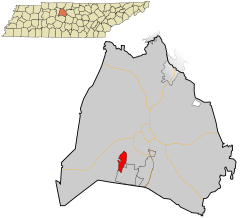 Location in Davidson County and the state of Tennessee. | |
| Coordinates: 36°6′20″N 86°51′18″W / 36.10556°N 86.85500°W | |
| Country | United States |
| State | Tennessee |
| County | Davidson |
| Area | |
| • Total | 3.1 sq mi (8.1 km2) |
| • Land | 3.1 sq mi (8.1 km2) |
| • Water | 0.0 sq mi (0.0 km2) |
| Elevation | 561 ft (171 m) |
| Population (2010) | |
| • Total | 2,912 |
| • Density | 940/sq mi (360/km2) |
| Time zone | Central (CST) (UTC-6) |
| • Summer (DST) | CDT (UTC-5) |
| FIPS code | 47-04620[1] |
| GNIS feature ID | 1305087[2] |
| Website |
www |

Belle Meade is a city in Davidson County, Tennessee, within Nashville. As of the 2010 census, it had a population of 2,912.[3] According to a 2015 estimate, the city had a population of 3,004. The per capita income for the city is by far the highest in the state and among the highest in the nation. The current mayor is James Hunt.
Overview
Belle Meade was absorbed into the metropolitan government of Nashville-Davidson County in 1963, but retains its independent city status, and its residents pay taxes both to the Metro government and to the City of Belle Meade. Belle Meade streets have distinct signage, the city has its own police force, its own mayor, and its own city hall. The vast majority of the Belle Meade area is designated by the ZIP code 37205. A few homes are in Zip Code 37215.
The 3.1-square-mile city takes its name from Belle Meade Plantation, known as the "Queen of Southern Plantations', which once encompassed 5,300 acres. In late 1904, the plantation, which had become insolvent, was sold and 2,200 acres were acquired for residential development. The manor house and several adjacent outbuildings were preserved.[4]
The city is home to the Belle Meade Country Club (), founded in 1901.
Notable residents
Belle Meade residents include former U.S. Vice President and 2000 Presidential Candidate Al Gore,[5] entertainers Vince Gill and Amy Grant,[6] Pulitzer Prize winning author Jon Meacham,[7]Chief Justice of the Tennessee Supreme Court Frank Drowota,[8] Thomas F. Frist, Jr., the co-founder and former CEO of the Hospital Corporation of America,[9] the latter's son, investor Thomas F. Frist, III,[10] fast food business executive C. Stephen Lynn,[10] and John R. Ingram, the Chairman and CEO of the Ingram Content Group.[10]
Geography
Belle Meade is located at 36°6′20″N 86°51′18″W / 36.10556°N 86.85500°W (36.105558, -86.854942).[11]
According to the United States Census Bureau, the city has a total area of 3.1 square miles (8.0 km2), all land.
Belle Meade Boulevard ends at the main historic entrance for Percy Warner Park, the city's largest park.
Richland Creek flows through the neighborhood.[12]
Demographics
| Historical population | |||
|---|---|---|---|
| Census | Pop. | %± | |
| 1940 | 2,061 | — | |
| 1950 | 2,831 | 37.4% | |
| 1960 | 3,082 | 8.9% | |
| 1970 | 2,933 | −4.8% | |
| 1980 | 3,182 | 8.5% | |
| 1990 | 2,839 | −10.8% | |
| 2000 | 2,943 | 3.7% | |
| 2010 | 2,912 | −1.1% | |
| Est. 2015 | 3,004 | [13] | 3.2% |
| Sources:[14][15] | |||
As of the census[1] of 2000, there were 2,943 people, 1,067 households, and 882 families residing in the city. The population density was 938.7 people per square mile (361.9/km²). There were 1,133 housing units at an average density of 361.4 per square mile (139.3/km²). The racial makeup of the city was 98.64% White, 0.34% African American, 0.03% Native American, 0.48% Asian, 0.20% from other races, and 0.31% from two or more races. Hispanic or Latino of any race were 0.71% of the population.
There were 1,067 households out of which 39.9% had children under the age of 18 living with them, 78.4% were married couples living together, 3.1% had a female householder with no husband present, and 17.3% were non-families. 15.5% of all households were made up of individuals and 7.2% had someone living alone who was 65 years of age or older. The average household size was 2.76 and the average family size was 3.08.
In the city, the population was spread out with 30.0% under the age of 18, 2.8% from 18 to 24, 21.0% from 25 to 44, 31.0% from 45 to 64, and 15.3% who were 65 years of age or older. The median age was 43 years. For every 100 females there were 93.9 males. For every 100 females age 18 and over, there were 90.6 males.
The median income for a household in the city was $144,720, and the median income for a family was $194,016. Males had a median income of $100,000 versus $71,944 for females. The per capita income for the city was $104,908, which is by far the highest in the state and among the highest in the nation. About 0.7% of families and 0.9% of the population were below the poverty line, including 1.2% of those under age 18 and none of those age 65 or over.
References
| Wikimedia Commons has media related to Belle Meade, Tennessee. |
- 1 2 "American FactFinder". United States Census Bureau. Archived from the original on 2013-09-11. Retrieved 2008-01-31.
- ↑ "US Board on Geographic Names". United States Geological Survey. 2007-10-25. Retrieved 2008-01-31.
- ↑ "Profile of General Population and Housing Characteristics: 2010 Demographic Profile Data (DP-1): Belle Meade city, Tennessee". U.S. Census Bureau, American Factfinder. Archived from the original on September 11, 2013. Retrieved March 13, 2012.
- ↑ "Belle Meade community passes heritage down through generations". The Tennessean. Retrieved 2013-09-23.
- ↑ Joshua Chaffee, Al Gore has a Nobel, an Oscar, and a big empty house, NBC News, 5/7/2013
- ↑ Vicki Stout, Symphony Ball Patrons Party, The Tennessean, December 15, 2014
- ↑ "The 2009 Pulitzer Prize Winners". pulitzer.org. Columbia University. Retrieved 28 November 2015.
- ↑ Gudehus, Leslie J. "Drowota Reflects on Receiving Award Named in His Honor". memphisdailynews.com. The Daily News Publishing Co. Inc. Retrieved 18 November 2015.
- ↑ Molly Cate, The House that Frist Built, Nashville Post, July 1, 2002
- 1 2 3 J.R. Lind, A glimpse at the most expensive homes in Nashville, Nashville City Paper, August 26, 2012
- ↑ "US Gazetteer files: 2010, 2000, and 1990". United States Census Bureau. 2011-02-12. Retrieved 2011-04-23.
- ↑ Google Map
- ↑ "Annual Estimates of the Resident Population for Incorporated Places: April 1, 2010 to July 1, 2015". Retrieved July 2, 2016.
- ↑ "Census of Population and Housing: Decennial Censuses". United States Census Bureau. Retrieved 2012-03-04.
- ↑ "Incorporated Places and Minor Civil Divisions Datasets: Subcounty Resident Population Estimates: April 1, 2010 to July 1, 2012". Population Estimates. U.S. Census Bureau. Archived from the original on 17 June 2013. Retrieved 11 December 2013.
External links
Coordinates: 36°06′20″N 86°51′18″W / 36.105558°N 86.854942°W
Municipalities and communities of Davidson County, Tennessee, United States | ||
|---|---|---|
| Cities | ||
| Neighborhoods | ||
| Footnotes | ‡This populated place also has portions in an adjacent county or counties | |