Beit Kama
| Beit Kama בֵּית קָמָה | |
|---|---|
 Beit Kama | |
| Coordinates: 31°26′44.12″N 34°45′37.96″E / 31.4455889°N 34.7605444°ECoordinates: 31°26′44.12″N 34°45′37.96″E / 31.4455889°N 34.7605444°E | |
| District | Southern |
| Council | Bnei Shimon |
| Affiliation | Kibbutz Movement |
| Founded | 18 April 1949 |
| Founded by | Hashomer Hatzair members |
| Population (2015)[1] | 1,356 |
| Website | Beit Kama's Hebrew site |
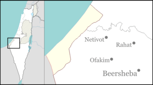
Beit Kama (Hebrew: בֵּית קָמָה, lit. House of Standing Grain) is a kibbutz in the northern Negev desert in Israel. Located north of the Bedouin city of Rahat, it falls under the jurisdiction of Bnei Shimon Regional Council. In 2015 its population was 1,356.
Beit Kama is a secular kibbutz that preserves the cooperative mode of life in most areas. It was traditionally affiliated to the HaKibbutz HaArtzi organization and the Hashomer Hatzair movements. It is the location of Nitzaney HaNegev regional elementary school.
History
The kibbutz was founded on 18 April 1949, south-east of the Arab village al-Jammama, which had been captured and depopulated on 22 May 1948 during the 1948 Arab–Israeli War.[2] The founders of Beit Kama were immigrants from Hungary who belonged to Hashomer Hatzair movement.
The settlement was initially called "Safiach", but later became Beit Kama, a name derived from Isaiah 17:5: "And it shall be as when the reaper gathers standing grain."[3]
Economy
Beit Kama jointly owns one of the largest agriculture cooperatives in Israel, Shikma, together with kibbutz Mishmar HaNegev, and operates a large dairy farm. Beit Kama once owned a biomedical company, Kamada. Although these two branches still functioning within Beit Kama they are no longer operated by the cooperative. It has a gas station at its junction on the road to Beersheba.
Archaeology
In 2013, archaeologists of the Israel Antiquities Authority discovered a Byzantine era mosaic floor on the grounds of the kibbutz. The red, black, and yellow mosaic is decorated with images of birds, local flora and geometrical designs. An ancient water system with pools and channels was also unearthed.[4]

References
- ↑ "List of localities, in Alphabetical order" (PDF). Israel Central Bureau of Statistics. Retrieved 16 October 2016.
- ↑ Morris, Benny (2004). The Birth of the Palestinian Refugee Problem Revisisted. Cambridge University Press. pp. xxii, no. 167. ISBN 978-0-521-00967-6.
- ↑ Carta's Official Guide to Israel and Complete Gazetteer to all Sites in the Holy Land. (3rd edition 1993) Jerusalem, Carta, p.113 , ISBN 965-220-186-3 (English)
- ↑ Byzantine era mosaic floor found on Negev kibbutz The Jerusalem Post, 5 December 2013