Beit Jinn
| Beit Jinn بيت جن | |
|---|---|
| Town | |
 Beit Jinn | |
| Coordinates: 33°18′38″N 35°55′8″E / 33.31056°N 35.91889°E | |
| Country |
|
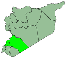
| Governorate | Rif Dimashq Governorate |
| District | Qatana District |
| Nahiyah | Beit Jinn |
| Population (2004 census)[1] | |
| • Total | 2,846 |
| Time zone | EET (UTC+2) |
| • Summer (DST) | EEST (UTC+3) |
| Area code(s) | 11 |
Beit Jinn (Arabic: بيت جن) is a town in southern Syria, administratively part of the Rif Dimashq Governorate, located southwest of Damascus on the foothills of Mount Hermon. According to the Syria Central Bureau of Statistics, Beit Jinn had a population of 2,846 in the 2004 census.[1] Its inhabitants are predominantly Sunni Muslims.[2]
The town is also the administrative center of the Beit Jinn Subdistrict which consists of nine towns with a combined population of 15,668.[1] The subdistrict has a mixed Sunni and Druze population and Beit Jinn contains a Druze religious shrine.[3] Nearby localities include Kafr Hawr, Qalaat al-Jandal and Qatana to the northeast and Sa'sa', Kanaker and Deir Maker to the southeast. The Nahr al-Awaj river (ancient Pharpar) passes near the town.
History
Beit Jinn was visited by Andalusian geographer Ibn Jubayr in the late 12th century, during Ayyubid rule. He noted that it was "a village between Darayyah and Baniyas lying among the hills."[4]
References
- 1 2 3 General Census of Population and Housing 2004. Syria Central Bureau of Statistics (CBS). Rif Dimashq Governorate. (Arabic)
- ↑ Gilbert, Ben (2013-11-02). "Syria: Refugees dodge patrols on deadly mountain hike to safety". Al-Jazeera America.
- ↑ Sharrouf, Ayman (2014-11-11). "Assad's Druze game exposed". NOW News.
- ↑ le Strange, 1890, p. 412.
Bibliography
- le Strange, Guy (1890). Palestine Under the Moslems: A Description of Syria and the Holy Land from A.D. 650 to 1500. Committee of the Palestine Exploration Fund.