Beit Aryeh-Ofarim
Beit Aryeh
| ||
|---|---|---|
| ||
 | ||
 Beit Aryeh | ||
| Coordinates: 32°2′7.79″N 35°3′13.68″E / 32.0354972°N 35.0538000°ECoordinates: 32°2′7.79″N 35°3′13.68″E / 32.0354972°N 35.0538000°E | ||
| Region | West Bank | |
| District | Judea and Samaria Area | |
| Founded | 1981 | |
| Government | ||
| • Type | Local council (from 1989) | |
| • Head of Municipality | Avi Naim | |
| Area | ||
| • Total | 8,500 dunams (8.5 km2 or 3.3 sq mi) | |
| Population (2015)[1] | ||
| • Total | 4,721 | |
| Name meaning | House of Aryeh - Fawns | |
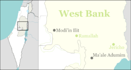
Beit Aryeh-Ofarim (Hebrew: בֵּית אַרְיֵה-עֳפָרִים) is an Israeli settlement and local council in the northern West Bank. It is located 32 kilometers (20 mi) north of Jerusalem and 25 kilometers (16 mi) east of Tel Aviv near the Palestinian village al-Lubban al-Gharbi, 3.8 km kilometers east of the Green line. It is situated inside the Israeli West Bank barrier[2] on 8,500 dunams of land. In 2015 it had a population of 4,721.
The international community considers Israeli settlements in the West Bank illegal under international law, but the Israeli government disputes this.[3]
History
Established in 1981, Beit Aryeh was recognised as a local council in 1989. In 2004, it merged with Ofarim. Beit Aryeh was named for Aryeh Ben-Eliezer, a Lithuanian-born Revisionist Zionist leader who served as a Knesset member in the 1950s and 1960s.
In 2011, the Israeli Ministry of Defense signed an agreement with the municipality of Beit Aryeh approving the construction of 100 homes and a bypass road between Beit Aryeh and Ofarim.[4]
Notable residents
References
- ↑ "List of localities, in Alphabetical order" (PDF). Israel Central Bureau of Statistics. Retrieved 16 October 2016.
- ↑ "Beit Arye". Peace Now.
- ↑ "The Geneva Convention". BBC News. 10 December 2009. Retrieved 27 November 2010.
- ↑ "100 Homes and a Bypass Road Approved in Beit Arye". Peace Now. 29 August 2011. Retrieved 16 April 2013.
External links
- Local council website (Hebrew)
| Cities | ||
|---|---|---|
| Regional committee | ||
| Regional councils | ||
| Local councils | ||
| See also | ||