Bedfont
| Bedfont | |
 Street of semi-detached homes and bungalows built like most of the area in the 19th and 20th centuries. |
|
 The modest medieval church in the Church of England has had topiary from its yew trees since 1704. They are today the largest sculpted examples in London. |
|
 Bedfont |
|
| Area | 4.45 km2 (1.72 sq mi) |
|---|---|
| Population | 12,701 ( Bedfont wards 2011)[1] |
| – density | 2,854/km2 (7,390/sq mi) |
| OS grid reference | TQ0873 |
| Civil parish | n/a |
| London borough | Hounslow |
| Ceremonial county | Greater London |
| Region | London |
| Country | England |
| Sovereign state | United Kingdom |
| Post town | FELTHAM |
| Postcode district | TW14 |
| Dialling code | 020 |
| Police | Metropolitan |
| Fire | London |
| Ambulance | London |
| EU Parliament | London |
| UK Parliament | Feltham and Heston |
| London Assembly | South West |
Coordinates: 51°27′00″N 0°26′24″W / 51.450°N 0.440°W
Bedfont is a suburban district of Hounslow in West London, 13 miles (21 km) WSW of Charing Cross and 2 miles (3 km) from Heathrow Airport. It straddles Staines Road (A305) and the River Crane and includes the area informally known as North Feltham and the neighbourhood of Hatton. Its south-western parks and streets are contiguous with the larger district of Feltham, adjoining Feltham railway station on the Waterloo to Reading Line. Bedfont is also served by Hatton Cross tube station on the Piccadilly line. Bedfont has a large central conservation area around Bedfont Green.
History
Origins and Medieval Bedfont
Referred to in the Domesday Book as "Bedefunde", the name is thought to be derived from Anglo-Saxon Bedfunta = "Bed’s spring", or Bydenfunta = "spring provided with a drinking-vessel"..
The Staines Road follows the Roman Via Trinobantes colloquially a Stane Street (stone street) linking Londinium (London) to Pontes (Staines-upon-Thames) and the West Country, though the name suggests older origins as the Trinobantes were a powerful Celtic tribe before the Roman invasion. Excavations prior to the building of Heathrow’s Terminal 5 site a few miles north west of Bedfont found evidence of settlement during the Bronze Age, Iron Age and Roman periods, suggesting there may have been people living in and around the Bedfont area during these periods.[2][3]
The hamlet of West Bedfont lay in the parish of neighbouring Stanwell although the boundary may not have been drawn until the 12th century.[4] West Bedfont today is indistinct, however neighbouring East Bedfont, on the Greater London side of the boundary, has developed into modern day Bedfont.
The Parish Church of St Mary the Virgin is situated on the edge of the village green and is the oldest surviving church in the borough dating from around 1150. Its Norman chancel, chancel arch and south doorway have survived the centuries, as have medieval wall paintings from the mid 13th century, which were uncovered in 1865.[5]
Manors
The Domesday Book has an entry stating that the manors of Bedfont, Hatton and Stanmore were all held by William Fitz Other. From the early 14th century the Manor of East Bedfont was held by the Trinitarian Priory of Hounslow, before being taken by the Crown during the reformation. The Berkeley family of Cranford then held the manor before selling it to the Earl of Northumberland in 1656. Pates Manor, architecturally a Grade II listed building also in Bedfont, was held by the Page family, a branch of the Pages of Harrow on the Hill.[6] Col. John Page, a member of the family, became a wealthy Virginia merchant who served on the colonial council.[7]
The growth of the town and industrialisation
Charles I licensed the Hounslow Sword Mill in 1630 on the banks of the Duke of Northumberland's River. The sword smiths, who came from Solingen in Germany, produced one thousand swords a month, which have become collector’s items and an impressive collection of these can be seen at the Gunnersbury Park Museum. There is also one on display at Warwick University.
The Longford River, which also flows through Bedfont, also dates from the reign of Charles I.
During the English Civil War, when both the Royalist and Parliamentary armies passed through Bedfont, the mill was taken by Parliamentary forces, and was converted to a gunpowder mill in 1654.
This converted mill was supplemented by new mills closer to Baber Bridge, in the area now known as Donkey Woods. The manufacture of gunpowder was a dangerous occupation and workers were killed or maimed in many explosions down the years, with the mills being demolished and rebuilt a number of times. The water-powered gunpowder mills continued to be used until 1926 when they were closed by the then owners, Imperial Chemical Industries.
Following on from the railways, the twentieth century saw the motor car appearing on the main road, and the building of Great South West Road in 1925 saw traffic diverted around Bedfont.
Postwar development and the construction of Heathrow
By 1946 another form of transport began to impact on the village when Heathrow Airport opened and became the largest employer in the area, with the effect of increasing the demand for local housing. The village of Heathrow was lost, as was some of the hamlet of Hatton. This sits beneath the airport's flight path, but The Green Man public house survives from around the 16th century together with a few period properties near the pub and London Underground station on the edge of the airport.
Buildings of interest
Bedfont has the unique claim of having two surviving manor houses. Pates Manor, once owned by the Page family, is behind the church and is the oldest house in the Borough with one wing dating from the late 15th century. Fawns Manor, on the south side of the Green, dates from the 16th century and was sold to the British Airways Housing Association in 1983 .[8] by Derek Sherborn, of the family who had owned it from the 17th century.
As coach services grew from the 17th to 18th centuries, so too did the number of inns in Bedfont. The Duke’s Head and The Bell were on Bedfont Green, and The Plough, The Sun, The White Horse and the Queen’s Head joined them in providing stabling and refreshments to the weary travellers on the road between London and the West Country. Only The Bell survives today from this group, latterly known as the "Bell on the Green".
The building of the Great Western Railway between London and Bristol in 1841 marked the beginning of the end for the golden age of the stagecoach, and by 1847 both state and mail coaches had ceased to run to the west. The Waterloo to Staines line was opened in 1848 leaving the roads mainly for the use of local traffic.
There are also many leisure clubs and pubs in Bedfont, one being the Bedfont Lane Community Association.
Sport
Captain Matthew Webb, who was the first man to swim the English Channel (25 August 1875), lived in The Limes, New Road, Bedfont from 1880 until 1883 when he died attempting to swim the rapids below the Niagara Falls.
Bedfont has two Non-League football teams :
- Bedfont & Feltham F.C. play at The Orchard ground very close to the ground of Bedfont Sports.
- Bedfont Sports F.C. play at the Bedfont Sports Recreation Ground.
Demography and housing
| Ward | Detached | Semi-detached | Terraced | Flats and apartments | Caravans/temporary/mobile homes/houseboats | Shared between households[1] |
|---|---|---|---|---|---|---|
| (ward) | 220 | 2,065 | 1,007 | 1,562 | 3 | 2 |
| Ward | Population | Households | % Owned outright | % Owned with a loan | hectares[1] |
|---|---|---|---|---|---|
| (ward) | 12.701 | 4,859 | 18 | 30.2 | 445 |
Gallery
-
.jpg)
Burlington House is one of the largest Georgian homes in the Conservation Area. A significant proportion of such homes in the London Commuter Belt have been converted into apartments.
-
.jpg)
Gable end terraced housing with steep, tall hipped roofs by the war memorial with tessellating paving, square green and trees in the background.
See also
![]() London portal
London portal
![]() Media related to Bedfont at Wikimedia Commons
Media related to Bedfont at Wikimedia Commons
References
- 1 2 3 Key Statistics; Quick Statistics: Population Density 2011 census Office for National Statistics
- ↑ "Heathrow reveals historic legacy". BBC. 17 July 2003. Retrieved 16 Dec 2011.
- ↑ "8,500-4,000 BC Deep Forest and a River". Framework Archaeology. 23 August 2006. Retrieved 16 Dec 2011.
- ↑ Susan Reynolds, ed. (1962). Stanwell: Introduction. A History of the County of Middlesex: Volume 3: Shepperton, Staines, Stanwell, Sunbury, Teddington, Heston and Isleworth, Twickenham, Cowley, Cranford, West Drayton, Greenford, Hanwell, Harefield and Harlington. Victoria County History. Boydell and Brewer. pp. 33–36. ISBN 978-0-7129-1034-7. Retrieved 16 December 2011.
- ↑ St Mary's Church: Historic England. "Details from listed building database (1360959)". National Heritage List for England.
- ↑ Pates Manor: Historic England. "Details from listed building database (1358318)". National Heritage List for England.
- ↑ Journal of the British Archaeological Association, Vol. XLIX, Printed for the Association, London, 1893
- ↑ Derek Sherborn (2003). An Inspector Recalls: Saving Our Heritage. The Book Guild Ltd. pp. 242–243. ISBN 1-85776-564-8.
| Districts | 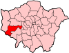 | |
|---|---|---|
| Attractions | ||
| Parks and open spaces | ||
| Constituencies | ||
| Bridges | ||
| Tube and rail stations | ||
| Places of worship |
| |
| Other topics | ||