Beaufort Range
| Beaufort Range | |
|---|---|
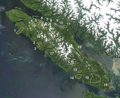 The Beaufort Range is marked 12 on map. | |
| Highest point | |
| Peak | Mount Joan |
| Elevation | 1,556 m (5,105 ft) |
| Coordinates | 49°24′52.9″N 124°55′10.9″W / 49.414694°N 124.919694°WCoordinates: 49°24′52.9″N 124°55′10.9″W / 49.414694°N 124.919694°W |
| Dimensions | |
| Area | 647 km2 (250 sq mi) |
| Geography | |
| Country | Canada |
| State/Province | British Columbia |
| Parent range | Vancouver Island Ranges |
The Beaufort Range is a mountain range on southern Vancouver Island, British Columbia, Canada, located north of Port Alberni and to the west of Qualicum Beach. It has an area of 448 km2 and is a subrange of the Vancouver Island Ranges which in turn form part of the Insular Mountains.[1]
The highest mountain in the Beaufort Range is Mount Joan at 1,556 m (5,105 ft).[1]
See also
References
- 1 2 Beaufort Range in the Canadian Mountain Encyclopedia
External links
- "Beaufort Range". BC Geographical Names.
- Beaufort Range, Lindsay Elms. Retrieved June 29, 2008.
This article is issued from Wikipedia - version of the 11/2/2014. The text is available under the Creative Commons Attribution/Share Alike but additional terms may apply for the media files.