Bayt Jirja
| Bayt Jirja | |
|---|---|
|
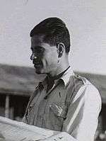
Farmers near Bayt Jirja, trashing wheat, in 1940 | |
 Bayt Jirja | |
| Arabic | بيت جرجه |
| Name meaning | The house of the highway[1] |
| Also spelled | Beit Jirja |
| Subdistrict | Gaza |
| Coordinates | 31°36′11.24″N 34°34′51.25″E / 31.6031222°N 34.5809028°ECoordinates: 31°36′11.24″N 34°34′51.25″E / 31.6031222°N 34.5809028°E |
| Palestine grid | 110/112 |
| Population | 940 (1945) |
| Date of depopulation | date unknown,[2] |
| Current localities | None |

Bayt Jirja (Arabic: بيت جرجه) was a Palestinian Arab village 15.5 km Northeast of Gaza. In 1931 the village consisted of 115 houses. It was overrun by Israeli forces during operation Yo'av in the 1948 Arab-Israeli war. Bayt Jirja was found abandoned in the November 1948 clean up sweeps to expel any partial inhabited villages and destroy village housing to prevent any possible re-occupation in the area.[3] The village was completely destroyed after the occupation and only one tomb remains.
History
Bayt Jirja contained the archaeological site of Khirbat 'Amuda, excavation there in 2005 yielded coins and pottery fragments from the Byzantine and early Islamic period.[4]
Khirbat 'Amuda was known to the Crusaders as Amouhde, and pottery fragments, cisterns, and a pool have also been found there.[5]
The Arab geographer Yaqut, writing in the 1220s, called the village for "Jirja", and said it was the birthplace of Abu al-Fadl al-Jirja, at one time the major authority in Palestine on hadith.[5]
Ottoman era
In 1517, Bayt Jirja was incorporated into the Ottoman Empire with the rest of Palestine, and in 1596 the village appeared in the Ottoman tax registers (erroneously named "Bayt Kharja") as being in the nahiya (subdistrict) of Gaza under the liwa' (district) of Gaza, and it had a population of 468. It paid taxes on a number of crops, including wheat, barley and fruit trees, as well as on goats and beehives.[6]
Sometime after this, the village must have been destroyed, as a marble slab at the entrance to the yard of the village mosque proclaimed that Abdullah Pasha of Acre, via his delegate Mohammed Shahin, had rebuilt the village in 1825-26.[7]
In May 1863, the French explorer Victor Guérin visited the village. He found it had 370 inhabitants, and a wali with ancient granite columns.[8] In 1883 the Palestine Exploration Fund's Survey of Western Palestine described Bayt Jirja as small, with gardens, and supplied with water from cisterns and a pond.[9]
British Mandate era
In the 1922 census of Palestine, conducted by the British Mandate authorities, Beit Jerja had a population of 397 inhabitants, all Muslims,[10] increasing in the 1931 census to 619, still all Muslim, in 115 houses.[11]
The villagers kept a shrine, located on the eastern edge and overlooking Wadi al-Abd, and which they believed to be the tomb of "prophet" (nabi) Jirja. An elementary school was established in the center of village in 1932, and it had 67 students in the mid-1940s. The village center also contained some small shops. There were a number of wells, ranging in depth from 30 to 80 meters, which supplied drinking and irrigation water.[5]
In 1945 the population of Beit Jirja consisted of 940 Arabs with a land area of 8,015 dunams, according to an official land and population survey.[12] Of this, 434 dunams were designated for citrus and bananas, 618 for plantations and irrigable land, 6,911 for cereals,[13] while 25 dunams were built-up areas.[14]
1948 War
The village was probably captured in early November 1948, along with neighbouring al-Majdal, during the last phase of Operation Yoav. The villagers fled or were expelled and the village was destroyed.[5]
According to the Palestinian historian Walid Khalidi, what remained of the village in 1992 was:
The site is encircled by barbed wire fencing, with only the street and scattered rubble still visible. One house on the northern edge of the village remains, along with some sycamore trees and cactuses. Some village lands are cultivated, while others are covered by woods.[5]
See also
References
- ↑ Palmer, 1881, p. 365
- ↑ Morris, 2004, p. xix, village #312, gives both date and cause of depopulation as "Not known"
- ↑ Morris, 2004, p. xix, village #312, pp. 517-518
- ↑ Nahshoni, 2008, Khirbat ‘Amuda Final Report
- 1 2 3 4 5 Khalidi, 1992, p. 88
- ↑ Hütteroth and Abdulfattah, 1977, p. 145. Quoted in Khalidi, 1992, p. 88
- ↑ Sharon, 1999, pp. 143, 144
- ↑ Guérin, 1869, p. 173
- ↑ Conder and Kitchener, 1883, III:259. Also quoted in Khalidi, p. 88
- ↑ Barron, 1923, Table V, Sub-district of Gaza, p. 8
- ↑ Mills, 1932, p. 2.
- ↑ Government of Palestine, Department of Statistics. Village Statistics, April, 1945. Quoted in Hadawi, 1970, p. 45
- ↑ Government of Palestine, Department of Statistics. Village Statistics, April, 1945. Quoted in Hadawi, 1970, p. 86
- ↑ Government of Palestine, Department of Statistics. Village Statistics, April, 1945. Quoted in Hadawi, 1970, p. 136
Bibliography
| Wikimedia Commons has media related to Bayt Jirja. |
- Barron, J. B., ed. (1923). Palestine: Report and General Abstracts of the Census of 1922. Government of Palestine.
- Conder, Claude Reignier; Kitchener, H. H. (1883). The Survey of Western Palestine: Memoirs of the Topography, Orography, Hydrography, and Archaeology. 3. London: Committee of the Palestine Exploration Fund.
- Guérin, Victor (1869). Description Géographique Historique et Archéologique de la Palestine. 1: Judee, pt. 2.
- Hadawi, Sami (1970). Village Statistics of 1945: A Classification of Land and Area ownership in Palestine. Palestine Liberation Organization Research Center.
- Hütteroth, Wolf-Dieter; Abdulfattah, Kamal (1977). Historical Geography of Palestine, Transjordan and Southern Syria in the Late 16th Century. Erlanger Geographische Arbeiten, Sonderband 5. Erlangen, Germany: Vorstand der Fränkischen Geographischen Gesellschaft. ISBN 0-88728-224-5.
- Khalidi, Walid (1992). All That Remains: The Palestinian Villages Occupied and Depopulated by Israel in 1948. Washington D.C.: Institute for Palestine Studies. ISBN 0-88728-224-5.
- Mills, E., ed. (1932). Census of Palestine 1931. Population of Villages, Towns and Administrative Areas. Jerusalem: Government of Palestine.
- Morris, Benny (2004). The Birth of the Palestinian Refugee Problem Revisited. Cambridge University Press. ISBN 978-0-521-00967-6.
- Nahshoni, Pirhiya (2008-09-10). "Khirbat 'Amuda" (120). Hadashot Arkheologiyot – Excavations and Surveys in Israel.
- Palmer, E. H. (1881). The Survey of Western Palestine: Arabic and English Name Lists Collected During the Survey by Lieutenants Conder and Kitchener, R. E. Transliterated and Explained by E.H. Palmer. Committee of the Palestine Exploration Fund.
- Sharon, Moshe (1999). Corpus Inscriptionum Arabicarum Palaestinae, B-C. 2. BRILL. ISBN 90-04-11083-6.
External links
- Bayt Jirja,
- Survey of Western Palestine, Map 20: IAA, Wikimedia commons
- Palestinians: profile of a people in search of statehood, 17 September 2011, The Guardian (Abu Ahmed, Gaza city, a descendant of Bayt Jirja refugees)