Bayou Cane, Louisiana
| Bayou Cane | |
| Census-designated place | |
| Country | United States |
|---|---|
| State | Louisiana |
| Parish | Terrebonne |
| Elevation | 7 ft (2.1 m) |
| Coordinates | 29°37′35″N 90°44′54″W / 29.62639°N 90.74833°WCoordinates: 29°37′35″N 90°44′54″W / 29.62639°N 90.74833°W |
| Area | 7.6 sq mi (19.7 km2) |
| - land | 7.6 sq mi (20 km2) |
| - water | 0.0 sq mi (0 km2), 0% |
| Population | 17,046 (2000) |
| Density | 2,231.4/sq mi (861.5/km2) |
| Timezone | CST (UTC-6) |
| - summer (DST) | CDT (UTC-5) |
| Area code | 985 |
 Location of Bayou Cane in Louisiana
| |
 Location of Louisiana in the United States
| |
Bayou Cane is a census-designated place (CDP) in Terrebonne Parish, Louisiana, United States. It is located just north of Houma and had a population of 17,046 at the 2000 census.
Bayou Cane is a principal city of the Houma–Bayou Cane–Thibodaux Metropolitan Statistical Area, which includes all of Terrebonne and Lafourche parishes.
Geography
Bayou Cane is located at 29°37′35″N 90°44′54″W / 29.62639°N 90.74833°W (29.626285, -90.748396).[1]
According to the United States Census Bureau, the CDP has a total area of 7.6 square miles (20 km2), all land.
Demographics
As of the census[2] of 2000, there were 17,046 people, 6,222 households, and 4,535 families residing in the CDP. The population density was 2,231.4 people per square mile (861.5/km²). There were 6,609 housing units at an average density of 865.1 per square mile (334.0/km²). The racial makeup of the CDP was 85.68% White, 9.81% African American, 1.95% Native American, 0.70% Asian, 0.02% Pacific Islander, 0.49% from other races, and 1.35% from two or more races. Hispanic or Latino of any race were 2.35% of the population.
There were 6,222 households out of which 37.2% had children under the age of 18 living with them, 55.5% were married couples living together, 13.0% had a female householder with no husband present, and 27.1% were non-families. 21.5% of all households were made up of individuals and 6.2% had someone living alone who was 65 years of age or older. The average household size was 2.68 and the average family size was 3.13.
In the CDP the population was spread out with 26.9% under the age of 18, 10.0% from 18 to 24, 31.6% from 25 to 44, 20.6% from 45 to 64, and 10.9% who were 65 years of age or older. The median age was 34 years. For every 100 females there were 92.9 males. For every 100 females age 18 and over, there were 90.7 males.
The median income for a household in the CDP was $40,955, and the median income for a family was $45,443. Males had a median income of $35,081 versus $20,995 for females. The per capita income for the CDP was $17,450. About 11.3% of families and 13.1% of the population were below the poverty line, including 18.5% of those under age 18 and 12.9% of those age 65 or over.
References
- ↑ "US Gazetteer files: 2010, 2000, and 1990". United States Census Bureau. 2011-02-12. Retrieved 2011-04-23.
- ↑ "American FactFinder". United States Census Bureau. Archived from the original on 2013-09-11. Retrieved 2008-01-31.
External links
Municipalities and communities of Terrebonne Parish, Louisiana, United States | ||
|---|---|---|
| Cities | 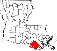 | |
| CDPs | ||
| Other unincorporated communities | ||
| Footnotes | ‡This populated place also has portions in an adjacent parish or parishes | |