Bayfield, Ontario
| Village of Bayfield | |
|---|---|
| Village | |
|
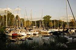
Marina in Bayfield | |
| Country | Canada |
| Province | Ontario |
| County | Huron County |
| Founded | 1832 |
Coordinates: 43°33′45″N 81°41′53″W / 43.562544°N 81.697962°W Bayfield (officially known as the Village of Bayfield), is a small community located within the town of Bluewater, Ontario, Canada. It is situated on the eastern shore of Lake Huron at the mouth of Bayfield River. Bayfield is a popular tourist destination. Visitors enjoy the historic Main Street lined with boutique shops, art galleries and fine dining restaurants. The marina and public beaches draw crowds in the summer months.
History
Bayfield was founded in 1832 by Carel Lodewijk, Baron van Tuyll van Serooskerken (1784-1835), a Dutch nobleman who had purchased large real estate holdings in the area.[1] It was named for noted Great Lakes surveyor and British naval officer Admiral Henry Wolsey Bayfield; who personally selected the site for the community.[2]
By 1869, Bayfield was a Village in the Township of Stanley County, Huron. It was a port of entry and vessels touched here on their route from Detroit to Goderich. Stages travelled daily to Seaforth.[3]

The Bayfield Town Hall was built in 1882, then moved to its present location on Clan Gregor Square in 1920. It was the seat of village government from that date until 1927 and again from 1965 to 1984. When the Village was disincorporated, the Town Hall was used for community events. Today the Hall remains the cultural centre of Village life.
Climate
| Climate data for Bayfield, Ontario | |||||||||||||
|---|---|---|---|---|---|---|---|---|---|---|---|---|---|
| Month | Jan | Feb | Mar | Apr | May | Jun | Jul | Aug | Sep | Oct | Nov | Dec | Year |
| Record high °C (°F) | 11.9 (53.4) |
18.5 (65.3) |
23.6 (74.5) |
23.9 (75) |
29.8 (85.6) |
32.0 (89.6) |
32.0 (89.6) |
34.4 (93.9) |
30.4 (86.7) |
25.5 (77.9) |
19.9 (67.8) |
16.7 (62.1) |
34.4 (93.9) |
| Average high °C (°F) | −0.7 (30.7) |
2.5 (36.5) |
5.2 (41.4) |
11.0 (51.8) |
18.0 (64.4) |
22.7 (72.9) |
24.1 (75.4) |
23.6 (74.5) |
21.0 (69.8) |
14.2 (57.6) |
7.5 (45.5) |
1.4 (34.5) |
12.54 (54.58) |
| Average low °C (°F) | −7.3 (18.9) |
−4.7 (23.5) |
−2.6 (27.3) |
1.4 (34.5) |
7.4 (45.3) |
12.6 (54.7) |
14.3 (57.7) |
13.4 (56.1) |
10.7 (51.3) |
5.2 (41.4) |
1.2 (34.2) |
−4.6 (23.7) |
3.92 (39.05) |
| Record low °C (°F) | −24.2 (−11.6) |
−17.6 (0.3) |
−21.8 (−7.2) |
−6.4 (20.5) |
−1.0 (30.2) |
3.8 (38.8) |
6.9 (44.4) |
5.2 (41.4) |
0.7 (33.3) |
−2.7 (27.1) |
−14.6 (5.7) |
−16.5 (2.3) |
−24.2 (−11.6) |
| Source: Environment Canada, The Weather Network | |||||||||||||
Annual events
.jpg)

As a small community Bayfield has many yearly traditions which include the Bayfield Fair in August, and Christmas in Bayfield, which takes place the weekend after Remembrance Day and includes the lighting of the trees in Clan Gregor Square as well as an annual Christmas Parade. Other annual events include the Fireman's Breakfast, Pioneer Park 5k Run, Santa Run, Halloween Witches Walk, and Corvette Fest and Volks Fest.

Bayfield has the largest croquet club in North America and members compete internationally.
Transportation
Bayfield is located on Highway 21, 20 kilometres south of Goderich.
References
- ↑ "The founding of Bayfield". Archived from the original on 2011-07-06. Retrieved 2009-06-23.
- ↑ Rayburn, Alan (1997), Place Names of Ontario (University of Toronto Press), Toronto-Buffalo-London, ISBN 0-8020-7207-0), pg.25
- ↑ The province of Ontario gazetteer and directory. H. McEvoy Editor and Compiler, Toronto : Robertson & Cook, Publishers, 1869