Batuan, Bohol
| Batuan | |
|---|---|
| Municipality | |
|
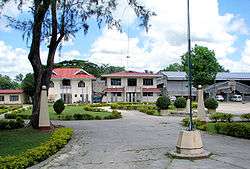
Poblacion Plaza | |
 Map of Bohol with Batuan highlighted | |
.svg.png) Batuan Location within the Philippines | |
| Coordinates: 9°48′N 124°08′E / 9.8°N 124.13°ECoordinates: 9°48′N 124°08′E / 9.8°N 124.13°E | |
| Country | Philippines |
| Region | Central Visayas (Region VII) |
| Province | Bohol |
| District | 3rd district of Bohol |
| Incorporated | 31 October 1903 |
| Barangay | 15 (see § Barangays) |
| Government [1] | |
| • Type | Sangguniang Bayan |
| • Mayor | Antonino Jumawid (LP) |
| • Vice mayor | Precious Joy Baguio |
| • Town Council |
Members
|
| • Representative | Arthur Yap |
| Area[2] | |
| • Total | 79.08 km2 (30.53 sq mi) |
| • Land | 78.15 km2 (30.17 sq mi) |
| Population (2015 census)[3] | |
| • Total | 12,767 |
| • Density | 160/km2 (420/sq mi) |
| • Voter (2016)[4] | 8,359 |
| Time zone | PST (UTC+8) |
| ZIP code | 6318 |
| IDD : area code | +63 (0)38 |
| Income class | 5th class |
| PSGC | 071207000 |
| Website |
www |

Batuan is a 5th municipal income class municipality in the province of Bohol, Philippines.[2] According to the 2015 census, it has a population of 12,767.[3] In the 2016 election, it had 8,359 registered voters.[4] Batuan is 51 km (32 miles) from Tagbilaran, and is located in the interior part of the island. It is accessible via the Tagbilaran—Loay—Carmen national road or the Tagbilaran—Balilihan—Batuan provincial road. It marches with Sagbayan to the north, with Bilar to the south, with Carmen and Valencia to the east, and with Catigbian and Balilihan to the west.
Batuan covers a total area of 7,908 hectares (19,540 acres) comprising fifteen barangays as per Municipal Comprehensive Development Plan for 1983–1992. However, a certification of the land area of Batuan, issued by ARED for operations, DENR Regional Office Region No. 7 Cebu City on 26 November 2001 at the instance of the LGU in connection with its Comprehensive Land Use Plan (CLUP) preparation work, showed a land area of only 4,878 hectares (12,050 acres), but that included only eleven barangays and excluded four – Quirino, Aloja, Behind the Clouds and Garcia.
Located within the province's tourist area, Batuan is the gateway to the Chocolate Hills, being only about 3 kilometres (1.9 mi) from the Chocolate Hills complex in Carmen.
History
This interior town used to be a barrio of Bilar during the Spanish regime and was called Lindugon. During the early years of American regime this barrio was made into a municipality by Act No. 370 of the Philippine Commission on 31 October 1903. Batuan became a separate municipality through the efforts of some local leaders, such as Manuel Decasa, Alejandro Barril, Victor Tiongson, among others, who were put behind bars for strongly advocating the movement to cede Batuan from its mother town Bilar, and its subsequent creation as a distinct and separate town. Notwithstanding, those leaders pursued their aspirations after release from prison. Municipality of Batuan was created, originally comprising only five barangays namely: Lindugon, Cambacay, Rosariohan, Janlud and Cantigdas; but today comprising fifteen.
The early years of local administration saw its seat at Lindugon, now Poblacion Vieja. In 1911 however, the Municipal Hall, the seat of local government, was transferred to sitio Tinagacan for reasons of accessibility. Eventually, the parish church was also relocated to its present site at the Poblacion.
Batuan got its name from edible fruit with the same name, which grew galore in the locality. Today though these trees can hardly be found in the area.
During the Japanese occupation, Batuan was a haven of evacuees from the provinces of Cebu, Leyte and from other parts of the island/province. It was at the Batuan Central School site where the unification of the guerilla forces of Bohol was forged on 29 June 1942, paving the way for the creation of the Bohol Area Command (BAC) under the command of Major Ismael Ingeniero, whose election was hotly contested by rival factions. The command had its headquarters in brgy Behind the Clouds. Major Ingeniero and his force played a pivotal role in the Battle of the Visayas and capture of Bohol.
Geography
Climate
Like most of the municipalities of the province, the climate in Batuan falls within Coronas climate type IV, characterized by not very pronounced maximum rainfall with a short dry season from one to three months and a wet season of nine to ten months.[5] The dry season starts in February and lasts up to April sometimes extending to the middle of May. The heaviest rainfalls are from June to August. It is usually cold during the night in the area. Batuan is generally out of the typhoon belt area and very seldom experiences typhoons.
Hydrogeology
The entire area of Batuan is covered by two sedimentary rock formations: Maribojoc Limestone, occupying 78.74 km2 (30.40 sq mi), 99.6% of its total land area, and Carmen formation, occupying 0.34 km2 (0.13 sq mi), 0.4%.[6]
Dominant slope of the area is 30 – 50% covering an estimated area of 29 km2 (11.2 sq mi), 37.1% of its total land area, with 21 km2 (8.1 sq mi), 26.9% in the 0 - 3% category (more or less level).
Batuan is entirely within the Loboc River Basin. Two tributaries of Loboc river – the Pagbathan and the Bayog – flow east—west into the main river course.
Agriculture
Basically, Batuan is an agricultural town as more than half of its total land area is devoted to agriculture, about 4,952 ha (12,240 acres) or 63%. This is the main source of livelihood in the locality where a great portion of its income is derived from crop production, livestock and poultry raising. Rice and corn are the principal crops grown in the area. Coconut, fruits root crops and leafy vegetables come next. Despite the absence of effective irrigation facilities, 1,794 ha (4,430 acres) (36.2% of agricultural land) are devoted to rice production, with an average production of 60 cavans per hectare.[lower-alpha 1] 1,313 ha (3,240 acres) (26.5%) are devoted to corn production. Coffee and cacao are among the industrial crops grown in the locality. Just launched by the LGU is the Fish Culture Farming program designed to encourage smallholders to develop small backyard fishponds to address the scarce supply and high costs of fish in the area.
Barangays
Batuan comprises 15 barangays:
| PSGC | Barangay | Population | ±% p.a. | Area[2] | PD 2015 | ||||
|---|---|---|---|---|---|---|---|---|---|
| 2015[3] | 2010[7] | ha | acre | /km2 | /sq mi | ||||
| 071207001 | Aloja | 3.3% | 424 | 437 | −0.57% | 385 | 951 | 110 | 290 |
| 071207016 | Behind the Clouds | 1.8% | 234 | 256 | −1.70% | 975 | 2,409 | 24 | 62 |
| 071207002 | Cabacnitan | 5.5% | 701 | 596 | +3.14% | 637 | 1,574 | 110 | 290 |
| 071207003 | Cambacay | 5.3% | 673 | 585 | +2.70% | 479 | 1,184 | 140 | 360 |
| 071207004 | Cantigdas | 6.2% | 786 | 735 | +1.29% | 380 | 939 | 210 | 540 |
| 071207005 | Garcia | 3.7% | 476 | 546 | −2.58% | 580 | 1,433 | 82 | 210 |
| 071207006 | Janlud | 6.1% | 780 | 703 | +2.00% | 589 | 1,455 | 130 | 340 |
| 071207008 | Poblacion Norte | 15.6% | 1,988 | 1,889 | +0.98% | 355 | 877 | 560 | 1,500 |
| 071207009 | Poblacion Sur | 10.3% | 1,313 | 1,353 | −0.57% | 561 | 1,386 | 230 | 610 |
| 071207010 | Poblacion Vieja | 7.0% | 899 | 894 | +0.11% | 428 | 1,058 | 210 | 540 |
| 071207011 | Quezon | 4.8% | 609 | 603 | +0.19% | 398 | 983 | 150 | 400 |
| 071207012 | Quirino | 3.8% | 480 | 447 | +1.37% | 340 | 840 | 140 | 370 |
| 071207013 | Rizal | 10.1% | 1,295 | 1,277 | +0.27% | 558 | 1,379 | 230 | 600 |
| 071207014 | Rosariohan | 7.3% | 929 | 939 | −0.20% | 699 | 1,727 | 130 | 340 |
| 071207017 | Santa Cruz | 9.2% | 1,180 | 939 | +4.45% | 544 | 1,344 | 220 | 560 |
| Total | 12,767 | 12,431 | +0.51% | 7,908 | 19,541 | 160 | 420 | ||
Demographics
| Population census of Batuan | |||||||||||||||||||||||||
|---|---|---|---|---|---|---|---|---|---|---|---|---|---|---|---|---|---|---|---|---|---|---|---|---|---|
|
| ||||||||||||||||||||||||
| Source: Philippine Statistics Office[3][7][8] | |||||||||||||||||||||||||
Batuan's working age or economically active population age 15-64, comprises 58% of its total population, while its dependent population, aged 0–14 and 65 years and above, comprises 42%.
In the 2016 election, it had 8,359 registered voters, meaning that 65% of the population are aged 18 and over.[4]
Local government
Education
There are eighteen learning institutions in Batuan of which nine are primary schools, six elementary schools, one public school and one private high school, providing secondary education. Batuan Colleges, a privately owned college school offering technical and short courses in a close tie-up with TESDA, has been in operation since mid‑2000s.
Welfare
All barangays have their Day Care centers where services are provided by day care workers on a regular basis, a program financially supported by the LGU aside from other programs like supplemental feeding, emergency assistance, and burial assistance.
The Municipal Health Office (MHO) is staffed by one doctor, five midwives, a nurse, a medical (laboratory) technologist, a sanitary inspector, and a dentist who reports only twice a week due to budget constraints. A team of Barangay Health Workers has been organized in all barangays to help facilitate and speed up the delivery of basic health services even in the remote areas. There are only three Barangay Health stations in the whole area. An ambulance is on stand-by for emergency uses.
Protective services
For the maintenance of peace and order in the area, the LGU has a local PNP station headed by a police chief with ten (20) junior PNP personnel, equipped with some high-powered firearms and one patrol car. The local PNP force is assisted in this regard by tanod members of each composite barangay as far as law and order are concerned at barangay level. The LGU however has neither existing or available personnel nor equipment for fire protection purposes.
Economy
Transport
Batuan has a total road network of about 92.1 kilometres (57.2 mi) of which 65.5 kilometres (40.7 mi) are barangay roads, 15.8 kilometres (9.8 mi) are provincial roads, 3.2 kilometres (2.0 mi) national and 10.8 kilometres (6.7 mi) municipal roads. While the entire national road network is of either concrete or asphalt surface, only about 2.3 kilometres (1.4 mi) (21%) of its municipal roads, and about 2.5 kilometres (1.6 mi) (4%) of its barangay roads are concrete with the larger portion still earth and / or gravel. 98% of its provincial roads are gravel.
Trade, commerce and industry
Commercial and trading transactions in Batuan gravitate to the urban area, considered the town's Central Business District. However, commercial and trading activities in the area are brisk. Commercial activities in Batuan pass through a network of various commercial establishments. Sari-sari stores are the most common. Other are bakeries, eateries, drugstores, farm and poultry stores, and hardware stores. Service providers in the area include iron works, welding shops, repair shops, furniture factories & communication facilities. Among the ubiquitous industries of Batuan are the rice and corn mills located mainly in the Poblacion areas. Other than those, industrial activities are minimal.
Although Batuan is only about 3 km (1.9 mi) from the Chocolate Hills complex, tourism activities in the municipality are very few. There are no facilities and establishments that cater to the needs and wants of the industry. Batuan also has the Camanayon Mountain.
Notes
- ↑ Cavan is a fairly imprecise, variable measure. It means "sack" or "box" in Visayan dialects, and was originally a measure of volume not weight. For rice nowadays though it is about 50 ± 5 kilograms (110 ± 11 lb), so 60 cavans per hectare is about 3,000 ± 300 kg/ha (2,680 ± 270 lb/acre), giving a total annual yield around 5,380 metric tons (5,300 long tons).
References
- ↑ "Municipality". Quezon City, Philippines: Department of the Interior and Local Government. Retrieved 31 May 2013.
- 1 2 3 "Municipal: Batuan, Bohol". PSA. Philippines: National Statistical Coordination Board. Retrieved 8 January 2016.
- 1 2 3 4 "Region VII (CENTRAL VISAYAS)". Census of Population (2015): Total Population by Province, City, Municipality and Barangay (Report). PSA. Retrieved 20 June 2016.
- 1 2 3 "2016 National and Local Elections Statistics". Commission on Elections. 2016.
- ↑ Coronas 1920.
- ↑ Faustina et al. 2003.
- 1 2 "Region VII (CENTRAL VISAYAS)". Census of Population and Housing (2010): Total Population by Province, City, Municipality and Barangay (Report). NSO. Retrieved 29 June 2016.
- ↑ "Region VII (CENTRAL VISAYAS)". Census of Population (1995, 2000 and 2007): Total Population by Province, City and Municipality (Report). NSO. Archived from the original on 24 June 2011.
Sources
- Coronas, José (1920). The Climate and Weather of the Philippines, 1903 – 1918. Manila Observatory: Bureau of Philippines.
- Faustino, D. V.; Yumul Jr, G. P.; de Jesus, J. V.; Dimalanta, C. B.; Aitchison, J. C.; Zhou, M-F.; Tamayo Jr, R. A. & de Leon, M. M. (2003). "Geology of southeast Bohol, central Philippines: accretion and sedimentation in a marginal basin" (online text). Australian Journal of Earth Sciences. 50: 571–583. doi:10.1046/j.1440-0952.2003.01015.x. Retrieved 22 October 2014.
External links
| Wikimedia Commons has media related to Batuan. |
 |
Sagbayan | | ||
| Catigbian Balilihan |
|
Carmen | ||
| ||||
| | ||||
| Bilar |