Barrett Island
Not to be confused with Barratt Island.
 Barrett Island Location in Antarctica | |
| Geography | |
|---|---|
| Location | Antarctica |
| Coordinates | 72°12′S 95°33′W / 72.200°S 95.550°WCoordinates: 72°12′S 95°33′W / 72.200°S 95.550°W |
| Administration | |
|
None | |
| Demographics | |
| Population | Uninhabited |
| Additional information | |
| Administered under the Antarctic Treaty System | |

Map of Thurston Island.
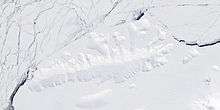
Satellite image of Thurston Island.
Barrett Island is an ice-covered island about 4 kilometres (2 nmi) long, lying just within the northern part of the mouth of Morgan Inlet, Thurston Island. It was mapped by the United States Geological Survey from surveys and from U.S. Navy air photos, 1960–66, and named by the Advisory Committee on Antarctic Names for Lieutenant (j.g.) Barry B. Barrett, a pilot of Squadron VX-6 on photographic flights during U.S. Navy Operation Deepfreeze 1964.[1]
See also
Maps
- Thurston Island – Jones Mountains. 1:500000 Antarctica Sketch Map. US Geological Survey, 1967.
- Antarctic Digital Database (ADD). Scale 1:250000 topographic map of Antarctica. Scientific Committee on Antarctic Research (SCAR), 1993–2016.
References
- ↑ "Barrett Island". Geographic Names Information System. United States Geological Survey. Retrieved 2011-05-20.
![]() This article incorporates public domain material from the United States Geological Survey document "Barrett Island" (content from the Geographic Names Information System).
This article incorporates public domain material from the United States Geological Survey document "Barrett Island" (content from the Geographic Names Information System).
This article is issued from Wikipedia - version of the 11/11/2016. The text is available under the Creative Commons Attribution/Share Alike but additional terms may apply for the media files.