Barre, Wisconsin
| Barre, Wisconsin | |
|---|---|
| Town | |
 Location of Barre, Wisconsin | |
| Coordinates: 43°50′15″N 91°6′11″W / 43.83750°N 91.10306°WCoordinates: 43°50′15″N 91°6′11″W / 43.83750°N 91.10306°W | |
| Country | United States |
| State | Wisconsin |
| County | La Crosse |
| Area | |
| • Total | 20.7 sq mi (53.5 km2) |
| • Land | 20.7 sq mi (53.5 km2) |
| • Water | 0.0 sq mi (0.0 km2) |
| Elevation[1] | 719 ft (219 m) |
| Population (2010) | |
| • Total | 1,234 |
| • Density | 49.1/sq mi (18.9/km2) |
| Time zone | Central (CST) (UTC-6) |
| • Summer (DST) | CDT (UTC-5) |
| Area code(s) | 608 |
| FIPS code | 55-04825[2] |
| GNIS feature ID | 1582754[1] |
Barre is a town in La Crosse County, Wisconsin, United States. The population was 1,234 at the 2010 census. It is part of the La Crosse, Wisconsin Metropolitan Statistical Area. The town hall is in the unincorporated community of Barre Mills.
Geography
According to the United States Census Bureau, the town has a total area of 20.7 square miles (53.5 km²), all of it land.
Demographics
| Historical population | ||
|---|---|---|
| Year | Pop. | ±% |
| 1990 | 908 | — |
| 2000 | 1,014 | +11.7% |
| 2010 | 1,234 | +21.7% |
As of the census[2] of 2000, there were 1,014 people, 347 households, and 275 families residing in the town. The population density was 49.1 people per square mile (18.9/km²). There were 354 housing units at an average density of 17.1 per square mile (6.6/km²). The racial makeup of the town was 98.72% White, 0.39% African American, 0.50% Asian, 0.10% from other races, and 0.20% from two or more races. Hispanic or Latino of any race were 1.48% of the population.
There were 347 households out of which 43.5% had children under the age of 18 living with them, 66.9% were married couples living together, 7.5% had a female householder with no husband present, and 20.7% were non-families. 17.0% of all households were made up of individuals and 5.2% had someone living alone who was 65 years of age or older. The average household size was 2.92 and the average family size was 3.29.
In the town the population was spread out with 33.3% under the age of 18, 5.9% from 18 to 24, 30.9% from 25 to 44, 22.5% from 45 to 64, and 7.4% who were 65 years of age or older. The median age was 33 years. For every 100 females there were 96.9 males. For every 100 females age 18 and over, there were 102.4 males.
The median income for a household in the town was $49,474, and the median income for a family was $53,250. Males had a median income of $34,519 versus $27,109 for females. The per capita income for the town was $21,609. About 2.0% of families and 2.9% of the population were below the poverty line, including 3.8% of those under age 18 and none of those age 65 or over.
References
- 1 2 "US Board on Geographic Names". United States Geological Survey. 2007-10-25. Retrieved 2008-01-31.
- 1 2 "American FactFinder". United States Census Bureau. Archived from the original on 2013-09-11. Retrieved 2008-01-31.
Municipalities and communities of La Crosse County, Wisconsin, United States | ||
|---|---|---|
| Cities | 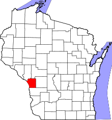 | |
| Villages | ||
| Towns | ||
| CDPs | ||
| Unincorporated communities | ||