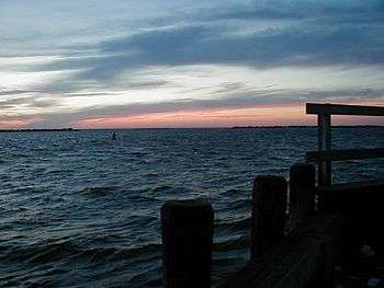
Barnegat Bay

Barnegat Bay is a small brackish arm of the Atlantic Ocean, approximately 42 miles (67.2 km) long, along the coast of Ocean County, New Jersey in the United States. It is separated from the Atlantic by the long Barnegat Peninsula (colloquially called a "barrier island"), as well as by the north end of Long Beach Island, popular segments of the Jersey Shore. The bay is fed by several small rivers, including the Toms River and Metedeconk River, which empty into the bay through small estuaries along its inner shore. The communities of Toms River, Silverton, and Forked River sit along the river estuaries on the bay.
The bay connects with the ocean through the Barnegat Inlet, along which sits the Barnegat Lighthouse. The bay is part of the Atlantic Intracoastal Waterway, entered on its north end by the Point Pleasant Canal and connecting on the south end with Little Egg Harbor via the small Manahawkin Bay. In a broader sense, Barnegat Bay is sometimes considered to stretch to the south end of Long Beach Island and to include Little Egg Harbor.
Three bridges span the bay from the mainland to the peninsula: the Mantoloking Bridge from Brick Township to Mantoloking, and the Thomas A. Mathis and J. Stanley Tunney Bridges from Toms River to Ortley Beach. The Barnegat Division of Edwin B. Forsythe National Wildlife Refuge comprises wetlands along the inner southern part of the bay. Along the outside of the bay, on the peninsula, is the Island Beach State Park. Various islands within the bay are a part of the National Wildlife Refuge or the Sedge Islands State Wildlife Management Area. The northern tip of Long Beach Island includes the Barnegat Lighthouse State Park.
History
The area surrounding Barnegat Bay and Barnegat Inlet was described by Henry Hudson, in 1609, as "... a great lake of water, as we could judge it to be ... The mouth of the lake hath many shoals, and the sea breaketh on them as it is cast out of the mouth of it." The bay was originally named in 1614 "Barendegat," or "Inlet of the Breakers," by Dutch settlers, referring to the waterway's turbulent channel.[1] During the American Revolutionary War, the bay was used as refuge by American privateers.
The bay has been a longtime center for commercial fishing. The village of Toms River was a significant whaling port in the 19th century. While still popular for fishing, Barnegat Bay has also become a popular destination for recreational boating. The water quality of the bay has been degraded by pollution in the rivers and creeks that feed it. The preservation of the bay's water quality has been an ongoing effort of several public and private organizations.
The bay was immortalized by the famous writer E. B. White, who used it as a setting for his short story "The Family That Dwelt Apart". The story appears in his collection Preposterous Parables. It was adapted into the animated short The Family That Dwelt Apart, narrated by White, by the National Film Board of Canada.[2]
The song "My Eyes Adored You" by New Jersey native Frankie Valli contains a reference to "walking home everyday over Barnegat Bridge and Bay". On March 22, 1975, the song became one of the Hot 100 number-one hits of 1975 (USA).
The Trust for Public Land, a national land conservation group, has done extensive work in the Barnegat Bay area for over two decades, protecting over 1,100 acres (4.5 km2) of land. The Trust recently began the new River to Bay Greenway, the primary goal of which is to create a 70-mile (110 km) multi-use recreational route across southern New Jersey from the Delaware River to Barnegat Bay.[3][4]
Issues
In the 2000s and 2010s, scientists and residents have drawn attention to fish kills, algae blooms, low dissolved oxygen levels, loss of habitat, diminishing clam populations, and the rise in stinging Chrysaora quinquecirrha (sea nettle jellyfish) populations in the bay, mainly due to high levels of nitrogen from fertilizer runoff.[5][6][7] The Environmental Protection Agency monitors the health of the bay by testing at four locations as frequently as once a week in the summer months, when surface water can reach 82 °F (28 °C).[8]
Community members have also expressed concern over the impact of stored radiation and thermal pollution at the Oyster Creek Nuclear Generating Station in Lacey Township.[9] The 1969 plant is the oldest operating nuclear power plant in the United States and is scheduled to be retired by 2019.[10]
Islands
Middle Sedge Island in Barnegat Bay is a 25-acre (100,000 m2) island, 14 acres (57,000 m2) of which are developed with a single house.[11] Other islands include: Little Sedge Island, Northwest Point Island and Marsh Elder Island. Some are privately owned and some are owned by the state of New Jersey.[12]
References
- ↑ Lloyd, John Bailey. "Eighteen Miles of History on Long Beach Island." p. 42. 1994 Down The Shore Publishing and The SandPaper, Inc.
- ↑ "The Family That Dwelt Apart". National Film Board of Canada. 1973. Retrieved November 13, 2009.
- ↑ "Barnegat Bay Program". The Trust for Public Land. Archived from the original on October 22, 2007.
- ↑ "River to Bay Greenway". The Trust for Public Land. Retrieved August 3, 2016.
- ↑ "Rutgers study says Barnegat Bay ecosystem will continue to decline unless development, runoff decreases". Associated Press. July 11, 2012. Retrieved August 15, 2012.
- ↑ Urgo, Jacqueline (September 2, 2011). "Researchers study nettlesome invasion in Barnegat Bay". Philadelphia Inquirer. Retrieved August 15, 2012.
- ↑ "Dreaded Intruders". The SandPaper. August 1, 2012. Retrieved August 15, 2012.
- ↑ Smith, Shawn (August 7, 2012). "EPA Sets Sail on the Barnegat Bay to Measure Water's Health". Lacey Patch. Retrieved August 15, 2012.
- ↑ Ahearn, James (July 17, 2012). "Opinion: Nuclear waste showdown looms for N.J., nation". The Bergen Record. Retrieved August 15, 2012.
- ↑ "Oyster Creek Generating Station".
- ↑ "Middle Sedge Island". Private Islands Online. Retrieved November 29, 2011.
... The property includes 14.4 acres of a 25 acre island. ...
- ↑ "SBB Conserves Islands in the Barnegat Bay". Ocean County Izaak Walton League. Retrieved March 1, 2008.
Of the tidal marsh islands to the north – Northwest Point Island, Marsh Elder Island, and Middle Sedge Island off Chadwick – some are in private ownership and some are owned by the state of New Jersey. Save Barnegat Bay wishes to see all of these islands eventually come under public ownership on a willing seller basis.
External links
| Wikimedia Commons has media related to Barnegat Bay. |
- State of New Jersey: Barnegat Bay Estuary Program
- Save Barnegat Bay – environmental advocacy site
- Rutgers University: Barnegat Bay Resources
- Jersey City Anglers Association: Future of Barnegat Bay
- ReClam the Bay – environmental organization that grows and plants millions of clams and oysters to reclaim Barnegat Bay
- Nitrogen Pollution Action Project – guide to eutrophication of Barnegat Bay and solutions
Coordinates: 39°51′06″N 74°06′51″W / 39.851709°N 74.114113°W