Barberino di Mugello
| Barberino di Mugello | |
|---|---|
| Comune | |
| Comune di Barberino di Mugello | |
|
Villa Le Maschere | |
 Barberino di Mugello Location of Barberino di Mugello in Italy | |
| Coordinates: 44°0′N 11°14′E / 44.000°N 11.233°ECoordinates: 44°0′N 11°14′E / 44.000°N 11.233°E | |
| Country | Italy |
| Region | Tuscany |
| Province / Metropolitan city | Province of Florence (FI) |
| Frazioni | Cavallina (2500 abitanti circa), Galliano, Montecarelli, Latera |
| Area | |
| • Total | 133.7 km2 (51.6 sq mi) |
| Elevation | 270 m (890 ft) |
| Population (Dec. 2004) | |
| • Total | 10,114 |
| • Density | 76/km2 (200/sq mi) |
| Demonym(s) | Barberinesi |
| Time zone | CET (UTC+1) |
| • Summer (DST) | CEST (UTC+2) |
| Postal code | 50031 |
| Dialing code | 055 |
| Website | Official website |
Barberino di Mugello is a comune (municipality) in the Province of Florence in the Italian region Tuscany, located about 25 kilometres (16 mi) north of Florence. As of 31 December 2004, it had a population of 10,114 and an area of 133.7 square kilometres (51.6 sq mi).[1]
Geography
The municipality of Barberino di Mugello contains the frazioni (i.e. subdivisions - mainly villages and hamlets) of Cavallina (approx 2,500 inhabitants), Galliano, Montecarelli, and Latera.
Barberino di Mugello borders the following municipalities: Calenzano, Cantagallo, Castiglione dei Pepoli, Firenzuola, San Piero a Sieve, Scarperia, Vaiano, Vernio.
Demographic evolution

Twin towns
-
 Laurenzana, Italy
Gallery
-

Barberino di Mugello
-

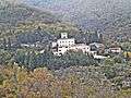
Medici villa in Cafaggiolo
-

Galliano-Clock tower
-

Pretorium Palace-barberino di Mugello
-

Bilancino lake
-

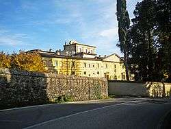
Villanova castle in Le Maschere
-

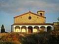
San Gavino Adimari parish church in San gavino by Montecarelli
-

San Michele the Arcangel in Montecarelli
-
San Giovanni in Petriolo parish church
-
Bovecchio
References
External links
![]() Media related to Barberino di Mugello at Wikimedia Commons
Media related to Barberino di Mugello at Wikimedia Commons