Bangkok Metropolitan Region
Not to be confused with Bangkok Metropolis, which is a reference to Bangkok's city limits.
The Bangkok Metropolitan Region (Thai: กรุงเทพมหานครและปริมณฑล; RTGS: Krung Thep Mahanakhon Lae Parimonthon; Literally: Bangkok and surrounding provinces), may refer to a government-defined "political definition" of the urban region surrounding the metropolis of Bangkok, or the built-up area, i.e., urban agglomeration of Bangkok, Thailand, which varies in size and shape, and gets filled in as development expands.
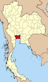
The political definition is defined as the metropolis and the five adjacent provinces of Nakhon Pathom, Pathum Thani, Nonthaburi, Samut Prakan, and Samut Sakhon.
Area and population
The Bangkok Metropolitan Region (political definition) covers an area of 7,761.6 km².[1]
Due to the success of the service and tourism industry in Bangkok, the city has gained in popularity for work among provincial Thais from the rural areas and with people from many countries in the Indochina region as well as many South Asian countries. In the past 20–30 years, there has been a large influx of Indians in to Thailand (especially Punjabis, Gujaratis, Tamils and Pashtuns), and also Persians, Portuguese, Khmer Krom, Mons, Chinese, as well as others emigrating to Thailand and Bangkok. There are large numbers of workers who legally reside outside the metropolitan area and travel into the city for day jobs. The population of the Bangkok metropolis ("the city") increases to nine million during the day, from eight million at night. The morning influx into the greater metropolitan region is not very significant, rather the influx is seasonal depending upon crop seasons in the rest of the country.
However, during New Year's holiday, the Songkran holiday, and other long weekends, the capital often seems deserted of many taxi drivers, street vendors, and other informal service providers.
Urban build-up
Bangkok has seen rapidly urbanization since its population reached two million in the 1960s. Since the 1980s, greater Bangkok's built-up areas have spilled beyond Bangkok's borders to neighboring provinces, initially to the north and south. Despite a general suburbanization trend, Bangkok remained centralized and the city core remained extremely dense until the early 2000s as heavy commuter traffic limited choices. The countryside between once independent towns and the capital became ever more filled in, with the advent and expansion of urban rail transit, as well as cheap credit enabling automobile adoption by the working class. The outward push of suburbanization has intensified as park and ride lots near train stations have sprung up.
In a manner similar to Los Angeles, Bangkok is transforming into a region where traffic flows in all directions rather than simply to the central core, as it once did. Suburbanziation has swallowed ever more fields and swamps, though even parts of Bangkok itself are not built-up. The first areas to suburbanize were in Pathum Thani, Nonthaburi, and Samut Prakan Provinces. Other areas more recently have agglomerated in Samut Sakhon and Nakhon Pathom. Samut Prakan, Nonthaburi, Pathum Thani and Samut Sakhon all have historic city centers.
Due to a lack of strict zoning laws, the metropolitan areas' growth appears haphazard. Central areas like Yaowarat, Siam, Sukhumvit, and Sathorn have seen skyrocketing land speculation as foreign investors are allowed to own condominiums, giving rise to Manhattanization. At the same time, fringe areas are being developed and the boundaries are no longer visible between each provincial city center. Due to the speed of this urban sprawl over the past twenty years, the Bangkok Metropolitan Administration has sought to tackle rising problems of commute times, pollution, and deteriorating air quality. Recent administrations have been relatively successful in conserving the air quality, however the city still lacks an effective mass transit network and a clean and effective plan to resolve environmental issues. This form of urbanization is not limited to Bangkok. Traces of it can be found in metropolitan areas where there has been a surge in population. The Pattaya-Chonburi Metropolitan Area is a prime example due to the increase in residential high-rise living and the rush for commercial office space. The shared infrastructure of greater Bangkok and greater Pattaya-Chonburi, being physically close, helps fuel the latter's torrid development.
Population
| Administrative Area | Area km² |
Population (2000Cf) |
Population (2010Cp) |
Population (2011 Registered) |
Population (Sep, 2013 Registered) |
Population (Apr, 2015 Registered) |
Pop.Density Inh/km²(2010C) |
|---|---|---|---|---|---|---|---|
| Bangkok Metropolis | 1,568.737 | 6,355,144 | 8,249,117 | 5,674,843 | 5,683,686 | 5,693,884 | 5,258.6 |
| Nonthaburi | 622.30 | 816,614 | 1,333,623 | 1,122,627 | 1,152,401 | 1,179,777 | 2,143.1 |
| Samut Prakan | 1,004.50 | 1,028,401 | 1,828,044 | 1,223,302 | 1,237,047 | 1,267,203 | 1,820.6 |
| Pathum Thani | 1,525.90 | 677,649 | 1,326,617 | 1,010,898 | 1,048,665 | 1,079,646 | 869.4 |
| Samut Sakhon | 872.30 | 466,281 | 885,559 | 499,098 | 516,392 | 535,429 | 1015.2 |
| Nakhon Pathom | 2,168.30 | 815,122 | 942,560 | 866,064 | 880,716 | 892,949 | 434.7 |
| Greater Bangkok | 7,762.00 | 10,159,211 | 14,565,520 | 10,396,832 | 10,518,907 | 10,648,888 | 1,876.64 |
source: http://www.citypopulation.de/php/thailand-admin.php (on NSO.go.th Census Data, 2010 figures subject to revision.)
| |||||||
Traffic
As of 31 October 2012, some 7,384,934 vehicles were registered in the metro area, roughly one vehicle for every two persons.[9] To alleviate the ensuing congestion, massive railway development is ongoing, but its construction is causing large scale disturbance to major thoroughfares.
Further destruction of green space
Bangkok's last undisturbed forested zone, Bang Krachao, in Samut Prakan's Phra Pradaeng District, also known as "the green lung" or "pig's stomach" (rtgs: krapho mu) (due to its shape) is threatened by urban sprawl, especially since a new city plan was implemented recently by Samut Prakan authorities. The plan has changed the pure green area to a "green and white" area, which allows residents to grow crops. Bang Krachao covers over 11,818 rai in six tambons in Phra Pradaeng.[10]
See also
References
- ↑ "Thailand: Bangkok Metropolitan Region / กรุงเทพมหานครและปริมณฑล". City Population. Retrieved 27 November 2015.
- ↑ "Who is included in the census?". 2010 Population and Housing Census. National Statistical Office Thailand. Retrieved 27 November 2015.
- ↑ "A deadly cocktail". The Economist. 2013-03-02. Retrieved 27 November 2015.
- ↑ "Current Migration Challenges in Thailand" (PDF). European External Action Service. European Union External Action. Retrieved 27 November 2015.
- ↑ http://stat.bora.dopa.go.th/stat/y_stat54.html
- ↑ Smith, Herbert. "Thailand: government extends a deadline for the registration of migrant workers". Lexology. Retrieved 27 November 2015.
- ↑ "Junta: No crackdown on foreign workers". The Nation. June 17, 2014. Retrieved 27 November 2015.
- ↑ "Thailand, Cambodia to quash 'rumours' after worker exodus". Bangkok Post. 2014-06-17. Retrieved 27 November 2015.
- ↑ Jitsomboon, Vipaporn (2012-12-17). "Traffic in Bangkok set to worsen in 2014, official warns". The Nation. Retrieved 27 November 2015.
- ↑ Saengpassa, Chularat; Sarnsamak, Pongphon (2014-04-08). "New city plan 'could ravage' the verdant Bang Krachao". The Nation. Retrieved 27 November 2015.
External links
Coordinates: 13°51′N 100°25′E / 13.850°N 100.417°E