Banfora
| Banfora | |
|---|---|
|
Banfora market | |
 Banfora Location within Burkina Faso, French West Africa | |
| Coordinates: 10°37′51″N 4°45′32″W / 10.63083°N 4.75889°WCoordinates: 10°37′51″N 4°45′32″W / 10.63083°N 4.75889°W | |
| Country |
|
| Region | Cascades |
| Province | Comoé |
| Elevation | 303 m (994 ft) |
| Population (2012)[1] | |
| • Total | 93,750 |
| Time zone | GMT (UTC+0) |
| Area code(s) | +226 209 |

Banfora is a city in south western Burkina Faso with a population of 93,750 people (2012). It is the capital of the Comoe province. The city lies 85 kilometres (53 mi) south-west of Bobo-Dioulasso, on the Abidjan – Ouagadougou Railway. The Cascades de Karfiguéla are a series of waterfalls close to Banfora. As of the 2006 Census, Banfora was the fourth largest city in Burkina Faso by population.
History

The first settlers were the Karaboro which together with the Gouin and Turkas constitute the city's main ethnic groups. They are all from the south of Burkina Faso. In 1903 the French colonialist forces created a military post at Banfora and one year later created an administrative position there. In 1905 a road was built linking Banfora to Bobo-Dioulasso and in 1931 a railway was built to the town.
Economy
The economy has grown around the sugar cane industry. The city is also an important market town and there are hotels which support a small tourism industry linked to the Cascades de Karfiguéla.
Transportation
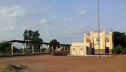
The city has a railroad station along the Abidjan – Ouagadougou Railway. As of June 2014 Sitarail operated a passenger train along the line three times a week in each direction.[2] It is a way station for transport to and from Côte d'Ivoire as it is the last city in Burkina Faso before the border. The paved road from Bobo-Dioulasso continues to the border and cargo will often stop at Niangoloko before reaching customs.
Education
Banfora has 19 primary schools, two high schools, four private colleges and the College of Sainte Thérèse.
Healthcare
The city has a regional hospital (CHR), a maternal and infant protection unit and three pharmacies. Traditional medicine is also practiced and there is a center for traditional therapies.
Demographics
The main ethnic groups are the Gouin, the Karaboro and the Turka. The most commonly used languages for communication between people of different ethnicities living in Banfora are Dioula and French.
Climate
Köppen-Geiger climate classification system classifies its climate as tropical wet and dry (Aw).
| Climate data for Banfora (altitude: 313m) | |||||||||||||
|---|---|---|---|---|---|---|---|---|---|---|---|---|---|
| Month | Jan | Feb | Mar | Apr | May | Jun | Jul | Aug | Sep | Oct | Nov | Dec | Year |
| Average high °C (°F) | 33.6 (92.5) |
35.7 (96.3) |
36.9 (98.4) |
36.8 (98.2) |
35 (95) |
32.6 (90.7) |
30.8 (87.4) |
30.2 (86.4) |
31.1 (88) |
33.3 (91.9) |
34.9 (94.8) |
33.6 (92.5) |
33.71 (92.68) |
| Daily mean °C (°F) | 25.4 (77.7) |
27.8 (82) |
29.9 (85.8) |
30.7 (87.3) |
29.5 (85.1) |
27.5 (81.5) |
26.3 (79.3) |
25.9 (78.6) |
26.3 (79.3) |
27.4 (81.3) |
27.4 (81.3) |
25.5 (77.9) |
27.47 (81.42) |
| Average low °C (°F) | 17.3 (63.1) |
19.9 (67.8) |
23 (73) |
24.6 (76.3) |
24 (75) |
22.5 (72.5) |
21.9 (71.4) |
21.6 (70.9) |
21.5 (70.7) |
21.6 (70.9) |
19.9 (67.8) |
17.4 (63.3) |
21.27 (70.22) |
| Average precipitation mm (inches) | 1 (0.04) |
5 (0.2) |
22 (0.87) |
56 (2.2) |
109 (4.29) |
136 (5.35) |
209 (8.23) |
282 (11.1) |
187 (7.36) |
64 (2.52) |
12 (0.47) |
3 (0.12) |
1,086 (42.75) |
| Source: Climate-Data.org[3] | |||||||||||||
| Climate data for Banfora (altitude: 300m) | |||||||||||||
|---|---|---|---|---|---|---|---|---|---|---|---|---|---|
| Month | Jan | Feb | Mar | Apr | May | Jun | Jul | Aug | Sep | Oct | Nov | Dec | Year |
| Average high °C (°F) | 33.8 (92.8) |
35.7 (96.3) |
37 (99) |
36.7 (98.1) |
35.1 (95.2) |
32.8 (91) |
31 (88) |
30.3 (86.5) |
31.1 (88) |
33.4 (92.1) |
35 (95) |
33.6 (92.5) |
33.79 (92.88) |
| Daily mean °C (°F) | 25.6 (78.1) |
27.8 (82) |
30 (86) |
30.6 (87.1) |
29.6 (85.3) |
27.7 (81.9) |
26.5 (79.7) |
25.9 (78.6) |
26.3 (79.3) |
27.5 (81.5) |
27.5 (81.5) |
25.5 (77.9) |
27.54 (81.58) |
| Average low °C (°F) | 17.4 (63.3) |
20 (68) |
23.1 (73.6) |
24.6 (76.3) |
24.1 (75.4) |
22.6 (72.7) |
22 (72) |
21.6 (70.9) |
21.6 (70.9) |
21.7 (71.1) |
20 (68) |
17.4 (63.3) |
21.34 (70.46) |
| Average precipitation mm (inches) | 1 (0.04) |
5 (0.2) |
22 (0.87) |
56 (2.2) |
109 (4.29) |
136 (5.35) |
209 (8.23) |
282 (11.1) |
186 (7.32) |
64 (2.52) |
11 (0.43) |
2 (0.08) |
1,083 (42.63) |
| Source: Climate-Data.org[4] | |||||||||||||
References
- ↑ "World Gazetteer".
- ↑ European Rail Timetable, Summer 2014 Edition, (journey time is 43 to 48 hours)
- ↑ "Climate: Banfora - Climate graph, Temperature graph, Climate table (altitude: 313m)". Climate-Data.org. Retrieved 2013-11-24.
- ↑ "Climate: Banfora - Climate graph, Temperature graph, Climate table (altitude: 300m)". Climate-Data.org. Retrieved 2013-11-24.
