Banda District (Ghana)
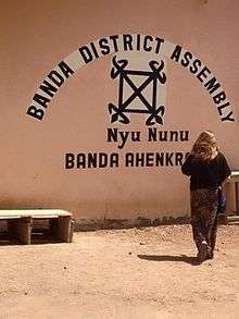

The Banda District is one of the Forty-six (46) new districts and municipalities created in the year 2012 in the Brong Ahafo Region of Ghana. Its capital is Banda Ahenkro.
History
Banda District was carved from Tain and forms part of the new districts and municipalities created in the year 2012 and were inaugurated at their various locations simultaneously on 28 June 2012.
The Late President, H.E. J.E.A Mills, by an Executive Instrument (E.I) created 46 new Districts. All the inaugurated and confirmed MMDAs established are operational with immediate effect hence bringing the total number of MMDAs to 216.
The district has a population size of 45,000 as at 2010 with males being 21,000 and females being 24,000 (Source: Ghana Statistical Service [1] –Population Estimates for Brong Ahafo Region-2010). The population has been increasing over the years with a growth rate of 2.6%.
List of settlements
| Settlements of Banda District | |||
| No. | Settlement | Population | Population year |
|---|---|---|---|
| 1 | Banda Ahenkro | ||
| 2 | BANDA BOASE | ||
| 3 | BONGASI | ||
| 4 | BOFIE | ||
| 5 | BANDAWAN | ||
| 6 | AKANYAKROM | ||
| 7 | DORBOR | ||
| 8 | SABIYE | ||
| 9 | WEWA | ||
| 10 | NYIRE | ||
| 11 | KANKA | ||
| 12 | SAASE | ||
| 13 | DOMPOFIE | ||
| 14 | KABRONO | ||
| 15 | FAWOMAN | ||
| 16 | MAKALA | ||
| 17 | TAINANO | ||
| 18 | SAMBA | ||
| 19 | SAMBA WALA AKURA | ||
| 20 | BUI VILLAGE | ||
| 21 | BOASE | ||
| 22 | AKANYAKROM | ||
| 23 | KOGYEI (KOJEE) | ||
| 24 | BIMA (BERMA) | ||
| 25 | DUMBOLE (DUMOLI) | ||
| 26 | SAMBA (SANWA) | ||
| 27 | SOGUKROM | ||
| 28 | BOFORAKURASE | ||
| 29 | BROSAN CAMP | ||
| 30 | KAMANKYELI | ||
| 31 | TABON AKURA | ||
| 32 | TABON TIBIRI | ||
| 33 | OHIA MPENIKA | ||
| 34 | GBAO | ||
| 35 | BUI CAMP | ||
References
Sources
- : Banda District
- , Thursday, 28 June 2012.
- GhanaDistricts.com
| Municipal |
|  |
|---|---|---|
| District |
| |