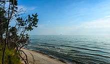
Baltic Sea
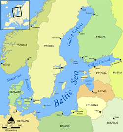

The Baltic Sea (German: Ostsee; Polish: Morze Bałtyckie, Bałtyk; Russian: Балтийское море; Danish: Østersøen; Swedish: Östersjön; Lithuanian: Baltijos jūra; Latvian: Baltijas jūra; Estonian: Läänemeri; Finnish: Itämeri) is a sea of the Atlantic Ocean, enclosed by Scandinavia, Finland, the Baltic countries, and the North European Plain. It includes the Gulf of Bothnia, the Bay of Bothnia, the Gulf of Finland, the Gulf of Riga, and the Bay of Gdańsk. The sea stretches from 53°N to 66°N latitude and from 10°E to 30°E longitude. A mediterranean sea of the Atlantic, with limited water exchange between the two bodies, the Baltic Sea drains through the Danish islands into the Kattegat by way of the straits of Øresund, the Great Belt, and the Little Belt.
The Baltic Proper is bordered on its northern edge, at the latitude 60°N, by the Åland islands and the Gulf of Bothnia, on its northeastern edge by the Gulf of Finland, on its eastern edge by the Gulf of Riga, and in the West by the South-Swedish part of the Scandinavian Peninsula.
The Baltic Sea is connected by artificial waterways to the White Sea via the White Sea Canal and to the German Bight of the North Sea via the Kiel Canal.
Definitions
Administration
The Helsinki Convention on the Protection of the Marine Environment of the Baltic Sea Area includes the Baltic Sea and the Kattegat, without calling Kattegat a part of the Baltic Sea, "For the purposes of this Convention the "Baltic Sea Area" shall be the Baltic Sea and the Entrance to the Baltic Sea, bounded by the parallel of the Skaw in the Skagerrak at 57°44.43'N."[3]
Traffic history
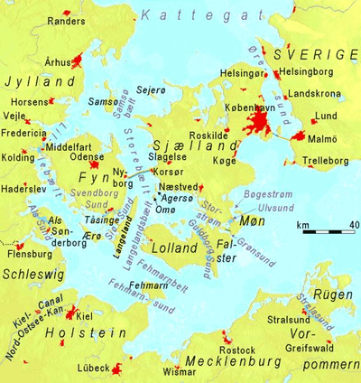
Historically, the Kingdom of Denmark collected Sound Dues from ships at the border between the ocean and the land-locked Baltic Sea. They were collected in the Øresund at Kronborg castle near Helsingør, in the Great Belt at Nyborg. In the Little Belt, the site of intake was moved to Fredericia, after that stronghold had been built. The narrowest part of Little Belt is the "Middelfart Sund" near Middelfart.[4]
Oceanography
Geographers widely agree that the preferred physical border of the Baltic is a line drawn through the southern Danish islands, Drogden-Sill and Langeland.[5] The Drogden Sill is situated north of Køge Bugt and connects Dragør in the south of Copenhagen to Malmö; it is used by the Øresund Bridge, including the Drogden Tunnel. By this definition, the Danish Straits are part of the entrance, but the Bay of Mecklenburg and the Bay of Kiel are parts of the Baltic Sea.
Hydrography and biology
Drogden Sill (depth of 7 m (23 ft)) sets a limit to Øresund and Darss Sill (depth of 18 m (59 ft)), and a limit to the Belt Sea.[6] The shallow sills are obstacles to the flow of heavy salt water from the Kattegat into the basins around Bornholm and Gotland.
The Kattegat and the southwestern Baltic Sea are well oxygenated and have a rich biology. The remainder of the Sea is brackish, poor in oxygen and in species. Thus, statistically, the more of the entrance that is included in its definition, the healthier the Baltic appears; conversely, the more narrowly it is defined, the more endangered its biology appears.
Etymology
While Tacitus called it Mare Suebicum[7] after the Germanic people called the Suebi, the first to name it the Baltic Sea (Mare Balticum) was the eleventh-century German chronicler Adam of Bremen. The origin of the latter name is speculative. It might be connected to the Germanic word belt, a name used for two of the Danish straits, the Belts, while others claim it to be directly derived from the source of the Germanic word, Latin balteus (belt).[8] Adam of Bremen himself compared the sea with a belt, stating that it is so named because it stretches through the land as a belt (Balticus, eo quod in modum baltei longo tractu per Scithicas regiones tendatur usque in Greciam). He might also have been influenced by the name of a legendary island mentioned in the Natural History of Pliny the Elder. Pliny mentions an island named Baltia (or Balcia) with reference to accounts of Pytheas and Xenophon. It is possible that Pliny refers to an island named Basilia ("kingdom" or "royal") in On the Ocean by Pytheas. Baltia also might be derived from "belt" and mean "near belt of sea (strait)." Meanwhile, others have suggested that the name of the island originates from the Proto-Indo-European root *bhel meaning white, fair. This root and its basic meaning were retained in both Lithuanian (as baltas) and Latvian (as balts). On this basis, a related hypothesis holds that the name originated from this Indo-European root via a Baltic language such as Lithuanian.[9] Another explanation is that, while derived from the aforementioned root, the name of the sea is related to names for various forms of water and related substances in several European languages, that might have been originally associated with colors found in swamps (compare Proto-Slavic *bolto "swamp"). Yet another explanation is that the name originally meant "enclosed sea, bay" as opposed to open sea.[10] Some Swedish historians believe the name derives from the god Balder of Nordic mythology.
In the Middle Ages the sea was known by variety of names. The name Baltic Sea became dominant only after 1600. Usage of Baltic and similar terms to denote the region east of the sea started only in 19th century.
Name in other languages
The Baltic Sea was known in ancient sources as Mare Suebicum or Mare Germanicum.[11] It is also known by the equivalents of "East Sea", "West Sea", or "Baltic Sea" in different languages:
- Baltic Sea is used in English; in the Baltic languages Latvian (Baltijas jūra) and Lithuanian (Baltijos jūra); in Latin (Mare Balticum) and the Romance languages French (Mer Baltique), Italian (Mar Baltico), Portuguese (Mar Báltico), Romanian (Marea Baltică) and Spanish (Mar Báltico); in Greek (Βαλτική Θάλασσα Valtikí Thálassa); in Albanian (Deti Balltik); in Welsh (Môr Baltig); in the Slavic languages Polish (Morze Bałtyckie or Bałtyk), Czech (Baltské moře or Balt), Slovenian (Baltsko morje), Bulgarian (Балтийско море Baltijsko More), Kashubian (Bôłt), Macedonian (Балтичко Море Baltičko More), Ukrainian (Балтійське море Baltijs′ke More), Belarusian (Балтыйскае мора Baltyjskaje Mora), Russian (Балтийское море Baltiyskoye More) and Serbo-Croatian (Baltičko more / Балтичко море); in Hungarian (Balti-tenger).
- In Germanic languages, except English, East Sea is used: Afrikaans (Oossee), Danish (Østersøen), Dutch (Oostzee), German (Ostsee), Icelandic and Faroese (Eystrasalt), Norwegian (Østersjøen), and Swedish (Östersjön). In Old English it was known as Ostsæ, in Hungarian the former name was Keleti-tenger (due the German influence).
- In addition, Finnish, a Finnic language, has calqued the Swedish term as Itämeri "East Sea", disregarding the geography (the sea is west of Finland), though understandably since Finland was a part of Sweden from the Middle Ages until 1809.
- In another Finnic language, Estonian, it is called the West Sea (Läänemeri), with the correct geography (the sea is west of Estonia).
History
The Classical world
At the time of the Roman Empire, the Baltic Sea was known as the Mare Suebicum or Mare Sarmaticum. Tacitus in his AD 98 Agricola and Germania described the Mare Suebicum, named for the Suebi tribe, during the spring months, as a brackish sea where the ice broke apart and chunks floated about. The Suebi eventually migrated south west to reside for a while in the Rhineland area of modern Germany, where their name survives in the historic region known as Swabia. Jordanes called it the Germanic Sea in his work, the Getica.
The Middle Ages
_3.JPG)
In the early Middle Ages, Norse (Scandinavian) merchants built a trade empire all around the Baltic. Later, the Norse fought for control of the Baltic against Wendish tribes dwelling on the southern shore. The Norse also used the rivers of Russia for trade routes, finding their way eventually to the Black Sea and southern Russia. This Norse-dominated period is referred to as the Viking Age.
Since the Viking age, the Scandinavians have referred to the Baltic Sea as Austmarr ("Eastern Lake"). "Eastern Sea", appears in the Heimskringla and Eystra salt appears in Sörla þáttr. Saxo Grammaticus recorded in Gesta Danorum an older name, Gandvik, -vik being Old Norse for "bay", which implies that the Vikings correctly regarded it as an inlet of the sea. Another form of the name, "Grandvik", attested in at least one English translation of Gesta Danorum, is likely to be a misspelling.)
In addition to fish the sea also provides amber, especially from its southern shores within today's borders of Poland, Russia and Lithuania. First mentions of amber deposits on the South coast of the Baltic Sea date back to the 12th century.[12] The bordering countries have also traditionally exported lumber, wood tar, flax, hemp and furs by ship across the Baltic. Sweden had from early medieval times exported iron and silver mined there, while Poland had and still has extensive salt mines. Thus the Baltic Sea has long been crossed by much merchant shipping.
The lands on the Baltic's eastern shore were among the last in Europe to be converted to Christianity. This finally happened during the Northern Crusades: Finland in the twelfth century by Swedes, and what are now Estonia and Latvia in the early thirteenth century by Danes and Germans (Livonian Brothers of the Sword). The Teutonic Order gained control over parts of the southern and eastern shore of the Baltic Sea, where they set up their monastic state. Lithuania was the last European state to convert to Christianity.
An arena of conflict

In the period between the 8th and 14th centuries, there was much piracy in the Baltic from the coasts of Pomerania and Prussia, and the Victual Brothers even held Gotland.
Starting in the 11th century, the southern and eastern shores of the Baltic were settled by migrants mainly from Germany, a movement called the Ostsiedlung ("east settling"). Other settlers were from the Netherlands, Denmark, and Scotland. The Polabian Slavs were gradually assimilated by the Germans.[13] Denmark gradually gained control over most of the Baltic coast, until she lost much of her possessions after being defeated in the 1227 Battle of Bornhöved.
.jpg)

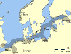
In the 13th to 17th centuries, the strongest economic force in Northern Europe was the Hanseatic League, a federation of merchant cities around the Baltic Sea and the North Sea. In the sixteenth and early seventeenth centuries, Poland, Denmark, and Sweden fought wars for Dominium maris baltici ("Lordship over the Baltic Sea"). Eventually, it was Sweden that virtually encompassed the Baltic Sea. In Sweden the sea was then referred to as Mare Nostrum Balticum ("Our Baltic Sea"). The goal of Swedish warfare during the 17th century was to make the Baltic Sea an all-Swedish sea (Ett Svenskt innanhav), something that was accomplished except the rout between Riga in Latvia and Szczecin in Poland. However, it was the Dutch who dominated Baltic trade in the seventeenth century.
In the eighteenth century, Russia and Prussia became the leading powers over the sea. Sweden's defeat in the Great Northern War brought Russia to the eastern coast. Russia became and remained a dominating power in the Baltic. Russia's Peter the Great saw the strategic importance of the Baltic and decided to found his new capital, Saint Petersburg, at the mouth of the Neva river at the east end of the Gulf of Finland. There was much trading not just within the Baltic region but also with the North Sea region, especially eastern England and the Netherlands: their fleets needed the Baltic timber, tar, flax and hemp.
During the Crimean War, a joint British and French fleet attacked the Russian fortresses in the Baltic. They bombarded Sveaborg, which guards Helsinki; and Kronstadt, which guards Saint Petersburg; and they destroyed Bomarsund in the Åland Islands. After the unification of Germany in 1871, the whole southern coast became German. World War I was partly fought in the Baltic Sea. After 1920 Poland was connected to the Baltic Sea by the Polish Corridor and enlarged the port of Gdynia in rivalry with the port of the Free City of Danzig.
During World War II, Germany reclaimed all of the southern and much of the eastern shore by occupying Poland and the Baltic states. In 1945, the Baltic Sea became a mass grave for retreating soldiers and refugees on torpedoed troop transports. The sinking of the Wilhelm Gustloff remains the worst maritime disaster in history, killing (very roughly) 9,000 people. In 2005, a Russian group of scientists found over five thousand airplane wrecks, sunken warships, and other material, mainly from World War II, on the bottom of the sea.
Since World War II
Since the end of World War II, various nations, including the Soviet Union, the United Kingdom and the United States, have disposed of chemical weapons in the Baltic Sea, raising concerns of environmental contamination.[14] Even now fishermen accidentally retrieve some of these materials: the most recent available report from the Helsinki Commission notes that four small scale catches of chemical munitions representing approximately 105 kg (231 lb) of material were reported in 2005. This is a reduction from the 25 incidents representing 1,110 kg (2,450 lb) of material in 2003.[15] Until now, the U.S. Government refuses to disclose the exact coordinates of the wreck sites. Rotting bottles leak Lost and other substances, thus slowly poisoning a substantial part of the Baltic Sea.
After 1945, the German population was expelled from all areas east of the Oder-Neisse line, making room for displaced Poles and Russians. Poland gained most of the southern shore. The Soviet Union gained another access to the Baltic with the Kaliningrad Oblast. The Baltic states on the eastern shore were annexed by the Soviet Union. The Baltic then separated opposing military blocs: NATO and the Warsaw Pact. Had war broken out, the Polish navy was prepared to invade the Danish isles. This border status restricted trade and travel. It ended only after the collapse of the Communist regimes in Central and Eastern Europe in the late 1980s.
Since May 2004, with the accession of the Baltic states and Poland, the Baltic Sea has been almost entirely surrounded by countries of the European Union (EU). The only remaining non-EU shore areas are Russian: the Saint Petersburg area and the exclave of the Kaliningrad Oblast.
Winter storms begin arriving in the region during October. These have caused numerous shipwrecks, and contributed to the extreme difficulties of rescuing passengers of the ferry M/S Estonia en route from Tallinn, Estonia, to Stockholm, Sweden, in September 1994, which claimed the lives of 852 people. Older, wood-based shipwrecks such as the Vasa tend to remain well-preserved, as the Baltic's cold and brackish water does not suit the shipworm.
Storm floods
Storm surge floodings are generally taken to occur when the water level is more than one metre above normal. In Warnemünde about 110 floods occurred from 1950 to 2000, an average of just over two per year.[16]
Historic flood events were the All Saints' Flood of 1304 and other floods in the years 1320, 1449, 1625, 1694, 1784 and 1825. Little is known of their extent.[17] From 1872, there exist regular and reliable records of water levels in the Baltic Sea. The highest was the flood of 1872 when the water was an average of 2.43 m (8 ft 0 in) above sea level at Warnemünde and a maximum of 2.83 m (9 ft 3 in) above sea level in Warnemünde. In the last very heavy floods the average water levels reached 1.88 m (6 ft 2 in) above sea level in 1904, 1.89 m (6 ft 2 in) in 1913, 1.73 m (5 ft 8 in) in January 1954, 1.68 m (5 ft 6 in) on 2–4 November 1995 and 1.65 m (5 ft 5 in) on 21 February 2002.[18]
Geography
Geophysical data
.svg.png)
An arm of the North Atlantic Ocean, the Baltic Sea is enclosed by Sweden and Denmark to the northwest, Finland to the northeast, the Baltic countries to the southeast, and the North European Plain to the southwest.
It is about 1,600 km (990 mi) long, an average of 193 km (120 mi) wide, and an average of 55 metres (180 ft) deep. The maximum depth is 459 m (1,506 ft) which is on the Swedish side of the center. The surface area is about 349,644 km2 (134,998 sq mi) [19] and the volume is about 20,000 km3 (4,800 cu mi). The periphery amounts to about 8,000 km (5,000 mi) of coastline.[20]
The Baltic Sea is one of the largest brackish inland seas by area, and occupies a basin (a zungenbecken) formed by glacial erosion during the last few ice ages.
Physical characteristics of the Baltic Sea, its main sub-regions, and the transition zone to the Skagerrak/North Sea area[21]
| Sub-area | Area | Volume | Maximum depth | Average depth |
|---|---|---|---|---|
| km2 | km3 | m | m | |
| 1. Baltic proper | 211,069 | 13,045 | 459 | 62.1 |
| 2. Gulf of Bothnia | 115,516 | 6,389 | 230 | 60.2 |
| 3. Gulf of Finland | 29,600 | 1,100 | 123 | 38.0 |
| 4. Gulf of Riga | 16,300 | 424 | > 60 | 26.0 |
| 5. Belt Sea/Kattegat | 42,408 | 802 | 109 | 18.9 |
| Total Baltic Sea | 415,266 | 21,721 | 459 | 52.3 |
Extent
The International Hydrographic Organization defines the limits of the Baltic Sea as follows:[22]
- Bordered by the coasts of Germany, Denmark, Poland, Sweden, Finland, Russia, Estonia, Latvia and Lithuania, it extends north-eastward of the following limits:
- In the Little Belt. A line joining Falshöft (54°47′N 9°57.5′E / 54.783°N 9.9583°E) and Vejsnæs Nakke (Ærø: 54°49′N 10°26′E / 54.817°N 10.433°E).
- In the Great Belt. A line joining Gulstav (South extreme of Langeland Island) and Kappel Kirke (54°46′N 11°01′E / 54.767°N 11.017°E) on Island of Lolland.
- In Guldborg Sound. A line joining Flinthorne-Rev and Skjelby (54°38′N 11°53′E / 54.633°N 11.883°E).
- In the Sound. A line joining Stevns Lighthouse (55°17′N 12°27′E / 55.283°N 12.450°E) and Falsterbo Point (55°23′N 12°49′E / 55.383°N 12.817°E).
Subdivisions
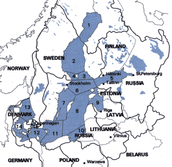
1 = Bothnian Bay
2 = Bothnian Sea
1 + 2 = Gulf of Bothnia, partly also 3 & 4
3 = Archipelago Sea
4 = Åland Sea
5 = Gulf of Finland
6 = Northern Baltic Proper
7 = Western Gotland Basin
8 = Eastern Gotland Basin
9 = Gulf of Riga
10 = Bay of Gdańsk/Gdansk Basin
11 = Bornholm Basin and Hanö Bight
12 = Arkona Basin
6–12 = Baltic Proper
13 = Kattegat, not an integral part of the Baltic Sea
14 = Belt Sea (Little Belt and Great Belt)
15 = Öresund (The Sound)
14 + 15 = Danish Straits, not an integral part of the Baltic Sea
The northern part of the Baltic Sea is known as the Gulf of Bothnia, of which the northernmost part is the Bay of Bothnia or Bothnian Bay. The more rounded southern basin of the gulf is called Bothnian Sea and immediately to the south of it lies the Sea of Åland. The Gulf of Finland connects the Baltic Sea with Saint Petersburg. The Gulf of Riga lies between the Latvian capital city of Riga and the Estonian island of Saaremaa.
The Northern Baltic Sea lies between the Stockholm area, southwestern Finland and Estonia. The Western and Eastern Gotland Basins form the major parts of the Central Baltic Sea or Baltic proper. The Bornholm Basin is the area east of Bornholm, and the shallower Arkona Basin extends from Bornholm to the Danish isles of Falster and Zealand.
In the south, the Bay of Gdańsk lies east of the Hel Peninsula on the Polish coast and west of the Sambia Peninsula in Kaliningrad Oblast. The Bay of Pomerania lies north of the islands of Usedom and Wolin, east of Rügen. Between Falster and the German coast lie the Bay of Mecklenburg and Bay of Lübeck. The westernmost part of the Baltic Sea is the Bay of Kiel. The three Danish straits, the Great Belt, the Little Belt and The Sound (Öresund/Øresund), connect the Baltic Sea with the Kattegat and Skagerrak strait in the North Sea.

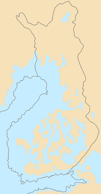
The ice
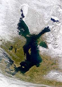
On the long-term average, the Baltic Sea is ice-covered at the annual maximum for about 45% of its surface area. The ice-covered area during such a typical winter includes the Gulf of Bothnia, the Gulf of Finland, the Gulf of Riga, the archipelago west of Estonia, the Stockholm archipelago, and the Archipelago Sea southwest of Finland. The remainder of the Baltic does not freeze during a normal winter, with the exception of sheltered bays and shallow lagoons such as the Curonian Lagoon. The ice reaches its maximum extent in February or March; typical ice thickness in the northernmost areas in the Bothnian Bay, the northern basin of the Gulf of Bothnia, is about 70 cm (28 in) for landfast sea ice. The thickness decreases farther south.
Freezing begins in the northern extremities of Gulf of Bothnia typically in the middle of November, reaching the open waters of the Bothnian Bay in early January. The Bothnian Sea, the basin south of Kvarken, freezes on average in late February. The Gulf of Finland and the Gulf of Riga freeze typically in late January. In 2011, the Gulf of Finland was completely frozen on 15 February.[24]
The ice extent depends on whether the winter is mild, moderate, or severe. Severe winters can lead to ice formation around southern Sweden and even in the Danish straits. According to the 18th-century natural historian William Derham, during the severe winters of 1703 and 1708, the ice cover reached as far as the Danish straits.[25] Frequently, parts of the Gulf of Bothnia and Gulf of Finland are frozen, in addition to coastal fringes in more southerly locations such as the Gulf of Riga. This description meant that the whole of the Baltic Sea was covered with ice.
It is known that since 1720, the Baltic Sea has frozen over entirely a total of 20 times. The most recent case was in early 1987, which was the most severe winter in Scandinavia since that date. The ice then covered 400,000 km2 (150,000 sq mi). During the winter of 2010–11, which was quite severe compared to those of the last decades, the maximum ice cover was 315,000 km2 (122,000 sq mi), which was reached on 25 February 2011. The ice then extended from the north down to the northern tip of Gotland, with small ice-free areas on either side, and the east coast of the Baltic Sea was covered by an ice sheet about 25 to 100 km (16 to 62 mi) wide all the way to Gdańsk. This was brought about by a stagnant high-pressure area that lingered over central and northern Scandinavia from around 10 to 24 February. After this, strong southern winds pushed the ice further into the north, and much of the waters north of Gotland were again free of ice, which had then packed against the shores of southern Finland.[26] The effects of the afore-mentioned high-pressure area did not reach the southern parts of the Baltic Sea, and thus the entire sea did not freeze over. However, floating ice was additionally observed near Świnoujście harbour in January 2010.
In recent years prior to 2011, the Bothnian Bay and the Bothnian Sea were frozen with solid ice near the Baltic coast and dense floating ice far from it. In 2008, there was almost no ice formation except for a short period in March.[27]
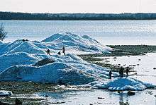
During winter, fast ice, which is attached to the shoreline, develops first, rendering ports unusable without the services of icebreakers. Level ice, ice sludge, pancake ice, and rafter ice form in the more open regions. The gleaming expanse of ice is similar to the Arctic, with wind-driven pack ice and ridges up to 15 m (49 ft). Offshore of the landfast ice, the ice remains very dynamic all year, and it is relatively easily moved around by winds and therefore forms pack ice, made up of large piles and ridges pushed against the landfast ice and shores.
In spring, the Gulf of Finland and the Gulf of Bothnia normally thaw in late April, with some ice ridges persisting until May in the eastern extremities of the Gulf of Finland. In the northernmost reaches of the Bothnian Bay, ice usually stays until late May; by early June it is practically always gone.
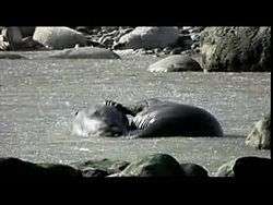
The ice cover is the main habitat for two large mammals, the grey seal (Halichoerus grypus) and the Baltic ringed seal (Pusa hispida botnica), both of which feed underneath the ice and breed on its surface. Of these two seals, only the Baltic ringed seal suffers when there is not adequate ice in the Baltic Sea, as it feeds its young only while on ice. The grey seal is adapted to reproducing also with no ice in the sea. The sea ice also harbours several species of algae that live in the bottom and inside unfrozen brine pockets in the ice.
Hydrography

The Baltic Sea flows out through the Danish straits; however, the flow is complex. A surface layer of brackish water discharges 940 km3 (230 cu mi) per year into the North Sea. Due to the difference in salinity, by salinity permeation principle, a sub-surface layer of more saline water moving in the opposite direction brings in 475 km3 (114 cu mi) per year. It mixes very slowly with the upper waters, resulting in a salinity gradient from top to bottom, with most of the salt water remaining below 40 to 70 m (130 to 230 ft) deep. The general circulation is anti-clockwise: northwards along its eastern boundary, and south along the western one .[28]
The difference between the outflow and the inflow comes entirely from fresh water. More than 250 streams drain a basin of about 1,600,000 km2 (620,000 sq mi), contributing a volume of 660 km3 (160 cu mi) per year to the Baltic. They include the major rivers of north Europe, such as the Oder, the Vistula, the Neman, the Daugava and the Neva. Additional fresh water comes from the difference of precipitation less evaporation, which is positive.
An important source of salty water are infrequent inflows of North Sea water into the Baltic. Such inflows, important to the Baltic ecosystem because of the oxygen they transport into the Baltic deeps, used to happen on average every four to five years until the 1980s. In recent decades they have become less frequent. The latest four occurred in 1983, 1993, 2003 and 2014 suggesting a new inter-inflow period of about ten years.
The water level is generally far more dependent on the regional wind situation than on tidal effects. However, tidal currents occur in narrow passages in the western parts of the Baltic Sea.
The significant wave height is generally much lower than that of the North Sea. Violent and sudden storms often sweep the surface, due to large transient temperature differences and a long reach of wind. Seasonal winds also cause small changes in sea level, of the order of 0.5 m (1 ft 8 in) .[28]
Salinity
The Baltic Sea's salinity is much lower than that of ocean water (which averages 3.5%), as a result of abundant freshwater runoff from the surrounding land, combined with the shallowness of the sea itself; indeed, runoff contributes roughly one-fortieth its total volume per year, as the volume of the basin is about 21,000 km3 (5,000 cu mi) and yearly runoff is about 500 km3 (120 cu mi). The open surface waters of the central basin have salinity of 0.5% to 0.8%, which makes the basin border-line freshwater. Drinking the water as a means of survival would actually hydrate the body instead of dehydrating, as is the case with ocean water. At the semi-enclosed bays with major freshwater inflows, such as the head of Finnish Gulf with the Neva mouth and the head of the Bothnian Gulf with the close mouths of the Lule, Tornio and Kemi, the salinity is considerably lower. Below 40 to 70 m (130 to 230 ft), the salinity is between 1.0% and 1.5% in the open Baltic Sea, and higher near the Danish Straits, but this is still less than half that of ocean water.
The flow of fresh water into the sea from approximately two hundred rivers and the introduction of salt from the South builds up a gradient of salinity in the Baltic Sea. Near the Danish straits the salinity is close to that of the Kattegat, but still not fully oceanic, because the saltiest water that passes the straits is already mixed with considerable amounts of outflow water. The salinity steadily decreases towards North and East. At the northern part of the Gulf of Bothnia the water is no longer salty and many fresh water species live in the sea. The salinity gradient is paralleled by a temperature gradient. These two factors limit many species of animals and plants to a relatively narrow region of the Baltic Sea.
The most saline water is vertically stratified in the water column to the north, creating a barrier to the exchange of oxygen and nutrients, and fostering completely separate maritime environments.[29]
Major tributaries
The rating of mean discharges differs from the ranking of hydrological lengths (from the most distant source to the sea) and the rating of the nominal lengths. Göta älv, a tributary of the Kattegat, is not listed, as due to the northward upper low-salinity-flow in the sea, its water hardly reaches the Baltic proper:
| Name | Mean Discharge (m3/s) | Length (km) | Basin (km2) | States sharing the basin | Longest watercourse |
| Neva | 2500 | 74 (nominal) 860 (hydrological) | 281,000 | Russia, Finland (Ladoga-affluent Vuoksi) | Suna (280 km) → Lake Onega (160 km) → Svir (224 km) → Lake Ladoga (122 km) → Neva |
| Vistula | 1080 | 1047 | 194,424 | Poland, tributaries: Belarus, Ukraine, Slovakia | |
| Daugava | 678 | 1020 | 87,900 | Russia (source), Latvia | |
| Neman | 678 | 937 | 98,200 | Belarus (source), Lithuania, Russia | |
| Kemijoki | 556 | 550 (main river) 600 (river system) | 51,127 | Finland, Norway (source of Ounasjoki) | longer tributary Kitinen |
| Oder | 540 | 866 | 118,861 | Czech Republic (source), Poland, Germany | |
| Lule älv | 506 | 461 | 25,240 | Sweden | |
| Narva | 415 | 77 (nominal) 652 (hydrological) | 56,200 | Russia (Source of Velikaya), Estonia | Velikaya (430 km) → Lake Peipus (145 km) → Narva |
| Torne älv | 388 | 520 (nominal) 630 (hydrological) | 40,131 | Norway (source), Sweden, Finland | Válfojohka → Kamajåkka → Abiskojaure → Abiskojokk (total 40 km) → Torneträsk (70 km) → Torne älv |
Islands and archipelagoes

- Åland Islands (Finland, autonomous)
- Archipelago Sea (Finland)
- Blekinge archipelago (Sweden)
- Bornholm, including Christiansø (Denmark)
- Falster (Denmark)
- Gotland (Sweden)
- Hailuoto (Finland)
- Kotlin (Russia)
- Lolland (Denmark)
- Kvarken archipelago, including Valsörarna (Finland)
- Møn (Denmark)
- Öland (Sweden)
- Rügen (Germany)
- Stockholm archipelago (Sweden)
- Usedom or Uznam (split between Germany and Poland)
- West Estonian archipelago (Estonia):
- Wolin (Poland)
- Zealand (Denmark)
Coastal countries

Countries that border on the sea:
![]() Denmark,
Denmark, ![]() Estonia,
Estonia, ![]() Finland,
Finland, ![]() Germany,
Germany, ![]() Latvia,
Latvia, ![]() Lithuania,
Lithuania, ![]() Poland,
Poland, ![]() Russia,
Russia, ![]() Sweden.
Sweden.
Countries that are in the drainage basin but do not border on the sea:
![]() Belarus,
Belarus, ![]() Czech Republic,
Czech Republic, ![]() Norway,
Norway, ![]() Slovakia,
Slovakia, ![]() Ukraine.
Ukraine.
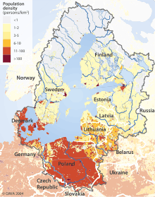
The Baltic sea drainage basin is roughly four times the surface area of the sea itself. About 48% of the region is forested, with Sweden and Finland containing the majority of the forest, especially around the Gulfs of Bothnia and Finland.
About 20% of the land is used for agriculture and pasture, mainly in Poland and around the edge of the Baltic Proper, in Germany, Denmark and Sweden. About 17% of the basin is unused open land with another 8% of wetlands. Most of the latter are in the Gulfs of Bothnia and Finland.
The rest of the land is heavily populated. About 85 million people live in the Baltic drainage basin, 15 million within 10 km (6 mi) of the coast and 29 million within 50 km (31 mi) of the coast. Around 22 million live in population centers of over 250,000. 90% of these are concentrated in the 10 km (6 mi) band around the coast. Of the nations containing all or part of the basin, Poland includes 45% of the 85 million, Russia 12%, Sweden 10% and the others less than 6% each.
Cities
|
The biggest coastal cities (by population):
|
 Port of Helsinki  Port of Tallinn  Port of Klaipėda Important ports (though not big cities): Estonia: Finland: Germany:
Latvia: Lithuania: Poland:
 Port of Kaliningrad Russia: Sweden:
|
Geology

| Evolution of the Baltic Sea |
|---|
| Pleistocene |
|
Eemian Sea (130,000–115,000 BP) Ice sheets and seas (115,000–12,600 BP) |
| Holocene |
|
Baltic Ice Lake (12,600–10,300 BP) Yoldia Sea (10,300–9,500 BP) Ancylus Lake (9,500–8,000 BP) Mastogloia Sea (8,000–7,500 BP) Littorina Sea (7,500–4,000 BP) Modern Baltic Sea (4,000 BP–present) |
The Baltic Sea somewhat resembles a riverbed, with two tributaries, the Gulf of Finland and Gulf of Bothnia. Geological surveys show that before the Pleistocene, instead of the Baltic Sea, there was a wide plain around a great river paleontologists call the Eridanos. Several Pleistocene glacial episodes scooped out the river bed into the sea basin. By the time of the last, or Eemian Stage (MIS 5e), the Eemian Sea was in place. Instead of a true sea, the Baltic can even today also be understood as the common estuary of all rivers flowing into it.
From that time the waters underwent a geologic history summarized under the names listed below. Many of the stages are named after marine animals (e.g. the Littorina mollusk) that are clear markers of changing water temperatures and salinity.
The factors that determined the sea's characteristics were the submergence or emergence of the region due to the weight of ice and subsequent isostatic readjustment, and the connecting channels it found to the North Sea-Atlantic, either through the straits of Denmark or at what are now the large lakes of Sweden, and the White Sea-Arctic Sea.
- Eemian Sea, 130,000–115,000 (years ago)
- Baltic Ice Lake, 12,600–10,300
- Yoldia Sea, 10,300–9500
- Ancylus Lake, 9,500–8,000
- Mastogloia Sea 8,000–7,500
- Littorina Sea, 7,500–4,000
- Post-Littorina Sea 4,000–present
The land is still emerging isostatically from its depressed state, which was caused by the weight of ice during the last glaciation. The phenomenon is known as post-glacial rebound. Consequently, the surface area and the depth of the sea are diminishing. The uplift is about eight millimetres per year on the Finnish coast of the northernmost Gulf of Bothnia. In the area, the former seabed is only gently sloping, leading to large areas of land being reclaimed in what are, geologically speaking, relatively short periods (decades and centuries).
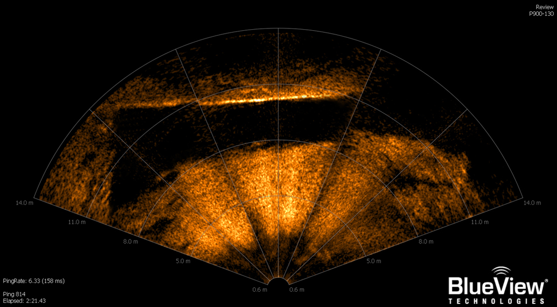
Anomalous object/formation
The Baltic Sea anomaly is a 60-metre (200 ft) diameter circular rock-like formation on the floor of the northern Baltic Sea at the center of the Bothnian Sea, discovered by Peter Lindberg, Dennis Åsberg and their Swedish "Ocean X" diving team in June 2011. The team reported that the formation rests on a pillar and includes a structure similar in appearance to a staircase, leading to a dark hole.
According to Ocean X, the formation has an appearance of "rough granite", is round, 3 to 4 metres (9.8 to 13.1 ft) thick and approximately 60 metres (200 ft) in diameter, stands on an 8-metre-tall (26 ft) pillar-like feature, and is located at a depth of 85 to 90 metres (279 to 295 ft). There is also another smaller object not far away.[31][32][33][34] The object is at the end of what resembles a 300-metre (980 ft) "runway".[35]
The Ocean X team has published one additional close-up sonar scan on their Web site and nine additional close-up sonar scans on their YouTube page that appear to show a 90-degree angle and other features of the object.[36][37]
On their second expedition, they reported that they found something that looks like a staircase and a round black hole that goes directly into the structure.[38]
Biology
Fauna
The fauna of the Baltic sea is a mixture of marine and freshwater species. Among marine fishes are cod, herring, hake, plaice, flounder, shorthorn sculpin, stickleback and turbot, and examples of freshwater species include perch, pike, whitefish and roach.
There is a decrease in faunal species from the Belts to the Gulf of Bothnia. The decreasing salinity along this path causes restrictions in both physiology and habitats.[39] The lack of tides has affected the marine species as compared with the Atlantic.
Since the Baltic Sea is so young there are only a few endemic species. The mostly asexually reproducing brown alga Fucus radicans seems to have evolved in the basin. Another endemic is the Copenhagen cockle parvicardium hauniense. However, several marine species have populations in the Baltic Sea adapted to the low salinity, such as the Baltic Sea herring which is smaller than the Atlantic herring.
A peculiar feature of the fauna is that it contains a number of glacial relict species, isolated populations of arctic species which have remained in the Baltic Sea since the last glaciation, such as the large isopod Saduria entomon, the Baltic subspecies of ringed seal, and the fourhorn sculpin. Some of these relicts are derived from glacial lakes, such as Monoporeia affinis, which is a main element in the benthic fauna of the low-salinity Bothnian Bay.
Cetaceans in Baltic Sea have been monitored by the ASCOBANS. Critically endangered populations of Atlantic white-sided dolphins and harbor porpoises inhabit the sea where white-colored porpoises have been recorded,[40] and occasionally oceanic and out-of-range species such as minke whales,[41] bottlenose dolphins,[42] beluga whales,[43] orcas,[44] and beaked whales[45] visit the waters. In recent years, very small, but with increasing rates, fin whales[46][47][48] and humpback whales migrate into Baltic sea including mother and calf pair.[49] Now extinct Atlantic grey whales and eastern population of North Atlantic right whales that is facing functional extinction[50] once migrated into Baltic Sea.[51]
Strandings of Leatherback turtles have been recorded in Baltic Sea, too.[52] Other notable megafauna include the basking sharks.[53]
Environmental status
.jpg)
Satellite images taken in July 2010 revealed a massive algal bloom covering 377,000 square kilometres (146,000 sq mi) in the Baltic Sea. The area of the bloom extended from Germany and Poland to Finland. Researchers of the phenomenon have indicated that algal blooms have occurred every summer for decades. Fertilizer runoff from surrounding agricultural land has exacerbated the problem and led to increased eutrophication.[54]
Approximately 100,000 km2 (38,610 sq mi) of the Baltic's seafloor (a quarter of its total area) is a variable dead zone. The more saline (and therefore denser) water remains on the bottom, isolating it from surface waters and the atmosphere. This leads to decreased oxygen concentrations within the zone. It is mainly bacteria that grow in it, digesting organic material and releasing hydrogen sulfide. Because of this large anaerobic zone, the seafloor ecology differs from that of the neighbouring Atlantic.
Plans to artificially oxygenate areas of the Baltic that have experienced eutrophication have been proposed by the University of Gothenburg and Inocean AB. The proposal intends to use wind-driven pumps to inject oxygen (air) into waters at, or around, 130m below sea level.[55]
Economy

Construction of the Great Belt Bridge in Denmark (completed 1997) and the Øresund Bridge-Tunnel (completed 1999), linking Denmark with Sweden, provided a highway and railroad connection between Sweden and the Danish mainland (the Jutland Peninsula, precisely the Zealand). The undersea tunnel of the Øresund Bridge-Tunnel provides for navigation of large ships into and out of the Baltic Sea. The Baltic Sea is the main trade route for export of Russian petroleum. Many of the countries neighboring the Baltic Sea have been concerned about this, since a major oil leak in a seagoing tanker would be disastrous for the Baltic—given the slow exchange of water. The tourism industry surrounding the Baltic Sea is naturally concerned about oil pollution.
Much shipbuilding is carried out in the shipyards around the Baltic Sea. The largest shipyards are at Gdańsk, Gdynia, and Szczecin, Poland; Kiel, Germany; Karlskrona and Malmö, Sweden; Rauma, Turku, and Helsinki, Finland; Riga, Ventspils, and Liepāja, Latvia; Klaipėda, Lithuania; and Saint Petersburg, Russia.
There are several cargo and passenger ferries that operate on the Baltic Sea, such as Scandlines, Silja Line, Polferries, the Viking Line, Tallink, and Superfast Ferries.
Tourism
European Route of Brick Gothic
European Route of Brick Gothic is a touristic route connecting cities with Brick Gothic architecture in three countries along the Baltic Sea: Denmark, Germany and Poland.
Piers
- Liepaja, Latvia
- Sopot, Poland
- Międzyzdroje, Poland
- Kołobrzeg, Poland
- Klaipėda, Lithuania
- Heiligendamm, Germany
- Ahlbeck (Usedom), Germany
Resort towns
Examples:
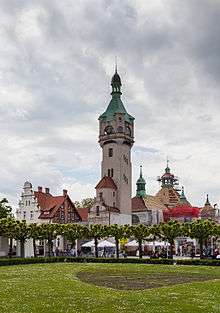
- Świnoujście, Poland
- Kamień Pomorski, Poland
- Kołobrzeg, Poland
- Hanko, Finland
- Mariehamn, Finland
- Pärnu, Estonia
- Jūrmala, Latvia
- Palanga, Lithuania
- Nida, Lithuania
- Sopot, Poland
- Ueckermünde, Germany
- Travemünde, Germany
- Ustka, Poland
- Svetlogorsk, Russia
The Helsinki Convention
1974 Convention
For the first time ever, all the sources of pollution around an entire sea were made subject to a single convention, signed in 1974 by the then seven Baltic coastal states. The 1974 Convention entered into force on 3 May 1980.
1992 Convention
In the light of political changes and developments in international environmental and maritime law, a new convention was signed in 1992 by all the states bordering on the Baltic Sea, and the European Community. After ratification the Convention entered into force on 17 January 2000. The Convention covers the whole of the Baltic Sea area, including inland waters and the water of the sea itself, as well as the seabed. Measures are also taken in the whole catchment area of the Baltic Sea to reduce land-based pollution. The Convention on the Protection of the Marine Environment of the Baltic Sea Area, 1992, entered into force on 17 January 2000.
The governing body of the Convention is the Helsinki Commission,[56] also known as HELCOM, or Baltic Marine Environment Protection Commission. The present contracting parties are Denmark, Estonia, the European Community, Finland, Germany, Latvia, Lithuania, Poland, Russia and Sweden.
The ratification instruments were deposited by the European Community, Germany, Latvia and Sweden in 1994, by Estonia and Finland in 1995, by Denmark in 1996, by Lithuania in 1997 and by Poland and Russia in November 1999.
See also
- Baltic (disambiguation)
- Baltic region
- Baltic Sea Action Group (BSAG)
- Baltic states
- Council of the Baltic Sea States
- List of cities and towns around the Baltic Sea
- List of rivers of the Baltic Sea
- MS Estonia
- Nord Stream
- Northern Europe
- Ports of the Baltic Sea
- Scandinavia
- SS Cap Arcona
- MV Wilhelm Gustloff
References
- ↑ "Coalition Clean Baltic". Archived from the original on 2 June 2013. Retrieved 5 July 2013.
- ↑ Oceanographic data
- ↑ Text of Helsinki Convention
- ↑ Pierers Universal-Lexikon, (a German encyclopedia from 1857–1865, automatic transcription of little quality): Sundzoll (Sound Dues )
- ↑ Leibniz-Institut für Ostseeforschung Warnemünde: "Gehört das Kattegatt noch zur Ostsee" (Is the Kattegat a part of the Baltic Sea?)
- ↑ Swedish Chemicals Agency (KEMI): The BaltSens Project – The sensitivity of the Baltic Sea ecosystems to hazardous compounds
- ↑ Tacitus, Germania (book): Ergo iam dextro Suebici maris litore Aestiorum gentes adluuntur, quibus ritus habitusque Sueborum, lingua Britannicae propior. – Upon the right of the Suevian Sea the AEstyan nations reside, who use the same customs and attire with the Suevians; their language more resembles that of Britain.
- ↑ (Swedish) Balteus in Nordisk familjebok.
- ↑ Forbes, Nevill (1910). The Position of the Slavonic Languages at the present day. Oxford University Press. p. 7.
- ↑ Dini, Pietro Umberto (1997). Le lingue baltiche (in Italian). Florence: La Nuova Italia. ISBN 978-88-221-2803-4.
- ↑ Hartmann Schedel 1493 map File:Schedelsche Weltchronik d 287.jpg: Baltic Sea called Mare Germanicum, North Sea called Oceanus Germanicus
- ↑ "The History of Russian Amber, Part 1: The Beginning", Ambery.net
- ↑ Wend – West Wend. Britannica.com. Retrieved on 23 June 2011.
- ↑ Chemical Weapon Time Bomb Ticks in the Baltic Sea Deutsche Welle, 1 February 2008.
- ↑ Activities 2006: Overview Archived 14 January 2009 at the Wayback Machine. Baltic Sea Environment Proceedings No. 112. Helsinki Commission.
- ↑ Sztobryn, Marzenna; Stigge, Hans-Joachim; Wielbińska, Danuta; Weidig, Bärbel; Stanisławczyk, Ida; Kańska, Alicja; Krzysztofik, Katarzyna; Kowalska, Beata; Letkiewicz, Beata; Mykita, Monika (2005). "Sturmfluten in der südlichen Ostsee (Westlicher und mittlerer Teil)" [Storm floods in the Southern Baltic (western and central part)] (PDF). Berichte des Bundesamtes für Seeschifffahrt und Hydrographie (in German) (39): 6.
- ↑ "Sturmfluten an der Ostseeküste – eine vergessene Gefahr?" [Storm floods along the Baltic Sea coastline – a forgotten threat?]. Informations-, Lern-, und Lehrmodule zu den Themen Küste, Meer und Integriertes Küstenzonenmanagement. EUCC Die Küsten Union Deutschland e. V. Retrieved 2 July 2012. Citing Weiss, D. "Schutz der Ostseeküste von Mecklenburg-Vorpommern". In Kramer, J.; Rohde, H. Historischer Küstenschutz: Deichbau, Inselschutz und Binnenentwässerung an Nord- und Ostsee [Historical coastal protection: construction of dikes, insular protection and inland drainage at North Sea and Baltic Sea] (in German). Stuttgart: Wittwer. pp. 536–567.
- ↑ Tiesel, Reiner (October 2003). "Sturmfluten an der deutschen Ostseeküste" [Storm floods at the German Baltic Sea coasts]. Informations-, Lern-, und Lehrmodule zu den Themen Küste, Meer und Integriertes Küstenzonenmanagement (in German). EUCC Die Küsten Union Deutschland e. V. Retrieved 2 July 2012.
- ↑ "EuroOcean". Archived from the original on 15 April 2014. Retrieved 14 April 2014.
- ↑ "Geography of the Baltic Sea Area". Archived from the original on 21 April 2006. Retrieved 27 August 2005. at envir.ee. (archived) (2006-04-21). Retrieved on 23 June 2011.
- ↑ p. 7
- ↑ "Limits of Oceans and Seas, 3rd edition" (PDF). International Hydrographic Organization. 1953. Archived from the original (PDF) on 8 October 2011. Retrieved 6 February 2010.
- ↑ Baltic Sea area clickable map
- ↑ Helsingin Sanomat, 16 February 2011, p. A8.
- ↑ Derham, William Physico-Theology: Or, A Demonstration of the Being and Attributes of God from His Works of Creation (London, 1713).
- ↑ Helsingin Sanomat, 10 February 2011, p. A4; 25 February 2011, p. A5; 11 June 2011, p. A12.
- ↑ Sea Ice Survey Space Science and Engineering Center, University of Wisconsin.
- 1 2 Alhonen, p. 88
- ↑ "The Baltic Sea: Its Past, Present and Future" (PDF). Archived 6 June 2007 at the Wayback Machine. (352 KB), Jan Thulin and Andris Andrushaitis, Religion, Science and the Environment Symposium V on the Baltic Sea (2003).
- ↑ Statistische Kurzinformation (in German). Landeshauptstadt Kiel. Amt für Kommunikation, Standortmarketing und Wirtschaftsfragen Abteilung Statistik. Retrieved on 11 October 2012.
- ↑ oceanexplorer.se: 2012-07-09
- ↑ Danish: 16. juli 2012, videnskab.dk: Nye billeder: Ukendt objekt i Østersøen er ren X-files Quote: "...Objektet er som først antaget 60 meter langt og nøjagtig lige så bredt..."
- ↑ Swedish: 15 jun 2012, expressen.se: Så ser den mystiska cirkeln ut på nära håll
- ↑ oceanexplorer.se: 2012-06-15
- ↑ Danish: Bygbjerg, Søren (17 Jun 2012). "SE NYE MYSTISKE BILLEDER: Ligger der en UFO på havets bund?". DR Nyheder (BBC News). Retrieved 13 September 2012.
- ↑ http://www.oceanexplorer.se/wp-content/uploads/2012/05/456_90D.jpg
- ↑ Asberg, Dennis. "Pictures from the object in the Baltic sea". Retrieved 13 September 2012.
- ↑ Swedish: 12 Aug 2012, expressen.se: Trappa senaste fyndet vid mystiska cirkeln
- ↑ Lockwood, A. P. M.; Sheader, M.; Williams, J. A. (1998). "Life in Estuaries, Salt Marshes, Lagoons and Coastal Waters". In Summerhayes, C. P.; Thorpe, S. A. Oceanography: An Illustrated Guide (2nd ed.). London: Manson Publishing. p. 246. ISBN 1-874545-37-5.
- ↑ White harbour porpoise sighting in Baltic Sea - WDC
- ↑ Minke whale (Balaenoptera acutorostrata) - MarLIN, The Marine Life Information Network
- ↑ Baltic dolphin sightings confirmed - National
- ↑ About the beluga - Russian Geographical Society
- ↑ Orcinus orca (Killer Whale, Orca)
- ↑ Rare Sowerby's beaked whale spotted in the Baltic Sea - WDC
- ↑ Wieder Finnwal in der Ostsee
- ↑ Finnwal in der Ostsee gesichtet
- ↑ Angler filmt Wal in Ostsee-Bucht
- ↑ Whales seen again in the waters of the Baltic Sea | News | Science & Scholarship in Poland
- ↑ North Atlantic Right Whale Species Guide - WDC
- ↑ Regional Species Extinctions - Examples of regional species extinctions over the last 1000 years and more.
- ↑ Rare Animals Are Mysteriously Turning Up in Denmark | Mysterious Universe
- ↑ http://deski.fi/download.php?file_name=BlnrYjTbXR.pdf.
- ↑ "Satellite spies vast algal bloom in Baltic Sea". BBC News. 23 July 2010. Archived from the original on 26 July 2010. Retrieved 27 July 2010.
- ↑ "Oxygenation at a Depth of 120 Meters Could Save the Baltic Sea, Researchers Demonstrate". Science Daily.
- ↑ Helcom : Welcome Archived 6 May 2007 at the Wayback Machine.. Helcom.fi. Retrieved on 23 June 2011.
- Alhonen, Pentti (1966). "Baltic Sea". In Fairbridge, Rhodes. The Encyclopedia of Oceanography. New York: Van Nostrand Reinhold Company. pp. 87–91.
Further reading
- Aarno Voipio (ed., 1981): "The Baltic Sea." Elsevier Oceanography Series, vol. 30, Elsevier Scientific Publishing, 418 p, ISBN 0-444-41884-9
- Ojaveer, H.; Jaanus, A.; MacKenzie, B. R.; Martin, G.; Olenin, S.; et al. (2010). "Status of Biodiversity in the Baltic Sea". PLoS ONE. 5 (9): e12467. doi:10.1371/journal.pone.0012467.
- Peter, Bruce (2009). Baltic Ferries. Ramsey, Isle of Man: Ferry Publications. ISBN 9781906608057.
- The BACC II Author Team, , et.al (2015). Second Assessment of Climate Change for the Baltic Sea Basin. Springer. doi:10.1007/978-3-319-16006-1. ISBN 978-3-319-16006-1.
External links
| Look up baltic sea in Wiktionary, the free dictionary. |
| Wikimedia Commons has media related to Baltic Sea. |
| Wikisource has the text of the 1879 American Cyclopædia article Baltic Sea. |
| Wikisource has the text of the 1911 Encyclopædia Britannica article Baltic Sea. |
- The Baltic Sea, Kattegat and Skagerak – sea areas and drainig basins, poster with integral information by the Swedish Meteorological and Hydrological Institute
- Baltic Sea clickable map and details.
- Protect the Baltic Sea while it's still not too late.
- The Baltic Sea Portal – a site maintained by the"Finnish Institute of Marine Research". Archived from the original on 14 February 2008. Retrieved 15 July 2007. (FIMR) (in English, Finnish, Swedish and Estonian)
- www.balticnest.org
- Encyclopedia of Baltic History
- Old shipwrecks in the Baltic
- How the Baltic Sea was changing – Prehistory of the Baltic from the Polish Geological Institute
- Late Weichselian and Holocene shore displacement history of the Baltic Sea in Finland – more prehistory of the Baltic from the Department of Geography of the University of Helsinki
- Baltic Environmental Atlas: Interactive map of the Baltic Sea region
- Can a New Cleanup Plan Save the Sea? – spiegel.de
- List of all ferry lines in the Baltic Sea
- The Helsinki Commission (HELCOM) HELCOM is the governing body of the "Convention on the Protection of the Marine Environment of the Baltic Sea Area"
- Baltice.org – information related to winter navigation in the Baltic Sea.
- Baltic Sea Wind – Marine weather forecasts
- Ostseeflug – A short film (55'), showing the coastline and the major German cities at the Baltic sea.
Countries bordering the Baltic Sea | |
|---|---|