Balkanabat
| Balkanabat | |
|---|---|
 | |
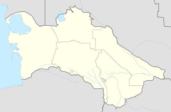 Balkanabat Location in Turkmenistan | |
| Coordinates: 39°31′00″N 54°22′00″E / 39.51667°N 54.36667°ECoordinates: 39°31′00″N 54°22′00″E / 39.51667°N 54.36667°E | |
| Country |
|
| Province | Balkan Province |
| Government | |
| • Mayor | Balkan Gulmamedov |
| Elevation | 17 m (56 ft) |
| Population (2011) | |
| • Total | 120,800 |
| Time zone | +5 GMT |
| Area code(s) | (00993) 222 X XX XX |
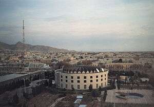
Balkanabat (Балканабат, بلخان آباد), formerly Nebit Dag, is a city in western Turkmenistan, and the capital of Balkan Province, the largest province in the country. It is located at 39°31′0″N 54°22′0″E / 39.51667°N 54.36667°E, at an altitude of 17 meters. Balkanabat lies at the foot of the Balkan Daglary mountain range. Balkanabat is about 450 km west of Ashgabat and 160 km east of the port city of Turkmenbashi. The city has an airport with scheduled daily flights to Ashgabat.
Name and History
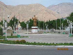
The former name, Nebit Dag, means "Oil Mountain" in Turkmen language, and it is named for the reserves of oil and large mountains of the Balkan mountain range. The town was founded in 1933, as a settlement along one of the stations of Trans-Caspian Railway. There is a large monument on the far eastern side of the city called "Monument to the Desert Explorers" which depicts a camel and several men struggling to walk through the windy desert of Karakum. Nebit Dag was renamed to Balkanabad (Balkan from name of Balkan mountains, abad - city) in 2001 by the decree of former President of Turkmenistan Saparmurat Niyazov.
The city has a "Health Path," which is a concrete path outside of the city built to give the citizens of the town a place to take a moderate hike along the mountainside. It was opened in 2004 to model a similar concrete path outside of Ashgabat. The city has five bazaars (markets) Gök, Jennet, Gündogar, Bereket and bazaar on 5th microregion. There is hotel "Nebitçi", a theatre, museums, restaurants and parks in Balkanabat. The north side of town contains the large park "Saparmyrat Türkmenbaşy Seýilgähi" which contains tennis courts, a life-size chess board and plenty of benches. The Yomud tribe was historic to the Balkan region and the Yomud carpet göl (pattern) is one of the five patterns represented on the Turkmen flag.
Demographics
Most of residence are Turkmens, other ethnic includes Russians, Kazakhs, Lezgins, Azeri, Armenians, Uzbeks, Tatars and Karakalpaks. Tajiks are also found.
Industry, Economy and Transport
It is an industrial center for petroleum and natural gas production. Animal breeding and wheat and cotton cultivation are another areas of economy in Balkanabat. The city is served by Balkanabat Airport. The city is connected to Ashgabat by Turkmenistan Airlines, as well as by train and bus. Buses route is from east to the west of Magtymguly shayoly (highway) and makes stops at bus station. While there is no official cab company, private citizens operate shared cabs. Almost any vehicle will pick up passengers and a ride costs is about 1 Turkmen manats (0.35 US cents). If the driver has already passengers in the car, then he will agree to take you if headed in the similar direction of their other available passengers. The city layout is a grid of apartment blocks called kvartal (quarters). There are main streets called Magtymguly, Pervomayskiy and Gurbansoltan eje shayoly. There are range of national banks, Turkmenpostal services in the centre by Magtymguly Shayoly, near 197 kvartal.
Education
There are a Kazakh school named after Madi Begenova, a Turkmen-Turkish high school and Turkmen primary and secondary schools.
Hotels
There is one 3-star hotel Nebitchi in the centre of the city.
See also
External links
| Wikivoyage has a travel guide for Balkanabat. |
Capital: Ashgabat | |