Balichak
| Balichak বালিচক | |
|---|---|
| Town | |
|
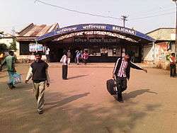
Balichak Station | |
 Balichak Location in West Bengal, India | |
| Coordinates: 22°22′N 87°33′E / 22.37°N 87.55°ECoordinates: 22°22′N 87°33′E / 22.37°N 87.55°E | |
| Country | India |
| State | West Bengal |
| District | Paschim Medinipur |
| Area | |
| • Total | 4.66 km2 (1.80 sq mi) |
| Elevation | 12 m (39 ft) |
| Population (2011) | |
| • Total | 13,784 |
| • Density | 3,000/km2 (7,700/sq mi) |
| Languages | |
| • Official | Bengali, English |
| Time zone | IST (UTC+5:30) |
| PIN | 721124 |
| Telephone code | 03222 |
| Vehicle registration | WB 34 |
| Lok Sabha constituency | Ghatal (MP — Deepak Adhikari(Dev);— AITC) |
| Vidhan Sabha constituency | Debra (MLA — Selima Khatun;— AITC) |
| Website |
paschimmedinipur |
Balichak is a census town in Debra CD Block in Paschim Medinipur district in the state of West Bengal, India. Balichak is 91 kilometres (56 mi) from Howrah on the Howrah-Kharagpur line and is part of the South Eastern Railway system.
Geography
Balichak is located at 22°22′N 87°33′E / 22.37°N 87.55°E.[1] It has an average elevation of 12 metres (42 feet). It is located in the Debra CD Block in the Kharagpur subdivision of the Paschim Medinipur district.[2]
Demographics
As per 2011 Census of India Balichak had a total population of 13,784 of which 6,735 (49%) were males and 7,049 (51%) were females. Population below 6 years is 1,261, which is 9.15 % of total population.
Literacy rate of Balichak town is 87.39 % , higher than national average of 74.04 %. Male literacy is around 92.22 % and female literacy rate is 82.82 %.
Language
Bengali is the the local language of this area.
CD Block HQ
The headquarters of Debra CD Block are located at Balichak.[3]
Transportation

Balichak is well connected by roads/highways to other important towns of South Bengal including Medinipur, Kharagpur, Belda, Jhargram, Contai, Digha, Howrah and also with Kolkata. This town is served by Balichak railway station. Local trains of South Eastern Line are frequently available at Balichak railway station. Locals use bicycles and motorbikes for transportation within the town. Rickshaws and cabs, totoes are also available.
Schools
There are numbers of schools in Balichak. The schools of Balichak Town are
- Maa Sarada Vidyamandir
- Balichak Christopherday School
- Aurobinda Vidyabhawan(English Medium, ICSE Board)
- Balichak Bhajahari Institution
- Balichak Girls High School
- Antala Sitala High School
- Duan Rudreswar High School
- Jhanjia Gopal Chandra Institution
- Brahmansasan High School
Banks and Financial Houses
There are few Banks and financial houses that serve the people living in Balichak and nearby areas. While State Bank of India is the busiest of all, other banks like United Bank of India, Vidyasagar Central Co-operative Bank Ltd. also have their presence here. And United Bank of India has two branches here. SBI Branch is at station Road, UBI(Balichak Branch) near Balichak Bhajahari institution and UBI(Hamirpur Branch) is at Balichak station road, Vidyasagar Central Coop Bank is at Balichak daily bazar. State Bank of India also has e-corner with branch. Life Insurance Corporation has a satellite branch in Balichak. The Private institutions do business mainly in the investment area.
ATM & E-Corner
- SBI ATM & E-Corner
- UBI ATM
- BOI ATM
- Vidyasagar Bank ATM
- Axis Bank ATM
- Indicash ATM
Culture
The regular Bengali festivals like Durga Puja, Saraswati Puja and Kali Puja are well attended. Other common pujas in the worship of Sitala, Jagaddhatri, Holi, Janmastami, Rath Yatra, Dussera(Ravan Pora) also takes place.
The Railway Station
Balichak is connected by train and is a part of the South Eastern railway. It is by far the busiest railway station in South Eastern Railway Zone within West Bengal due to its connectivity to few other major places like Pingla, Sabang, Debra etc. Being one of the busiest stations in the network, hundreds of passengers from all around Balichak & even far-away places commute daily from Balichak Railway Station. Few year ago the station got the facility of computerized ticketing service which helped local people to get railway tickets for anywhere in India.
References
- ↑ Falling Rain Genomics, Inc - Balichak
- ↑ "District Wise List of Statutory Towns( Municipal Corporation,Municipality,Notified Area and Cantonment Board) , Census Towns and Outgrowths, West Bengal, 2001". Census of India, Directorate of Census Operations, West Bengal. Archived from the original on 2007-09-30. Retrieved 2008-12-27.
- ↑ "District Census Handbook: Paschim Medinipur" (PDF). Map of Paschim Medinipur with CD Block HQs and Police Stations (on the fifth page). Directorate of Census Operations, West Bengal, 2011. Retrieved 20 November 2016.
Cities, towns and locations in Paschim Medinipur District | |||||||||||||||
|---|---|---|---|---|---|---|---|---|---|---|---|---|---|---|---|
| Cities, municipal and census towns |
| ||||||||||||||
| Locations other than cities and towns |
| ||||||||||||||
| Related topics |
| ||||||||||||||