Balcones Heights, Texas
| Balcones Heights, Texas | |
|---|---|
| City | |
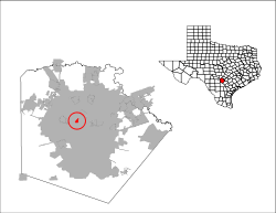 Location of Balcones Heights, Texas | |
| Coordinates: 29°29′23″N 98°32′53″W / 29.48972°N 98.54806°WCoordinates: 29°29′23″N 98°32′53″W / 29.48972°N 98.54806°W | |
| Country | United States |
| State | Texas |
| County | Bexar |
| Government | |
| • Type | Type A General Law |
| • City Council |
Mayor Suzanne de Leon Stephen Lara Miguel Valverde Jack Burton Lamar Gillian Charles White |
| • City Administrator | David J. Harris |
| Area | |
| • Total | 0.6 sq mi (1.7 km2) |
| • Land | 0.6 sq mi (1.7 km2) |
| • Water | 0.0 sq mi (0.0 km2) |
| Elevation | 830 ft (253 m) |
| Population (2000) | |
| • Total | 3,016 |
| • Density | 4,674.6/sq mi (1,804.9/km2) |
| Time zone | Central (CST) (UTC-6) |
| • Summer (DST) | CDT (UTC-5) |
| ZIP code | 78201 |
| Area code(s) | 210; 726 (assigned) |
| FIPS code | 48-05384[1] |
| GNIS feature ID | 1329967[2] |
| Website |
balconesheights |
Balcones Heights is a city in Bexar County, Texas, United States. The population was 2,941 at the 2010 census. Balcones Heights is considered by some locals to be a district of San Antonio, despite the fact that the community was incorporated in 1948 to avoid annexation into the city. Balcones Heights is an enclave of San Antonio since San Antonio city limits now completely surround it.
The first indoor shopping mall in Bexar County, which opened up with the name "Wonderland Shopping City" and is known as Wonderland of the Americas, lies within the borders of Balcones Heights. The City is now home to many medical professional offices, new pedestrian and transit-oriented developments, and the Methodist TexSan Hospital. Balcones Heights drew local attention in late 2006 for being the first location in the San Antonio area to approve the installation of "red-light cameras." These cameras, designed to photograph violations of traffic light rules (particularly applying to red lights), were installed in March 2007. Since their installation, traffic accidents in these intersections have decreased 40% according to City data.
Geography
Balcones Heights is located at 29°29′23″N 98°32′53″W / 29.48972°N 98.54806°W (29.489729, -98.547927),[3] 9 miles northwest of Downtown San Antonio.
According to the United States Census Bureau, the city has a total area of 0.6 square miles (1.6 km2).None of the area is covered with water.
Demographics
| Historical population | |||
|---|---|---|---|
| Census | Pop. | %± | |
| 1950 | 376 | — | |
| 1960 | 950 | 152.7% | |
| 1970 | 2,504 | 163.6% | |
| 1980 | 2,640 | 5.4% | |
| 1990 | 3,022 | 14.5% | |
| 2000 | 3,016 | −0.2% | |
| 2010 | 2,941 | −2.5% | |
| Est. 2015 | 3,254 | [4] | 10.6% |
As of the census[1] of 2000, there were 3,016 people, 1,437 households, and 708 families residing in the city. The population density was 4,674.6 people per square mile (1,791.5/km²). There were 1,539 housing units at an average density of 2,385.4 per square mile (914.2/km²). The racial makeup of the city was 69.66% White, 5.37% African American, 1.56% Native American, 1.13% Asian, 0.03% Pacific Islander, 17.41% from other races, and 4.84% from two or more races. Hispanic or Latino of any race were 69.60% of the population.
There were 1,437 households out of which 27.2% had children under the age of 18 living with them, 26.2% were married couples living together, 18.2% had a female householder with no husband present, and 50.7% were non-families. 43.6% of all households were made up of individuals and 7.7% had someone living alone who was 65 years of age or older. The average household size was 2.10 and the average family size was 2.92.
In the city the population was spread out with 23.7% under the age of 18, 14.5% from 18 to 24, 33.1% from 25 to 44, 19.5% from 45 to 64, and 9.2% who were 65 years of age or older. The median age was 32 years. For every 100 females there were 107.1 males. For every 100 females age 18 and over, there were 107.1 males.
The median income for a household in the city was $21,452, and the median income for a family was $27,074. Males had a median income of $21,209 versus $18,944 for females. The per capita income for the city was $13,529. About 18.1% of families and 21.1% of the population were below the poverty line, including 23.6% of those under age 18 and 15.2% of those age 65 or over.
Education
Most of the city is served by San Antonio Independent School District.[6] Most residents of the San Antonio ISD section are zoned to Baskin Academy,[7] with a small portion zoned to Maverick Elementary.[8] All such residents are zoned to Longfellow Middle School,[9] and Jefferson High School, all in San Antonio.[10]
Some of the city is served by the North East Independent School District.[6] The portion is served by Dellview Elementary School,[11] Jackson Middle School,[12] and Lee High School, all in San Antonio.[13]
Private schools
St. Gregory the Great Catholic School opened in 1955 under the Sisters of Presentation of the Blessed Virgin Mary Congregation.
References
- 1 2 "American FactFinder". United States Census Bureau. Archived from the original on 2013-09-11. Retrieved 2008-01-31.
- ↑ "US Board on Geographic Names". United States Geological Survey. 2007-10-25. Retrieved 2008-01-31.
- ↑ "US Gazetteer files: 2010, 2000, and 1990". United States Census Bureau. 2011-02-12. Retrieved 2011-04-23.
- ↑ "Annual Estimates of the Resident Population for Incorporated Places: April 1, 2010 to July 1, 2015". Retrieved July 2, 2016.
- ↑ "Census of Population and Housing". Census.gov. Archived from the original on May 11, 2015. Retrieved June 4, 2015.
- 1 2 "Zoning Map." City of Balcones Heights. Retrieved on March 24, 2010.
- ↑ "Baskin Elementary Attendance Boundary" (Archive). San Antonio Independent School District. Retrieved on June 26, 2016.
- ↑ "Maverick Elementary Attendance Boundary" (Archive). San Antonio Independent School District. Retrieved on June 26, 2016.
- ↑ "Longfellow Middle Attendance Boundary" (Archive). San Antonio Independent School District. Retrieved on June 26, 2016.
- ↑ "Jefferson High Attendance Boundary 2014-2015" (Archive). San Antonio Independent School District. Retrieved on June 26, 2016.
- ↑ "Dellview Elementary School" Map. North East Independent School District. Retrieved on March 24, 2010.
- ↑ "Jackson Middle School" Map. North East Independent School District. Retrieved on March 24, 2010.
- ↑ "Lee High School" Map. North East Independent School District. Retrieved on March 24, 2010.
External links
- Balcones Heights official website
- "Don't run red lights in Balcones Heights"—article from the San Antonio Express-News (accessed March 31, 2007)
Municipalities and communities of Bexar County, Texas, United States | ||
|---|---|---|
| Cities | 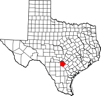 | |
| Towns | ||
| CDPs | ||
| Other unincorporated communities | ||
| Footnotes | ‡This populated place also has portions in an adjacent county or counties | |