Bakhuys Airstrip
| Bakhuys Airstrip | |
|---|---|
| IATA: none – ICAO: SMBG | |
| Summary | |
| Airport type | Public |
| Operator | Luchtvaartdienst Suriname |
| Location | Bakhuys Gebergte, Suriname |
| Coordinates | 04°46′46″N 56°48′45″W / 4.77944°N 56.81250°WCoordinates: 04°46′46″N 56°48′45″W / 4.77944°N 56.81250°W |
| Map | |
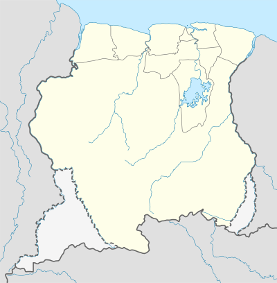 SMBG Location in Suriname | |
Bakhuys Airstrip (ICAO: SMBG) is an airstrip near the Bakhuys Mountains, (Bakhuys Gebergte) in Suriname.
Charters and destinations
Charter Airlines serving this airport are:
| Airlines | Destinations |
|---|---|
| Blue Wing Airlines | Paramaribo, Zorg en Hoop Airport[1] |
| Caricom Airways | Paramaribo, Zorg en Hoop Airport[2] |
| Gum Air | Paramaribo, Zorg en Hoop Airport[3] |
| Hi-Jet Helicopter Services | Paramaribo, Zorg en Hoop Airport |
| Suriname Air Force/ Surinaamse Luchtmacht | Paramaribo, Zorg en Hoop Airport |
See also
 Suriname portal
 Aviation portal
- List of airports in Suriname
- Transport in Suriname
References
- ↑ Blue Wing schedule
- ↑ Caricom destinations Archived March 15, 2013, at the Wayback Machine.
- ↑ Gum Air destinations
This article is issued from Wikipedia - version of the 11/14/2016. The text is available under the Creative Commons Attribution/Share Alike but additional terms may apply for the media files.