Bajie Subdistrict
| Bajie Subdistrict | |
|---|---|
| Subdistrict | |
| Chinese transcription(s) | |
| • Simplified | 八街街道 |
| • Traditional | 八街街道 |
| • Pinyin | Bājiē Jiēdào |
 | |
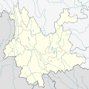 Bajie Location in Yunnan province | |
| Coordinates: 24°39′58″N 102°21′33″E / 24.66611°N 102.35917°ECoordinates: 24°39′58″N 102°21′33″E / 24.66611°N 102.35917°E | |
| Country | China |
| Province | Yunnan |
| Prefecture-level city | Kunming |
| County-level city | Anning City |
| Area | |
| • Total | 344.18 km2 (132.89 sq mi) |
| Population (2010) | |
| • Total | 38,442 |
| • Density | 110/km2 (290/sq mi) |
| Time zone | China Standard (UTC+8) |
| Postal code | 650305 |
| Area code(s) | 0871 |
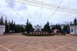
Bajie Subdistrict (Chinese: 八街街道; pinyin: Bājiē Jiēdào) is a subdistrict situated in southern Anning City, Yunnan province, southwestern China. It lies about 38 km west of Anning City, situated on the west bank of the Mingyi River. Formerly a town, its status changed to a subdistrict of Anning in 2011.[1]
References
- ↑ 安宁全域撤镇设街道办事处 (in Chinese). 云南经济日报. 19 April 2011. Retrieved 27 September 2011.
This article is issued from Wikipedia - version of the 4/4/2016. The text is available under the Creative Commons Attribution/Share Alike but additional terms may apply for the media files.