Baillif Airport
| Baillif Airport | |||||||||||
|---|---|---|---|---|---|---|---|---|---|---|---|
| IATA: BBR – ICAO: TFFB | |||||||||||
| Summary | |||||||||||
| Airport type | Public | ||||||||||
| Serves | Basse Terre | ||||||||||
| Elevation AMSL | 64 ft / 20 m | ||||||||||
| Coordinates | 16°00′50″N 61°44′35″W / 16.01389°N 61.74306°WCoordinates: 16°00′50″N 61°44′35″W / 16.01389°N 61.74306°W | ||||||||||
| Map | |||||||||||
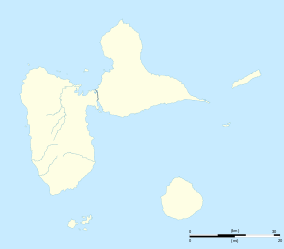 BBR Location of the airport in Guadeloupe | |||||||||||
| Runways | |||||||||||
| |||||||||||
Baillif Airport (IATA: BBR, ICAO: TFFB) is an airport serving Basse Terre, a coastal city in Guadeloupe. The airport has high terrain north through southeast.
See also
.svg.png) Guadeloupe portal
Guadeloupe portal Aviation portal
- Transport in Guadeloupe
- List of airports in Guadeloupe
References
- ↑ Airport information for BBR at Great Circle Mapper.
- ↑ Google Maps - Baillif
External links
This article is issued from Wikipedia - version of the 10/7/2016. The text is available under the Creative Commons Attribution/Share Alike but additional terms may apply for the media files.