Bagshot railway station
| Bagshot | |
|---|---|
 | |
| Location | |
| Place | Bagshot |
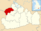
| Local authority | Surrey Heath |
| Grid reference | SU914636 |
| Operations | |
| Station code | BAG |
| Managed by | South West Trains |
| Number of platforms | 2 |
| DfT category | E |
|
Live arrivals/departures, station information and onward connections from National Rail Enquiries | |
| Annual rail passenger usage* | |
| 2010/11 |
|
| 2011/12 |
|
| 2012/13 |
|
| 2013/14 |
|
| 2014/15 |
|
| History | |
| Key dates | Opened 18 March 1878 |
| National Rail – UK railway stations | |
| * Annual estimated passenger usage based on sales of tickets in stated financial year(s) which end or originate at Bagshot from Office of Rail and Road statistics. Methodology may vary year on year. | |
|
| |

| Ascot to Guildford Line | |||||||||||||||||||||||||||||||||||||||||||||||||||||||||||||||||||||||||||||||||||||||||||||||||||||||||||||||||||||||||||||||||||||||||||||||||||||||||||||||||||||||||||||||||||||||||||||||||||||
|---|---|---|---|---|---|---|---|---|---|---|---|---|---|---|---|---|---|---|---|---|---|---|---|---|---|---|---|---|---|---|---|---|---|---|---|---|---|---|---|---|---|---|---|---|---|---|---|---|---|---|---|---|---|---|---|---|---|---|---|---|---|---|---|---|---|---|---|---|---|---|---|---|---|---|---|---|---|---|---|---|---|---|---|---|---|---|---|---|---|---|---|---|---|---|---|---|---|---|---|---|---|---|---|---|---|---|---|---|---|---|---|---|---|---|---|---|---|---|---|---|---|---|---|---|---|---|---|---|---|---|---|---|---|---|---|---|---|---|---|---|---|---|---|---|---|---|---|---|---|---|---|---|---|---|---|---|---|---|---|---|---|---|---|---|---|---|---|---|---|---|---|---|---|---|---|---|---|---|---|---|---|---|---|---|---|---|---|---|---|---|---|---|---|---|---|---|---|
Legend | |||||||||||||||||||||||||||||||||||||||||||||||||||||||||||||||||||||||||||||||||||||||||||||||||||||||||||||||||||||||||||||||||||||||||||||||||||||||||||||||||||||||||||||||||||||||||||||||||||||
| |||||||||||||||||||||||||||||||||||||||||||||||||||||||||||||||||||||||||||||||||||||||||||||||||||||||||||||||||||||||||||||||||||||||||||||||||||||||||||||||||||||||||||||||||||||||||||||||||||||
|
Mileages from London Waterloo via various routes | |||||||||||||||||||||||||||||||||||||||||||||||||||||||||||||||||||||||||||||||||||||||||||||||||||||||||||||||||||||||||||||||||||||||||||||||||||||||||||||||||||||||||||||||||||||||||||||||||||||
Bagshot railway station serves the village of Bagshot, in the west of Surrey, England. The station, and all trains calling there, are operated by South West Trains. It is situated on the Ascot to Guildford line.
History
The station was opened by the London and South Western Railway, it became part of the Southern Railway during the Grouping of 1923. The station then passed on to the Southern Region of British Railways on nationalisation in 1948.
When Sectorisation was introduced in the 1980s, the station was served by Network SouthEast until the Privatisation of British Railways.
Services
Trains operate between Ascot and Guildford, via Bagshot and Aldershot, every 30 minutes Monday to Saturday and every 60 minutes on Sundays. On Mondays to Fridays, there are three trains per day that continue beyond Ascot to London Waterloo in the morning peak period, and two from London in the evening.
Services are run using a four carriage Class 450 or Class 456 and 2 cycles can be carried per train.
References
- Butt, R. V. J. (1995). The Directory of Railway Stations: details every public and private passenger station, halt, platform and stopping place, past and present (1st ed.). Sparkford: Patrick Stephens Ltd. ISBN 1-8526-0508-1. OCLC 60251199.
- Jowett, Alan (2000). Jowett's Nationalised Railway Atlas (1st ed.). Penryn, Cornwall: Atlantic Transport Publishers. ISBN 0-9068-9999-0. OCLC 228266687.
- Jowett, Alan (March 1989). Jowett's Railway Atlas of Great Britain and Ireland: From Pre-Grouping to the Present Day (1st ed.). Sparkford: Patrick Stephens Ltd. ISBN 1-8526-0086-1. OCLC 22311137.
- Station on navigable O.S. map
External links
| Wikimedia Commons has media related to Bagshot railway station. |
- Train times and station information for Bagshot railway station from National Rail
| Preceding station | |
Following station | ||
|---|---|---|---|---|
| Ascot | South West Trains Ascot to Guildford line |
Camberley | ||
Coordinates: 51°21′50″N 0°41′20″W / 51.364°N 0.689°W
| Towns, villages and neighbourhoods |
|  | ||||||||||||||||||||||||||
|---|---|---|---|---|---|---|---|---|---|---|---|---|---|---|---|---|---|---|---|---|---|---|---|---|---|---|---|---|
| Parks | ||||||||||||||||||||||||||||
| Listed Churches | ||||||||||||||||||||||||||||
| Education | ||||||||||||||||||||||||||||
| Transport |
| |||||||||||||||||||||||||||
| Buildings and structures | ||||||||||||||||||||||||||||
| Sport | ||||||||||||||||||||||||||||
Places listed are articles or sections notable as settlements, arranged by post town Camberley is the administrative centre and largest single settlement | ||||||||||||||||||||||||||||