Bagrami
Not to be confused with Bagram.
| Bagrami | |
|---|---|
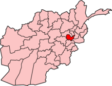
 Bagrami Location in Afghanistan | |
| Coordinates: 34°29′28″N 69°16′32″E / 34.49111°N 69.27556°ECoordinates: 34°29′28″N 69°16′32″E / 34.49111°N 69.27556°E | |
| Country |
|
| Elevation | 5,896 ft (1,797 m) |
| Population (2007) | |
| • Total | 31,680 |
| Time zone | + 4.30 |
Bagrami is a town situated very close to Kabul at 34°29′28″N 69°16′32″E / 34.4911°N 69.2756°E at 1797 m altitude. The population is 31,680 (2007 calculation). The road to Kabul is not bad and the city can be reached in 30 minutes, so Bagrami is becoming a suburb. The Bagrami Industrial Park is almost ready and this is one of the major projects for the economy of the region. In 2010 the town also harboured a shanty town of mud-built huts from refugees escaping the violence of the Taliban insurgency in the southern provinces of Afghanistan. [1]
Notes
This article is issued from Wikipedia - version of the 12/11/2012. The text is available under the Creative Commons Attribution/Share Alike but additional terms may apply for the media files.