Badarpur, Assam
| Badarpur Bengali: বদরপুর | |
|---|---|
| City | |
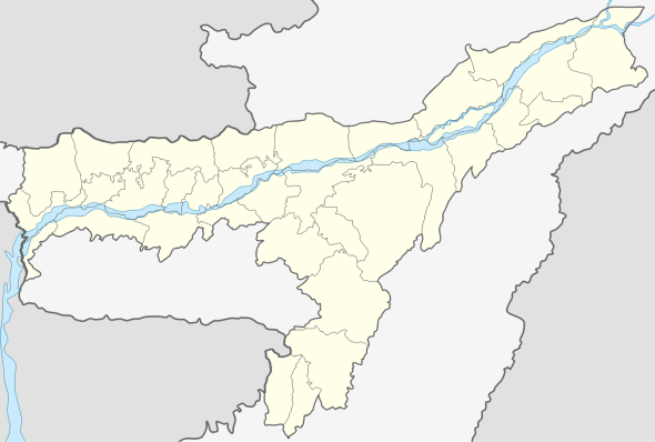 Badarpur  Badarpur Location in Assam, India | |
| Coordinates: 24°54′N 92°36′E / 24.9°N 92.6°ECoordinates: 24°54′N 92°36′E / 24.9°N 92.6°E | |
| Country |
|
| State | Assam |
| District | Karimganj |
| Government | |
| • Body | Badarpur Town Committee |
| Elevation | 16 m (52 ft) |
| Population (2001) | |
| • Total | 11,291 |
| Languages | |
| • Official | Bengali |
| Time zone | IST (UTC+5:30) |
| ISO 3166 code | IN-AS |
| Vehicle registration | AS |
Badarpur (Pron:/ˌbʌdəˈpʊə/) (Bengali: বদরপুর) is a town and a town area committee in Karimganj district in the state of Assam, India.
Geography
Badarpur is located at 24°54′N 92°36′E / 24.9°N 92.6°E.[1] It has an average elevation of 16 metres (52 feet).
Demographics
As of 2001 India census,[2] Badarpur had a population of 11,291. Males constitute 52% of the population and females 48%. Badarpur has an average literacy rate of 84%, higher than the national average of 79.5%. 10% of the population is under 6 years of age. As of 28th of March, 2016, the population of Badarpur stands around 1,50,000.
Politics
Badarpur is part of Karimganj (Lok Sabha constituency).[3] At present the MLA of Badarpur is Jamal Uddin Ahmed.[4]
References
- ↑ Falling Rain Genomics, Inc - Badarpur
- ↑ "Census of India 2001: Data from the 2001 Census, including cities, villages and towns (Provisional)". Census Commission of India. Archived from the original on 2004-06-16. Retrieved 2008-11-01.
- ↑ "List of Parliamentary & Assembly Constituencies" (PDF). Assam. Election Commission of India. Archived from the original (PDF) on 2006-05-04. Retrieved 2008-10-05.
- ↑ "Badarpur Constituency". goassam.com. Retrieved 27 October 2016.
This article is issued from Wikipedia - version of the 10/27/2016. The text is available under the Creative Commons Attribution/Share Alike but additional terms may apply for the media files.