Bad König
| Bad König | ||
|---|---|---|
| ||
 Bad König | ||
Location of Bad König within Odenwaldkreis district 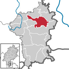
 | ||
| Coordinates: 49°45′N 09°01′E / 49.750°N 9.017°ECoordinates: 49°45′N 09°01′E / 49.750°N 9.017°E | ||
| Country | Germany | |
| State | Hesse | |
| Admin. region | Darmstadt | |
| District | Odenwaldkreis | |
| Government | ||
| • Mayor | Uwe Veith | |
| Area | ||
| • Total | 46.73 km2 (18.04 sq mi) | |
| Population (2015-12-31)[1] | ||
| • Total | 9,544 | |
| • Density | 200/km2 (530/sq mi) | |
| Time zone | CET/CEST (UTC+1/+2) | |
| Postal codes | 64732 | |
| Dialling codes | 06063 | |
| Vehicle registration | ERB | |
| Website | www.badkoenig.de | |

Bad König is a town and resort (Kurort) in the central Odenwald in the Odenwaldkreis (district) in Hesse, Germany, 29 km southeast of Darmstadt.
Geography
Neighbouring communities
Bad König borders in the north on the communities of Höchst and Lützelbach, in the east and south on the town of Michelstadt and in the west on the communities of Brombachtal and Brensbach.
Constituent communities
Besides the main town, also called Bad König, the town has the outlying Ortsteile of Zell, Momart, Etzen-Gesäß, Fürstengrund, Kimbach, Nieder-Kinzig and Ober-Kinzig with Gumpersberg.
History

Bad König is one of the oldest settlements in the Mümling valley. There were Germanic settlers quite early on. In Roman times, the name for this place was apparently Quintiacum, and Quinticha was the name under which Bad König had its first documentary mention between 820 and 822. In the Middle Ages it was originally an Imperial holding, then belonging to the Fulda Monastery. Bad König was already fortified in the Early Middle Ages, and was the hub of a tithing area with a tithing office. In 1477, Künnig als Chur Maintzisch Lehn (or in standard modern German König als Kurmainzisches Lehen – “König as an Electorate of Mainz fief”) was given to the Schenk Konrad von Erbach. Under the terms of the Erbach land partition in 1747, the Amt of König passed into the ownership of the Counts of Erbach-Schönberg. In 1948, König was granted the right to call itself staatlich anerkanntes Bad, or “state-recognized resort”, and in 1980 this resort in the Odenwald was granted town rights.
Jewish community
In (Bad) König there was a Jewish community until 1939. Its establishment went back to the 18th century. The town’s Jewish population peaked at 100 about 1880. It was an Orthodox community. The Jewish families in town owned livestock and horse businesses, cereal and flour businesses, manufacturing businesses and colonial goods businesses as well as those that made glass and porcelain. The firm J. Mannheimer had a great shop for farming machinery. For Jewish resort guests there was a kosher guesthouse. The synagogue built in 1795-1797 was heavily damaged on Kristallnacht (9 November 1938), and in 1939 it was torn down. In 1933 there were still 72 Jews living in town. Because of the scenes of utter brutality in connection with Kristallnacht, most of them left town, especially as from 1939 they were no longer allowed to buy food. At least ten Jews from Bad König were deported to the camps and murdered.[2]
Politics
The municipal election held on 26 March 2006 yielded the following results:
| Parties and voter communities | % 2006 |
Seats 2006 |
% 2001 |
Seats 2001 | |
| CDU | Christian Democratic Union of Germany | 45.2 | 12 | 45.7 | 14 |
| SPD | Social Democratic Party of Germany | 44.2 | 12 | 42.3 | 13 |
| GREENS | Bündnis 90/Die Grünen | 4.4 | 1 | – | – |
| FDP | Free Democratic Party | 6.2 | 2 | 2.9 | 1 |
| GAL | Grün-Alternative Liste Bad König | – | – | 6.7 | 2 |
| ÜWG | Überparteiliche Wählergemeinschaft Bad König | – | – | 2.4 | 1 |
| Total | 100.0 | 27 | 100.0 | 31 | |
| Voter turnout in % | 47.4 | 59.6 | |||
There are local deputies in the outlying centres of Etzen-Gesäß, Fürstengrund, Kimbach, Nieder-Kinzig, Ober-Kinzig and Zell.
Town partnerships
![]() Argentat, Limousin, France since 1982.
Argentat, Limousin, France since 1982.
Economy and infrastructure
Transport
The town is linked to the long-distance road network by Bundesstraße 45 (Hanau–Eberbach). The Odenwaldbahn (railway; RMV Line 65) links Bad König, as well as the outlying centre of Zell, with the Neckar valley and also Frankfurt and Darmstadt.
Personality

- Franz Taurinus (1794-1874), mathematician
- Friedrich Bergsträsser (1800-1847), Hessian politician and former liberal-conservative deputy of the 2nd Chamber of the Estates of the Grand Duchy of Hesse
- Johann Adam Groh (1824-1881), co-founder of the agricultural cooperative associations in Hessen
- Carl Weyprecht (1838-1881), polar explorer
- Gottfried Büchner (1851-1919), mayor of Bad König and liberal member of Hesse Landtag
- Georg Vetter (1891-1969), painter
References
- ↑ "Bevölkerung der hessischen Gemeinden". Hessisches Statistisches Landesamt (in German). August 2016.
- ↑ Informationen zur jüdischen Geschichte
External links
- Town’s website (German)
- Bad König at DMOZ (German)
Towns and municipalities in Odenwaldkreis district | ||
|---|---|---|