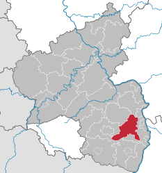
Bad Dürkheim (district)
| Bad Dürkheim | ||
|---|---|---|
| District | ||
| ||
 | ||
| Country |
| |
| State | Rhineland-Palatinate | |
| Capital | Bad Dürkheim | |
| Area | ||
| • Total | 595 km2 (230 sq mi) | |
| Population (31 December 2015)[1] | ||
| • Total | 132,203 | |
| • Density | 220/km2 (580/sq mi) | |
| Time zone | CET (UTC+1) | |
| • Summer (DST) | CEST (UTC+2) | |
| Vehicle registration | DÜW | |
| Website | kreis-bad-duerkheim.de | |
Bad Dürkheim (German pronunciation: [ˈbaːt ˈdyːɐ̯khaɪm]) is a district in Rhineland-Palatinate, Germany. It is bounded by (from the west and clockwise) the districts of Kaiserslautern, Donnersbergkreis and Alzey-Worms, the city of Worms, the Rhein-Pfalz-Kreis, the city of Neustadt/Weinstraße, the districts of Südliche Weinstraße, the city of Landau (the Taubensuhl/Fassendeich forest part of the city), the district Südwestpfalz, and the city of Kaiserslautern.
History
The eastern rim of the Palatinate forest has been densely populated since the Middle Ages. Several medieval castles show the significance of the region during the early Holy Roman Empire.
The district was established in 1969 by combining portions of the former districts of Neustadt and Frankenthal.
DIALECT
The dialect of Bad Dürkheim and environs is closer to the Pennsylvania Dutch language—also known as Pennsylvania German or as Deitsch, the native tongue of the Amish and others—than any other dialect of German.
Geography
The district is located on the eastern rim of the Palatinate Forest a line of hills called the Haardt. The German Wine Road (Deutsche Weinstraße), a scenic road along the best vineyards of the Palatinate wine region, runs through the district from north to south. The district is sometimes called "the heart of the Palatinate".
The best wine-growing area is the Mittelhaardt ("Middle Haardt"), where the Riesling wine is cultivated, which is considered to be one of the best German wines.
It is known for the great wine which they celebrate every year.
Coat of arms
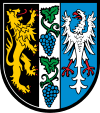 |
The coat of arms displays:
|
Towns and municipalities
| Verband-free towns | Verband-free municipality |
|---|---|
| Verbandsgemeinden | |||
|---|---|---|---|
|
|
| |
| 1seat of the Verbandsgemeinde; 2town | |||
References
- ↑ "Gemeinden in Deutschland mit Bevölkerung am 31. Dezember 2015" (PDF). Statistisches Bundesamt (in German). 2016.
External links
- Official website (German)
| Wikimedia Commons has media related to Landkreis Bad Dürkheim. |
Coordinates: 49°30′N 8°10′E / 49.5°N 8.17°E