Backwell
| Backwell | |
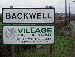 Village of the Year signs marks the entrance to Backwell. |
|
 Backwell |
|
| Population | 4,589 (2011)[1] |
|---|---|
| OS grid reference | ST485685 |
| Unitary authority | North Somerset |
| Ceremonial county | Somerset |
| Region | South West |
| Country | England |
| Sovereign state | United Kingdom |
| Post town | BRISTOL |
| Postcode district | BS48 |
| Dialling code | 01275 |
| Police | Avon and Somerset |
| Fire | Avon |
| Ambulance | South Western |
| EU Parliament | South West England |
| UK Parliament | North Somerset |
Coordinates: 51°24′47″N 2°44′23″W / 51.4131°N 2.7398°W
Backwell is a rural village and civil parish in Somerset, England. It falls within the Unitary Authority of North Somerset and has a population of 4,589.[1] It is 7 miles (11.3 km) south west of Bristol, on the A370 to Weston-super-Mare. It includes the hamlets of Backwell Common, Backwell Green and Farleigh and the districts of West Town and Downside.
Nearby are Nailsea, Flax Bourton, Yatton, Brockley and Barrow Gurney.
History
Backwell Hillfort between Flax Bourton and Backwell is an iron age hill fort.[2]
The village has a long history, appearing in the Domesday Book in 1086 with the name 'Bacoile' meaning 'The well back on the hill'.
The parish was part of the hundred of Hartcliffe.[3]
The lords of the manor from the 12th to 17th centuries were the Rodneys. Walter de Rodney was given the manor for his support of the Empress Matilda against King Stephen.[4]
Governance
The parish council has responsibility for local issues, including setting an annual precept (local rate) to cover the council’s operating costs and producing annual accounts for public scrutiny. The parish council evaluates local planning applications and works with the local police, district council officers, and neighbourhood watch groups on matters of crime, security, and traffic. The parish council's role also includes initiating projects for the maintenance and repair of parish facilities, such as the village hall or community centre, playing fields and playgrounds, as well as consulting with the district council on the maintenance, repair, and improvement of highways, drainage, footpaths, public transport, and street cleaning. Conservation matters (including trees and listed buildings) and environmental issues are also of interest to the council.[5]
The parish falls within the unitary authority of North Somerset which was created in 1996, as established by the Local Government Act 1992. It provides a single tier of local government with responsibility for almost all local government functions within its area including local planning and building control, local roads, council housing, environmental health, markets and fairs, refuse collection, recycling, cemeteries, crematoria, leisure services, parks, and tourism. It is also responsible for education, social services, libraries, main roads, public transport, trading standards, waste disposal and strategic planning, although fire, police and ambulance services are provided jointly with other authorities through the Avon Fire and Rescue Service, Avon and Somerset Constabulary and the Great Western Ambulance Service.

North Somerset's area covers part of the ceremonial county of Somerset but it is administered independently of the non-metropolitan county. Its administrative headquarters is in the town hall in Weston-super-Mare. Between 1 April 1974 and 1 April 1996, it was in the Woodspring district of the county of Avon.[6] Before 1974 that the parish was part of the Long Ashton Rural District.[7]
An electoral ward in the same name exists. The ward stretches from Brockley, through Backwell to Barrow Gurney in the east. The total population of this ward taken from the 2011 census was 5,930.[8]
The parish is represented in the House of Commons of the Parliament of the United Kingdom as part of the North Somerset county constituency. It elects one Member of Parliament (MP) by the first past the post system of election. It is also part of the South West England constituency of the European Parliament which elects seven MEPs using the d'Hondt method of party-list proportional representation.
Geography

Backwell lake, which is also known as Buckland's Pool, is next to the road between Nailsea and Backwell at Buckland's Batch. The lake was built as a balancing pond in the mid-1970s It has now become a wildlife haven for birds, bats and dragonflies, which are attracted by the open water and surrounding vegetation. Bird species include gadwall, shoveler, pochard, tufted duck, grey heron and mute swans.[9]
Stancombe Quarry was first built in 1952. Today, the quarry which is operated by Tarmac, produces Carboniferous Limestone, which is mainly for use on the roads,[10] after crushing on site.[11] The site has an expected output of 28 million tonnes over a 25-year period.[12] country.[13] The annual mean temperature is approximately 10 °C (50.0 °F). Seasonal temperature variation is less extreme than most of the United Kingdom because of the adjacent sea temperatures. The summer months of July and August are the warmest with mean daily maxima of approximately 21 °C (69.8 °F). In winter mean minimum temperatures of 1 °C (33.8 °F) or 2 °C (35.6 °F) are common.[13] In the summer the Azores high pressure affects the south-west of England, however convective cloud sometimes forms inland, reducing the number of hours of sunshine. Annual sunshine rates are slightly less than the regional average of 1,600 hours.[13] In December 1998 there were 20 days without sun recorded at Yeovilton. Most the rainfall in the south-west is caused by Atlantic depressions or by convection. Most of the rainfall in autumn and winter is caused by the Atlantic depressions, which is when they are most active. In summer, a large proportion of the rainfall is caused by sun heating the ground leading to convection and to showers and thunderstorms. Average rainfall is around 700 mm (28 in). About 8–15 days of snowfall is typical. November to March have the highest mean wind speeds, and June to August have the lightest winds. The predominant wind direction is from the south-west.[13]
Playing Fields

Backwell Playing Fields is a 17-acre (2.8 hectare) public park and a collection of sports fields in the western side of Backwell. Its slogan is "The jewel in the centre of our village" [14]
On June 6, 1929, Theodore Robinson opened the park to the public [15] and gave it to the "Children and adults of the parish of Backwell", as a result the fields have no sole owner. The fields are, however, managed and maintained by a team of directors of the Backwell Playing Fields Charity.[14]
The fields are often used for playing football, mainly for Ashton and Backwell United FC's home games, as the club's home and stadium is at the Playing Fields. Other sports grounds at the Fields are Backwell Tennis Club, West Backwell Bowling Club, and Backwell Judo Club. The fields are also home to a youth club. 1st Backwell Scouts hut is just outside the park boundaries, but the fields are used a lot by them for their outdoor activities.
Facilities
As well as the facilities in the Playing Fields, Backwell also has:
- Post office
- Doctor's surgery
- Dentist
- Chemist
- Corner Shop
- Newsagent's shop
- Equestrian shop
- Three pubs
- 5 Barbershops/Hair Salons
- Swimming pool
- Estate agents
- Funeral Directors
- Bakery
- Fish and chips shop
- Italian restaurant
- Grill House Cafe
- Indian restaurant
- Indian takeaway
- Many Red telephone boxes
- Petrol Station
- Cash machine
In the past there had been a bank, a library and a fourth pub in the village, which are now closed.
Education
The largest junior school in Backwell is Backwell Church of England Junior School, which provides education to 240 children aged between 7 and 11. The school is highly praised by Ofsted and performs consistently well in the league tables.[16] In addition there is West Leigh Infant School which covers reception and Key Stage 1 and which has received an outstanding Ofsted report.[17] In 2013, West Leigh and Backwell Junior schools became a federation.[18]
A private primary school, Fairfield PNEU, is located in the village, having been founded in 1935 and moved to its current site in 1947.[19]
The secondary school, Backwell School, consistently features high in the league tables for GCSE results,[20] and is recognised as one of the best state schools in North Somerset. Pupils travel to the school from surrounding areas, such as Bristol and Yatton, by public transport or school coach. The school has about 1,700 pupils and used to be a Secondary Modern until the abolition of the Tripartite System. Alumni include Richard Ottaway, politician[21] and the bestselling author Joel McIver.[22]
Transport
Many residents of Backwell commute daily to Bristol by car via the A370, and public transport — First Somerset & Avon operates the local buses; there is also a "Circle Line" bus service operated by Travelwest which runs through the village. The closest motorway is the M5.
Nailsea and Backwell railway station is managed by Great Western Railway. Over the decades the station's name has alternated between its current name and simply 'Nailsea', even though it is in Backwell. The station is only staffed during rush hour. The journey time to Bristol Temple Meads is 11 minutes; London Paddington takes two hours without changes. The direct service to London makes the village popular with commuters willing to spend four hours a day travelling by train.[23] The car park at the station is full by 8:00 on weekdays.[24] In recent years the number of services direct to London have been reduced.
Bristol Airport is at Lulsgate Bottom, which borders the district of Downside, 3 miles (4.8 km) from the centre of Backwell. The airport serves both domestic and international routes.
Religious sites

The Anglican parish church of St. Andrew dates from the 12th century. It was altered and enlarged in the 13th, 15th, 16th and 17th centuries. It has been designated as a Grade I listed building.[25]
The tower at the west end of the church is over 100 feet (30 m) tall and dates from the 15th century. It contains a ring of eight bells, two of which are medieval.[26]
The font dates from the 12th century. It consists of a circular bowl with cable moulding, and a circular stem with foliate moulding on the base. It was restored in 1907.[25]
There is also a Methodist Church in Backwell West Town and a Baptist Church on Backwell Common.
Sport
Ashton & Backwell United F.C. was originally called Backwell United but then merged with one of Bristol's largest youth club's Ashton Boys FC. They are currently members of the Western League First Division. They moved to their current home in 1947, the Backwell Recreation Ground.
Backwell Karate, also known as Backwell Shotokan Karate Club, was established in the village in 1978 and is a member club of the Karate Union of Great Britain governing body.
Backwell Golf Club (now defunct) first appeared during the 1890s. The club closed prior to WW1.[27]
References
- 1 2 "2011 Census Profile" (Excel). North Somerset Council. Retrieved 4 January 2014.
- ↑ "Backwell Hillfort". Hillfort in England in Somerset. Megalithic Portal. Retrieved 15 January 2011.
- ↑ "Somerset Hundreds". GENUKI. Retrieved 9 October 2011.
- ↑ Dunning, Robert (1980). Somerset & Avon. Bartholomew. p. 30. ISBN 0-7028-8380-8.
- ↑ "Backwell Parish Council". Backwell Parish Council. Retrieved 28 August 2010.
- ↑ "The Avon (Structural Change) Order 1995". HMSO. Archived from the original on 30 January 2008. Retrieved 19 December 2007.
- ↑ "Long Ashton RD". A vision of Britain Through Time. University of Portsmouth. Retrieved 4 January 2014.
- ↑ "ward population 2011.Retrieved 9 March 2015".
- ↑ "Bucklands Pool/Backwell Lake". Natural England. Archived from the original on 24 July 2011. Retrieved 28 August 2010.
- ↑ Stancombe Quarry production
- ↑ "Hazemag at Stancombe Quarry". Aggregates and Recycling Information Network. Retrieved 29 January 2011.
- ↑ "Contaminated land inspection strategy November 2001 (revised 2003)" (PDF). North Somerset Council. Retrieved 29 January 2011.
- 1 2 3 4 "South West England: climate". Met Office. Retrieved 14 March 2010.
- 1 2 "Home - Backwell Playing Fields". www.backwellpark.co.uk. Archived from the original on 22 December 2015. Retrieved 2015-12-14.
- ↑ "Backwell Park". Backwell Playing Fields Association. Retrieved 28 August 2010.
- ↑ "Backwell Church of England Junior School". Department for Education and Skills. Retrieved 28 August 2010.
- ↑ "West Leigh Infant School". Inspection Report. Ofsted. Retrieved 28 August 2010.
- ↑ "Welcome to Our Federation". Retrieved 27 October 2016.
- ↑ "History". Fairfield School. Archived from the original on 8 September 2010. Retrieved 28 August 2010.
- ↑ "Backwell School". Department for Education and Skills. Retrieved 28 August 2010.
- ↑ "Richard Ottaway". BBC News Online. 2001. Retrieved 13 February 2008.
- ↑ Interview in Venue magazine, 2008
- ↑ Emmett, Susan (28 March 2008). "The West of England: the new commuter belt". The Times. Retrieved 3 October 2009.
- ↑ "Station car park set to expand". Bristol Evening Post. 12 January 2009. Retrieved 3 October 2009.
- 1 2 "St. Andrew's Church". Images of England. English Heritage. Retrieved 7 March 2009.
- ↑ "History". St Andrew's Church, Backwell. Retrieved 5 April 2009.
- ↑ “Backwell Golf Club”, “Golf’s Missing Links”.
External links
| Wikimedia Commons has media related to Backwell. |
- Backwell at DMOZ
- Backwell Church of England Junior School
- Backwell Parish Council
- Backwell in the Domesday Book