Ankadinondry Sakay
| Ankadinondry Sakay Babetville | |
|---|---|
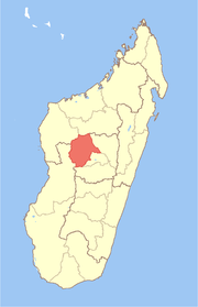
 Ankadinondry Sakay Location in Madagascar | |
| Coordinates: 18°58′S 46°27′E / 18.967°S 46.450°E | |
| Country |
|
| Region | Bongolava |
| District | Tsiroanomandidy |
| Elevation[1] | 922 m (3,025 ft) |
| Population (2001)[2] | |
| • Total | 32,000 |
| Time zone | EAT (UTC3) |
Ankadinondry Sakay, anciently Babetville is a town and commune in Madagascar. It belongs to the district of Tsiroanomandidy, which is a part of Bongolava Region.
It is situated at the Route nationale 1b between Analavory and Tsiroanomandidy at a distance of 35 km from Analavory.[3]
The population of the commune was estimated to be approximately 32,000 in 2001 commune census.[2]
Primary and junior level secondary education are available in town. The majority 80% of the population of the commune are farmers, while an additional 5% receives their livelihood from raising livestock. The most important crop is rice, while other important products are maize and cassava. Industry and services provide employment for 0.5% and 14.5% of the population, respectively.[2]
References and notes
- ↑ Estimated based on DEM data from Shuttle Radar Topography Mission
- 1 2 3 "ILO census data". Cornell University. 2002. Retrieved 2008-05-02.
- ↑ Dilag
| Fenoarivobe |
|  |
|---|---|---|
| Tsiroanomandidy | ||
Coordinates: 18°58′S 46°27′E / 18.967°S 46.450°E