Bab Huta

Bab al-Huta is a neighborhood in the Muslim Quarter of the Old City of Jerusalem to the north of the Haram al-Sharif (Temple Mount). It is named after the gate in the Haram compound which is Arabic for "Forgiveness Gate".
History
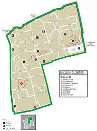
In the late 15th century, Mujir ad-Din described it as one of the largest quarters in Jerusalem.[1] A census taken by the Ottoman authority registered only Muslims in the quarter.[1] At the beginning of the 20-th century, the quarter had boundaries defined as follows:
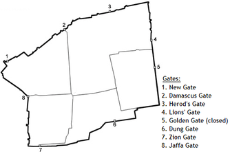
- North and East - the city walls between St Stephen's and Herod gates.
- South - the north side of the Temple Mount.
- West - Zawiyat el-Hunud Street, 'Aqabet er-Rahibat, Bab el-Ghawanima Street.[1]
Around the end of the 19th century, Jews were a majority of Jerusalem's population, and began to spread out of the Jewish Quarter into the Muslim Quarter, including Bab al-Huta.
Demographics
The neighborhood is considered one of the poorest areas in the Old City. It is home to the Dom Romani community of the Old City, known in Arabic as al-Nawar, led by mukhtar Abed-Alhakim Mohammed Deeb Salim.[2][3][4][5]
References
- 1 2 3 Adar Arnon (1992). "The Quarters of Jerusalem in the Ottoman Period". Middle Eastern Studies. 28 (1): 1–65.
- ↑ Selig, Abe. Jerusalem’s Herod’s Gate receives face-lift. 06/29/2010. Jerusalem Post
- ↑ A People Apart: The Romani community seeks recognition. By Eetta Prince-Gibson. Dom Research Center. 2001
- ↑ Danny Rubinstein. People / Steve Sabella: Blurring the lines. Haaretz. 2005
- ↑ Joseph B. Glass and Rassem Khamaisi. Report on the Socio-Economic Conditions in the Old City of Jerusalem. Munk Centre for International Studies, University of Toronto. p.4
Coordinates: 31°46′55″N 35°14′07″E / 31.78194°N 35.23528°E
Neighborhoods of Jerusalem | ||
|---|---|---|
Jerusalem neighborhoods east of the 1949 armistice line are depicted in green, those west of the line in blue (see Green Line). | ||
| Old City |  | |
| Central Neighborhoods |
| |
| Northern Neighborhoods | ||
| Eastern Neighborhoods | ||
| Southern Neighborhoods | ||
| Western Neighborhoods | ||
| Historical Neighborhoods | ||
| ||